Bollettino valanghe

Southeast Mountains

Crested Butte Avalanche Center
Vedi sulla mappa

Pericolo valanghe

Wed
Alta quota
3 · Marcato
Limite del bosco
3 · Marcato
Sotto il limite
2 · Moderato
Non aggiornato — questo bollettino è scaduto 4 years ago. Stai vedendo condizioni passate, non il bollettino in corso.

In sintesi

The danger will start trending down now that the storm is over.  The most dangerous conditions linger on wind-loaded slopes where intense drifting yesterday formed larger slabs: give those slopes a chance to heal.   In wind-sheltered terrain, carefully assess for smaller storm slabs and consider terrain consequences before stepping out.   Shallow or rocky slopes with variable depths have lingering concerns for avalanches breaking on deeply buried weak layers.  

Problemi valanghivi

  • Storm Slabs

    • Alta quota
    • Limite del bosco
    • Sotto il limite del bosco
    Probabilità
    Likely
    Dimensione
    1–2.5

    The Southeast Mountains have picked up 1 to 2 feet of snow since Friday, accompanied by strong winds yesterday.  Storm slabs are up to several feet thick.  They'll be larger and may be more sensitive to triggers on wind-loaded slopes: be extra cautious of leeward terrain.  Storm slabs are smaller and less common in wind-sheltered terrain.  Use small, steep slopes to assess storm instabilities at any elevation.  You can generally avoid the problem on slopes less than about 35 degrees.

    An example of a storm instability triggered earlier this week.  Slabs have grown significantly thicker since then.

  • Persistent Slabs

    • Alta quota
    • Limite del bosco
    • Sotto il limite del bosco
    Probabilità
    Possible
    Dimensione
    2–3

    On most slopes in the Northwest Mountains, faceted weak layers are buried deeply and unreactive to human triggers.  Some slopes have unusually shallow or variable snow depths where riders may be able to trigger a hard slab several feet thick or more.  Be cautious of windward terrain features with variable depths, rock bands, and slopes that previously avalanched in early December where you are most likely to find a thin trigger point.   The safest riding is where the snowpack is uniform and consistently deeper than about 5 feet (150 cm).   

    In the Southeast Mountains, faceted weak layers are buried 2 to 6 feet deep and are becoming more difficult to trigger.  Slabs are most easily triggered where they are thinner, which is most common in shallow areas near Crested Butte and CB South, or in wind-affected terrain.   Be cautious of windward terrain features with variable depths, rock bands, and slopes where slabs are only a few feet thick.   The safest riding is where the snowpack is uniform and consistently deeper than about 5 feet (150 cm).  


Avalanche Discussion

The final pulse of this week's storm went out with a bang.  We observed significant wind transport with Monday morning's strong to extreme southwest winds, which have since decreased and shifted to the northwest.  The last pulse delivered 5" to 12" of snow across the forecast area, adding to the upwards of 10" (SE Mtns) to 20" (NW Mtns) that fell on Friday through Saturday.   The threat of slab avalanches will be trending down over the next few days now that the storm has moved on.  We could see an increasing threat of relatively small natural loose avalanches from very steep, rocky terrain on sunbaked slopes over the next few days.

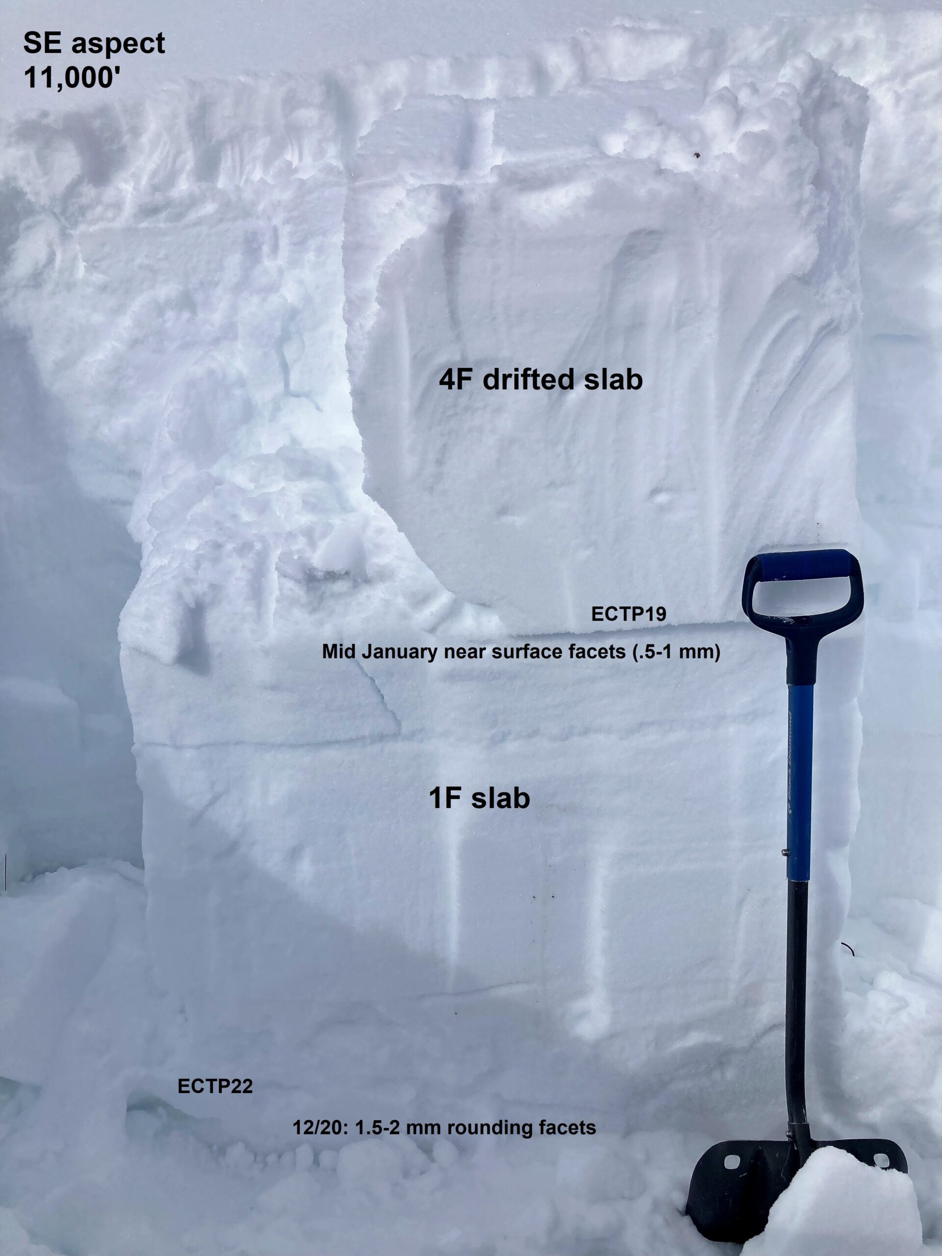
The week-long dry spell that preceded this storm caused a small-grained near-surface facet layer to form at the storm interface, now 1 to 3+ feet deep.  It's not a well-developed weak layer that will last for weeks on end, but it could keep storm instabilities lingering for a few days longer than normal.  Wind-drifted slopes have developed denser, thicker slabs that are more likely to surprise you, bury you, or behave erratically.  Give leeward terrain a wider berth and more distrust today.  This snow pit from Sunday demonstrates what that structure looks like on a drifted slope prior to Monday's intense wind loading.  Slabs are generally softer and smaller in sheltered terrain.  Where the snow is fluffy and protected from the wind, be cautious above terrain traps or in bigger terrain that can entrain more snow.  

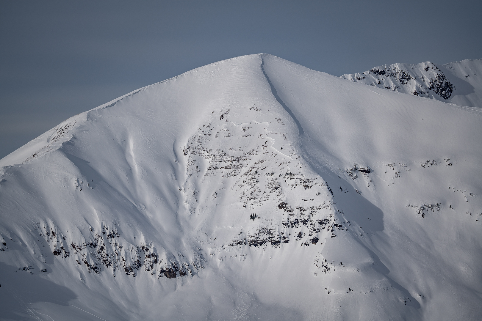
During or in the wake of each of the major loading events in January, we've seen a few avalanches release on deeply buried weak layers.  Though the chances of triggering a deeper layer are relatively low,  they pose a high consequence threat that is most concerning where the snowpack is relatively shallow and variable in snow depths.  The snowpack structure tends to be thinner and more susceptible to human triggers in parts of the Southeast Mountains.  Here are a few examples of avalanches this month that failed on early-season weak layers from the Northwest Mountains (Ruby Peak, Robinson Basin)  and the Southeast Mountains (CBMR, Walrod).   

Your observations are especially helpful as skies clear and we assess how the multiple weak layers in our snowpack responded to the most recent storm.  You can submit observations here, or by texting photos to 970-444-2170.  

Regioni coperte