Bollettino valanghe

Salt Lake

Utah Avalanche Center
Vedi sulla mappa

Pericolo valanghe

  • Alta quota
  • Limite del bosco
  • Sotto il limite del bosco
Non aggiornato — questo bollettino è scaduto 3 years ago. Stai vedendo condizioni passate, non il bollettino in corso.

In sintesi

There is a CONSIDERABLE avalanche danger for wet avalanches on sunny slopes facing southeast through west. There is a MODERATE danger on slopes facing northwest through north and east, especially on any wind-loaded slopes.

Cornices also present an avalanche hazard: stay well-back from corniced-ridgelines and avoid traveling on slopes with large, overhanging cornices above.

With so much snow, watch out for roof avalanches especially as the day heats up.

Problemi valanghivi

  • Loose Wet

    • Alta quota
    • Limite del bosco
    • Sotto il limite del bosco
    Probabilità
    Likely
    Dimensione
    3

    The snowpack took its first real hit of strong sunshine on Thursday and has adjusted somewhat, but given the huge amounts of new snow, I expect additional wet avalanche activity today. Although most avalanches should involve wet loose snow, south-facing slopes have buried crusts several feet deep and there is also the potential for larger wet slabs, especially as warm weather continues through this weekend.

    This is an easy problem to avoid: get off of and out from underneath the solar aspects as they begin to warm and head to north facing slopes where the snow is dry.


  • Cornices

    • Alta quota
    • Limite del bosco
    • Sotto il limite del bosco
    Probabilità
    Possible
    Dimensione
    3

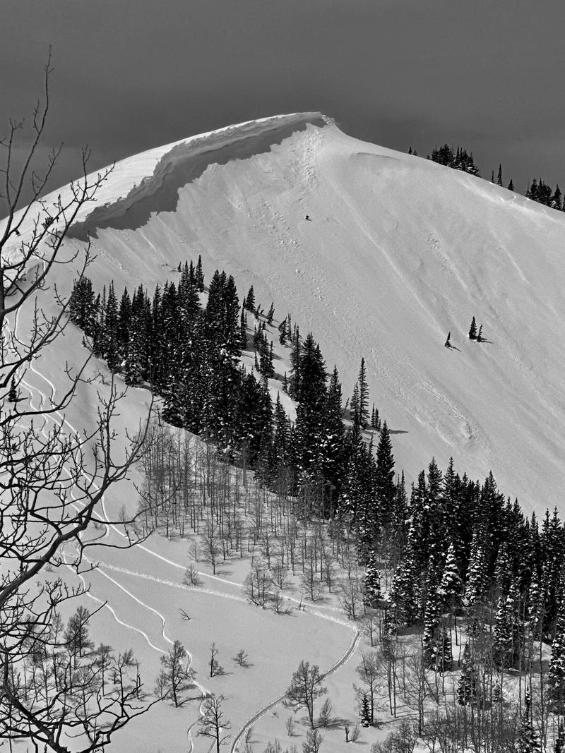
    Immense cornices adorn most exposed ridgelines and these are likely to become increasingly sensitive with warming temperatures. Cornice falls have two primary hazards:

    1. Large and hard chunks of cornice debris could fall on top of you;

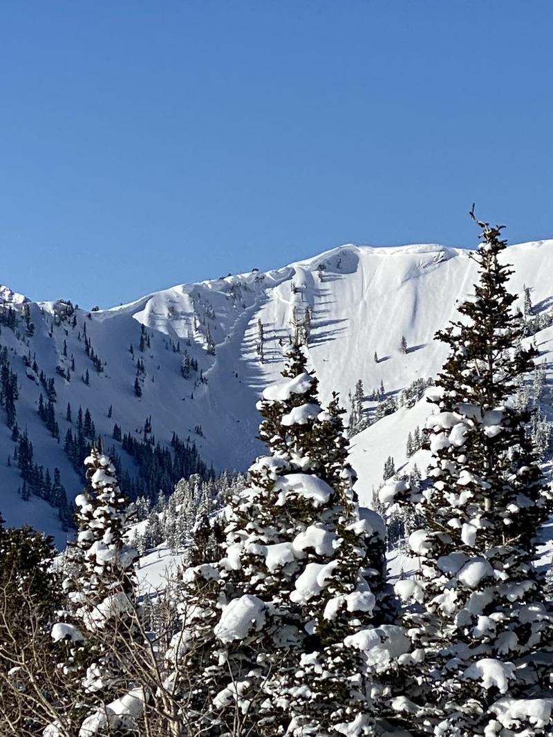
    2. cornice falls can trigger an avalanche onto the slope below, such as this avalanche in Upper Days that occurred either Tuesday or Wednesday.

    The video below (with colorful language) from yesterday on Clayton's Peak shows a natural cornice fall.

    Travel advice is to stay well-back from cornices when traveling along ridgelines and do not travel underneath any large, overhanging cornices.

  • Storm Slabs

    • Alta quota
    • Limite del bosco
    • Sotto il limite del bosco
    Probabilità
    Possible
    Dimensione
    2

    Although instabilities within the recent storm snow have mostly settled out, there are some isolated slopes where you could trigger an avalanche, especially on any slope that is wind-drifted.

Special Announcement

The report for the Pole Canyon Accident is available HERE. Thank you to the people involved for sharing so much information so that we can all learn from this accident and come home safely to our loved ones.

Recent Activity

There was widespread natural and control work avalanche activity in Little Cottonwood Canyon on Thursday. These avalanches were 4-8' deep and several hundred feet wide, with some avalanches reaching the road. A few highlights include Grizzly Gulch, Mount Superior, and White Pine Chutes. Other notable avalanches that occurred during the storm on Tuesday or Wednesday morning include Cardiac Ridge and George's Bowl. It's worth looking through all recent avalanches from this recent storm cycle.

The photo below is from the Grizzly Gulch avalanche - it was remotely triggered from an explosive 2,000' away and was 8' deep, 800' wide, and filled up the bottom of Grizzly Gulch with debris stopping 150' short of the Grizzly Gulch trailhead.

Snow and Weather

This Morning: Skies are clear and temperatures are in the mid 20's F. Winds are from the south/southwest and have increased overnight, gusting into the 20's mph at mid elevations and 40's at upper elevations.

Today: Skies will cloud up this afternoon and temperatures will rise into the 30's and low 40's F, possibly creating some greenhousing at low and mid-elevations. The southwest winds will increase throughout the day, gusting into the 20's mph at mid elevations and into the 40's and 50's mph at upper elevations.

Looking Ahead: Warm and partly cloudy over the weekend, with very warm temperatures into early next week with temperatures remaining above freezing overnight.

You should be able to find soft/dry snow on northerly aspects above about 9,000'. All other snow surfaces will be crusted from strong sunshine over the past two days.

General Announcements

CLICK HERE FOR MORE GENERAL INFO AND FAQ

This information does not apply to developed ski areas or highways where avalanche control is normally done. This forecast is from the U.S.D.A. Forest Service, which is solely responsible for its content. This forecast describes general avalanche conditions and local variations always occur.

Observations and Avalanches

Backcountry Emergency Procedures

Instagram

Facebook

Get Forecast Email

Previous Forecasts

Contact via email

Submit Observation

Regioni coperte