

Bollettino valanghe

Presidential Range

Mount Washington Avalanche Center
Vedi sulla mappa

Pericolo valanghe

Sat
Alta quota
2 · Moderato
Limite del bosco
2 · Moderato
Sotto il limite
1 · Debole
Non aggiornato — questo bollettino è scaduto 4 years ago. Stai vedendo condizioni passate, non il bollettino in corso.

In sintesi

Warming temperatures and rain today will increase the chance for human-triggered avalanches. Watch out for pockets of wind drifted snow on all aspects at middle and upper elevations. The chance for triggering a large avalanche in east-facing ravines is possible where deep pockets of soft snow are found.

Problemi valanghivi

  • Wet Slabs

    • Alta quota
    • Limite del bosco
    • Sotto il limite del bosco
    Probabilità
    Possible
    Dimensione
    1–2

    The potential for small and large wet slides will increase during the day as temperatures rise well above freezing. The chance for triggering a small slide exists on all aspects - anywhere you find soft, penetrable snow on a steep slope. The largest slabs will be the most worrisome, capable of producing a D1.5 to D2 avalanche and can be found on northeast, east and southeast aspects at ravine level elevations. 

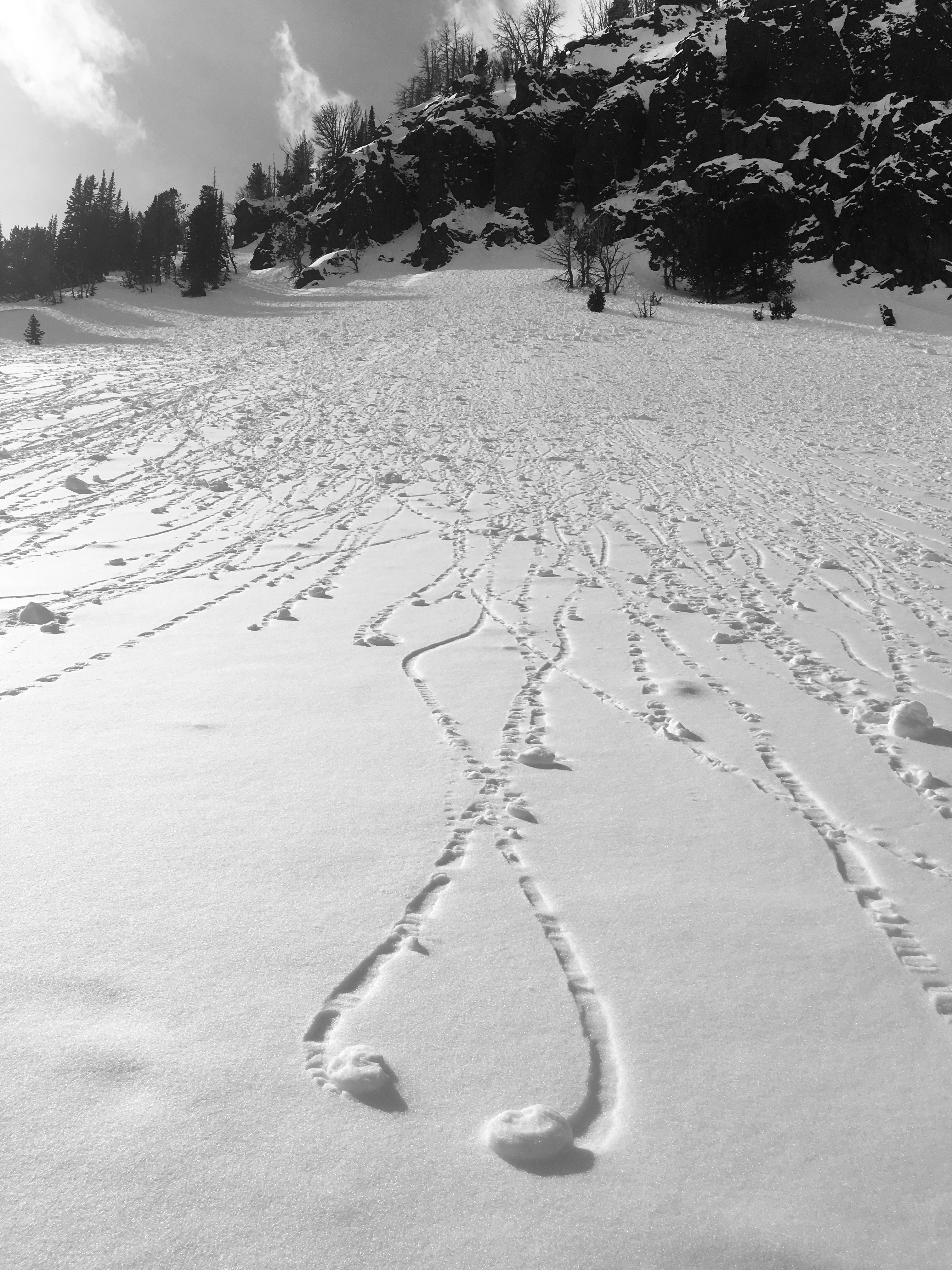
    Be on the lookout for roller balls moving down steep slopes. Can you easily make a snowball? Is it raining? Are you sinking into a mushy snowpack? If you see these signs of wet snow instability it's time to move off of steep slopes and pay attention to what's above you. Keep in mind wet snow stability can change rapidly.
Avalanche Discussion

WET AVALANCHE CONCERNS

This is the 2nd day of the warmup after several days of snow showers and cold temperatures. Here are two wet avalanche scenarios to consider:

Thin Wet Loose Slides: These avalanches are commonly small. They are not likely to bury you but can sweep you off of your feet and carry you where you don't want to go. Watch out for these on very steep slopes anywhere in the forecast area with a thin layer of snow (less than boot top) on a frozen melt-freeze crust. 

Wet Slabs: Large wet avalanches will be possible in east facing ravines where several days of west wind and snow showers  have created pockets of larger wind slabs.These avalanches can be large and destructive. Wet slabs occur when meltwater percolates and spreads along a weak layer in the snowpack, weakening the bond of the overlying slab. These slides are notoriously difficult to predict so keep in mind this uncertainty until temperatures cool. 

It's important to address the uncertainty associated with forecasting wet snow avalanches. Two things are needed: a weakness in the snowpack and water from melting. Today, there is certainly some free water moving through the snowpack as temperatures rise. Recent observations show a lack of spatial uniformity both in distribution and stability. Obs1 Obs2 Obs3. Generally speaking, recent field observations suggest good stability in the recently formed slabs going into this warming event. Warming and rain today will work to decrease stability. If and when slopes become unglued will be hard to predict. Unfortunately, the only way to manage uncertainty is avoidance. Stepping back from very steep, consequential terrain is prudent wherever water is moving down into the snowpack.

________________________________________________________________

OBSERVATIONS: Please consider submitting an observation of what you are seeing in your travels. Submitting an observation hones your skills, informs other users, and improves our forecasts.

Regioni coperte