

Bollettino valanghe

Ogden

Utah Avalanche Center
Vedi sulla mappa

Pericolo valanghe

  • Alta quota
  • Limite del bosco
  • Sotto il limite del bosco
Non aggiornato — questo bollettino è scaduto 2 years ago. Stai vedendo condizioni passate, non il bollettino in corso.

In sintesi

The overall avalanche danger is LOW this morning but quickly rises to MODERATE on steep aspects facing east, south, and west for Wet Snow. Avalanche activity may involve loose-wet snow avalanches and larger wet slabs. Both natural and human-triggered cornice falls are possible.

Timing is everything - move off of and out from under steep slopes once the snow becomes wet and unsupportable.

Problemi valanghivi

  • Loose Wet

    • Alta quota
    • Limite del bosco
    • Sotto il limite del bosco
    Probabilità
    Possible
    Dimensione
    2

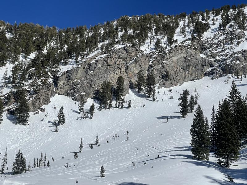
    Strong sunshine and warm temperatures mean another day of wet avalanche activity with the potential for natural and human-triggered loose-wet avalanches and wet slab avalanches on steep, sunny slopes and low-elevation northerly slopes. Winds may limit the softening of the snow surface at the upper elevations.

    Wet snow is the easiest avalanche problem to avoid: timing is everything - simply move to shady slopes once the snow surface becomes wet and unsupportable. Signs that the snow surface is becoming wet include rollerballs and pinwheels. Watch for terrain traps where the concrete-like wet snow can accumulate.
Special Announcement

Gear up for next season or snag deals to close out this season while supporting the UAC’s efforts. Your participation directly funds the state's avalanche forecasting, awareness, and education programs. Check out the auction found here!

Recent Activity

No new avalanches were reported yesterday from the Ogden area.

Snow and Weather

Under clear skies, mountain temperatures range from 34 to 44 degrees °F. Winds are from the south and blow 10-25 mph across the upper elevations. Today, we will see another very warm day with plenty of sunshine and temperatures warming into the low 60s at 8,500'. The wind will remain from the southwest as high-pressure slides east, opening the door for a closed low to track south of us on Sunday, bringing cooler temps and some snow.

The window for corn or supportable snow is very narrow as most southerly slopes only have a shallow superficial refreeze. As the sun comes over the hill, it instantly turns the snow-wet, sticky, and unsupportable. Southerly wind may keep some upper-elevation slopes frozen with slide-for-life conditions. Dry snow is hard to find.

Additional Info

Thank you all for another fantastic season. Even with a slow start, we finished with above-average snow and many great powder days. Thank you to all our supporters, regular readers, and observers. It's a team effort, and all of us at the UAC are grateful for your help.

Our regular daily avalanche forecasts end this Sunday, April 14. After that, we will issue updates with any snowfall in the Salt Lake zone. We will issue updates in other zones with significant weather events as needed. We will continue publishing any observations through the rest of April as well. Have a great spring, have fun, and stay safe!

General Announcements

CLICK HERE FOR MORE GENERAL INFO AND FAQ

This information does not apply to developed ski areas or highways where avalanche control is normally done. This forecast is from the U.S.D.A. Forest Service, which is solely responsible for its content. This forecast describes general avalanche conditions and local variations always occur.

Observations and Avalanches

Backcountry Emergency Procedures

Instagram

Facebook

Get Forecast Email

Previous Forecasts

Contact via email

Submit Observation

Regioni coperte