
Quick report
- Aspect
- West
- Red Flags
- Rapid Warming, Poor Snowpack Structure
- Elevation
- 3353 m
- Slope Angle
- 23°
- Red Flags Comment
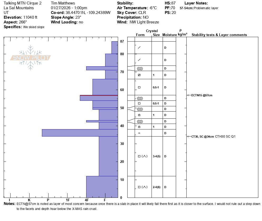
- <p>I say rapid warming from a place of solar input on south aspects more than a rapid rise in air temps. Steep South was damp by noon, and on our first run down from the Pre-Laurel Peak station towards Show Off the lower portion of the run was damp, and becoming unconsolidated. Not to mention a reef of small rocks. The snowpack structure is poor. You can find areas without a slab from the weekends storm, and you could find areas with strong over weak. Mainly in areas that were more influenced by the winds. </p>
Photo: 1 Walk far and stay low, and you can still find soft snow without a slab over the PWL's.
Photo:2 Stoked Evan in his natural environment
Video: 1 Dave enjoying the fruits of due diligence.
Snowpack
- Instability Comment
- <p>Still a problem, and will continue to be problem with each new loading event. Currently most likely to find this in the alpine where the wind has stiffened up the weekends storm snow into slabs. </p> <p>No evidence today to support further wind slab development. I'd still stay on guard in the alpine, and pay attention to what looks like wind drifted snow. It's likely resting on some type of persistent grain. </p>
The previous days NW winds have done some damage to the alpine terrain above treeline, and created a mix bag of surfaces. The best snow can be found near treeline in locations that were sheltered from the NW winds of days past. Solar aspects became damp from strong solar input and little wind to help keep the surface cooler.