


Quick report
Due to our persistent weak layer in the upper snowpack, caution should be taken in high wind loaded areas above 30° slope from N-E-SE aspects. This persistent weak layer is being very stubborn and you may not have any warning signs prior to a large avalanche. Avalanches can be remotely triggered, even on flat adjacent terrain from a distance.
Weather
- Air Temp
- 32
- Cloud Cover
- overcast
- Wind Loading
- moderate
- Recent Snowfall
- 10cm
- Snow Avail For Transport
- moderate amounts
Snowpack
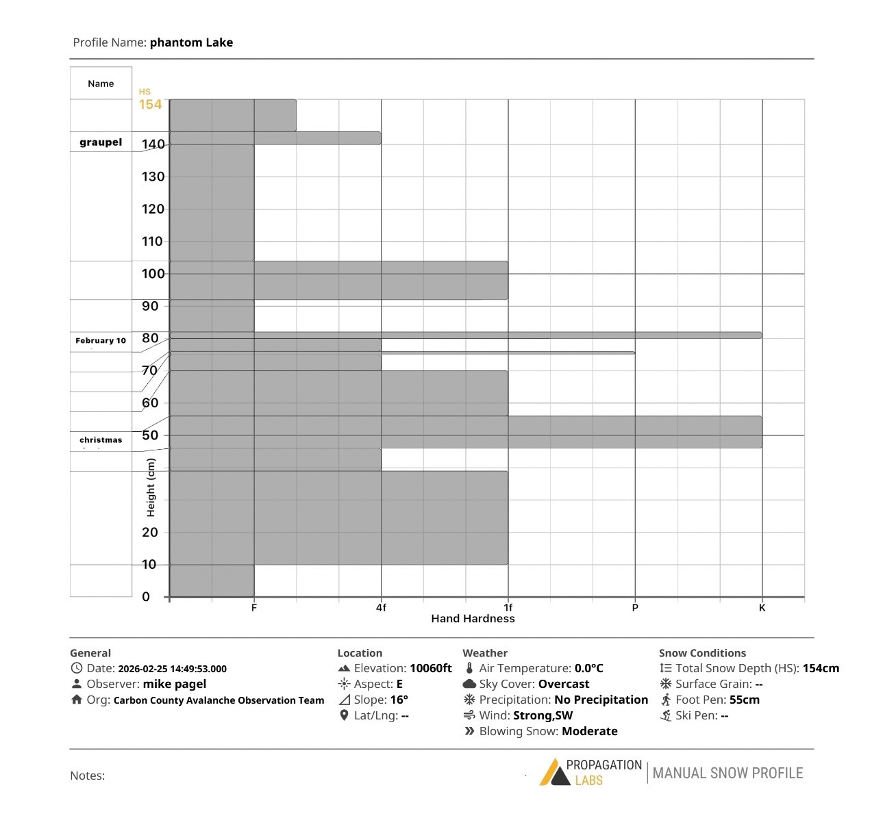
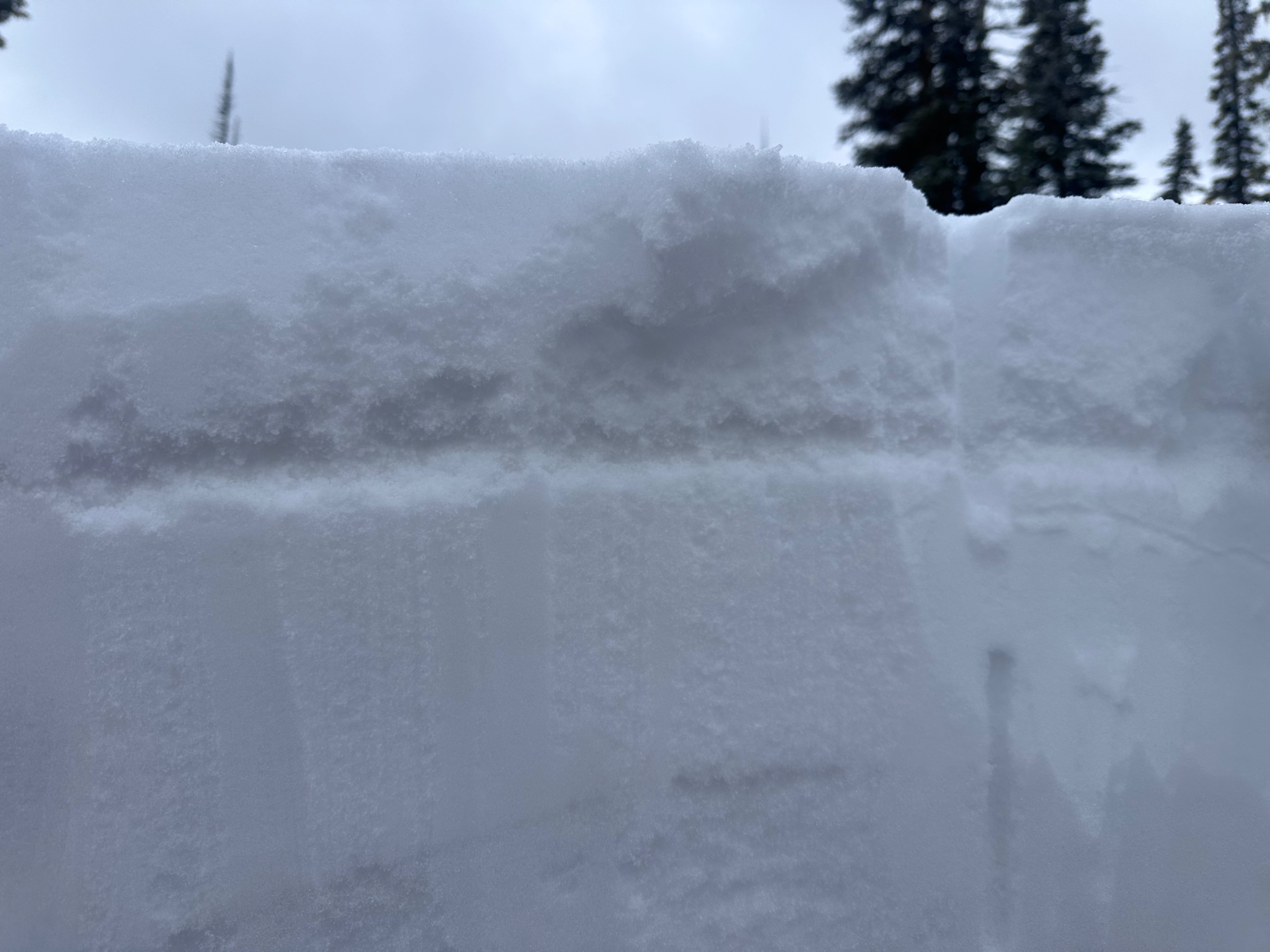
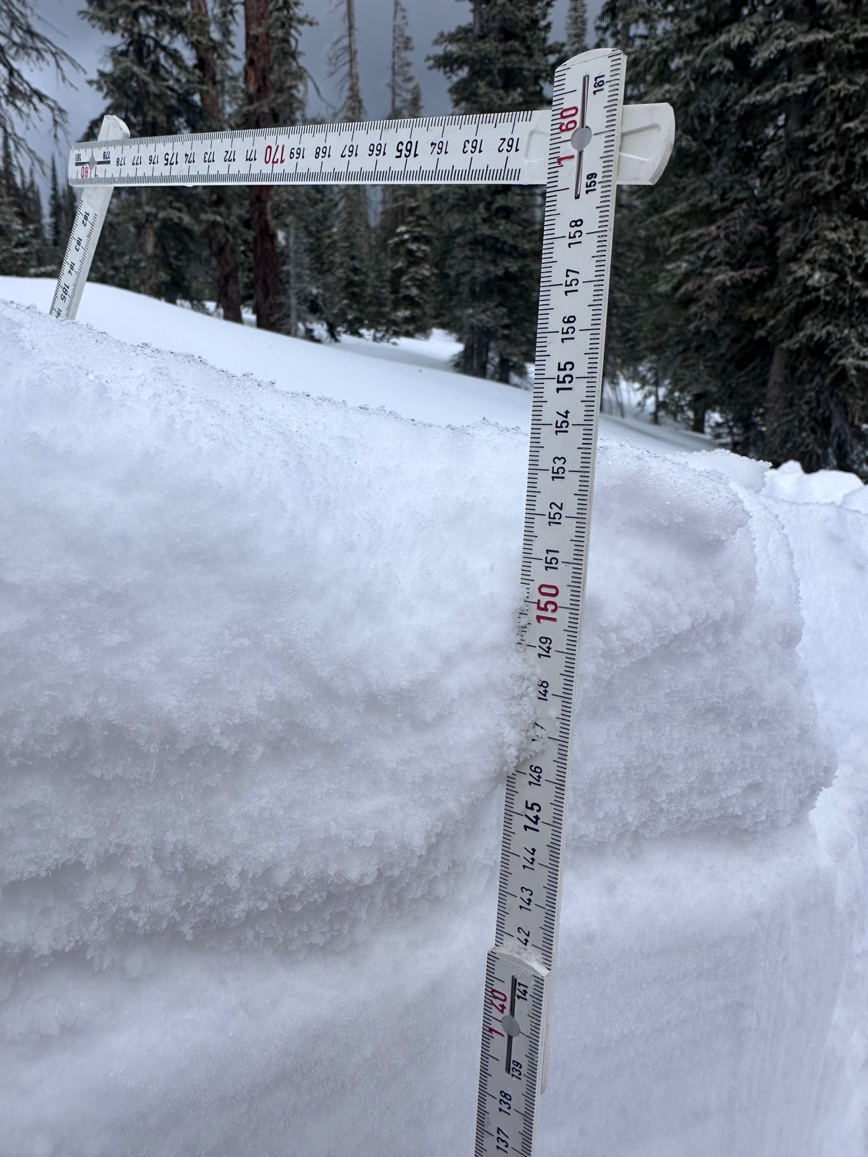
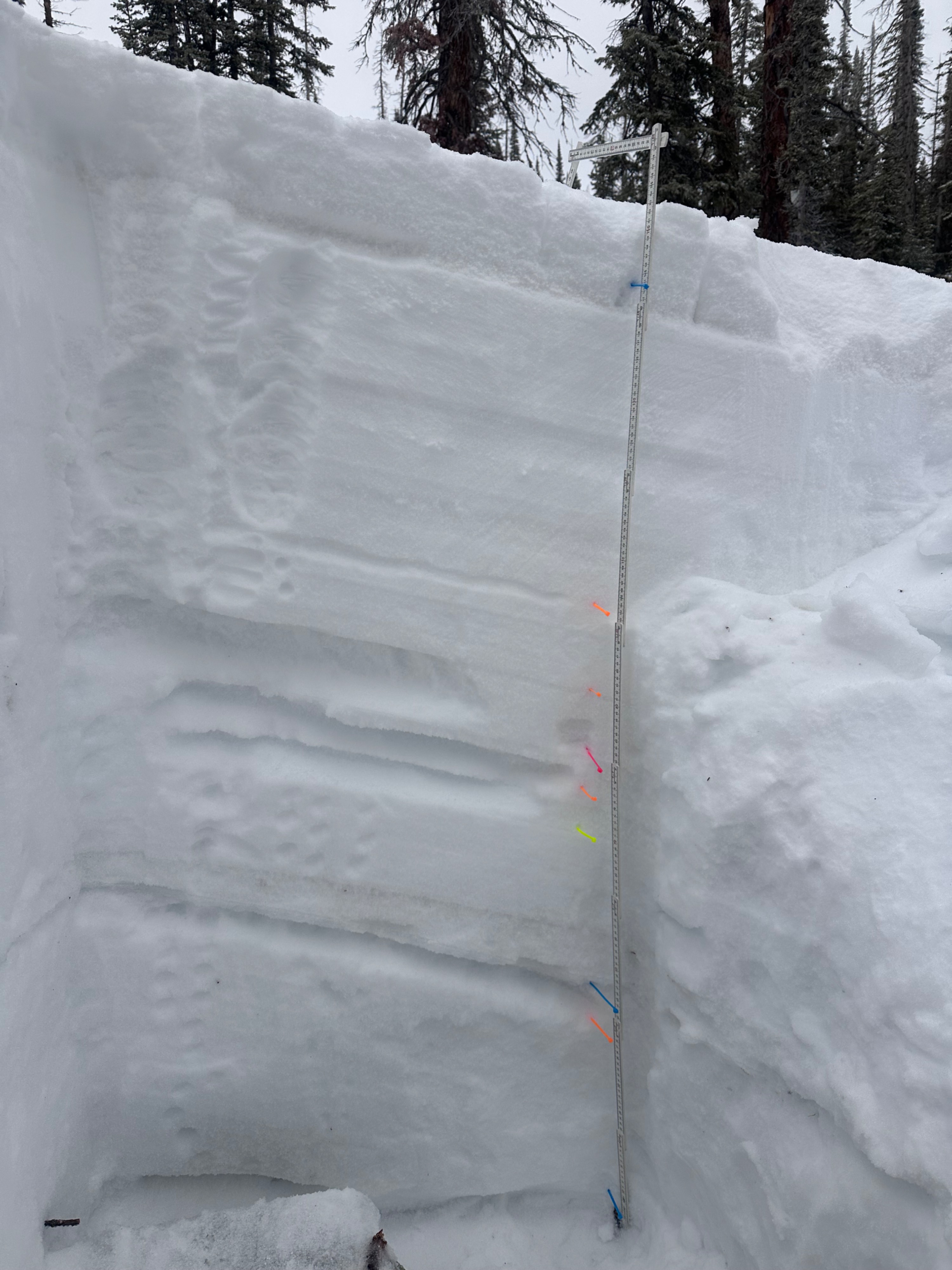
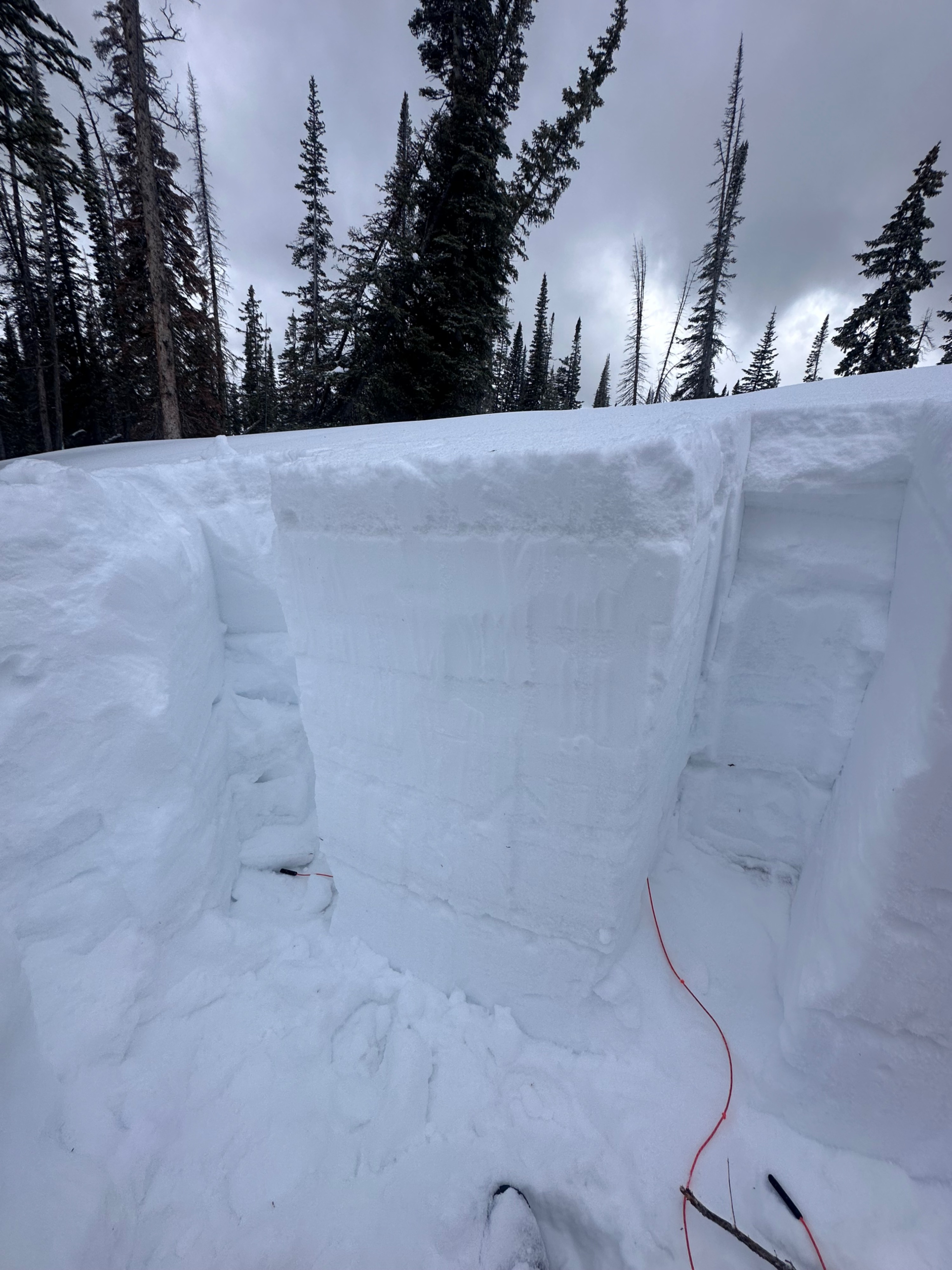
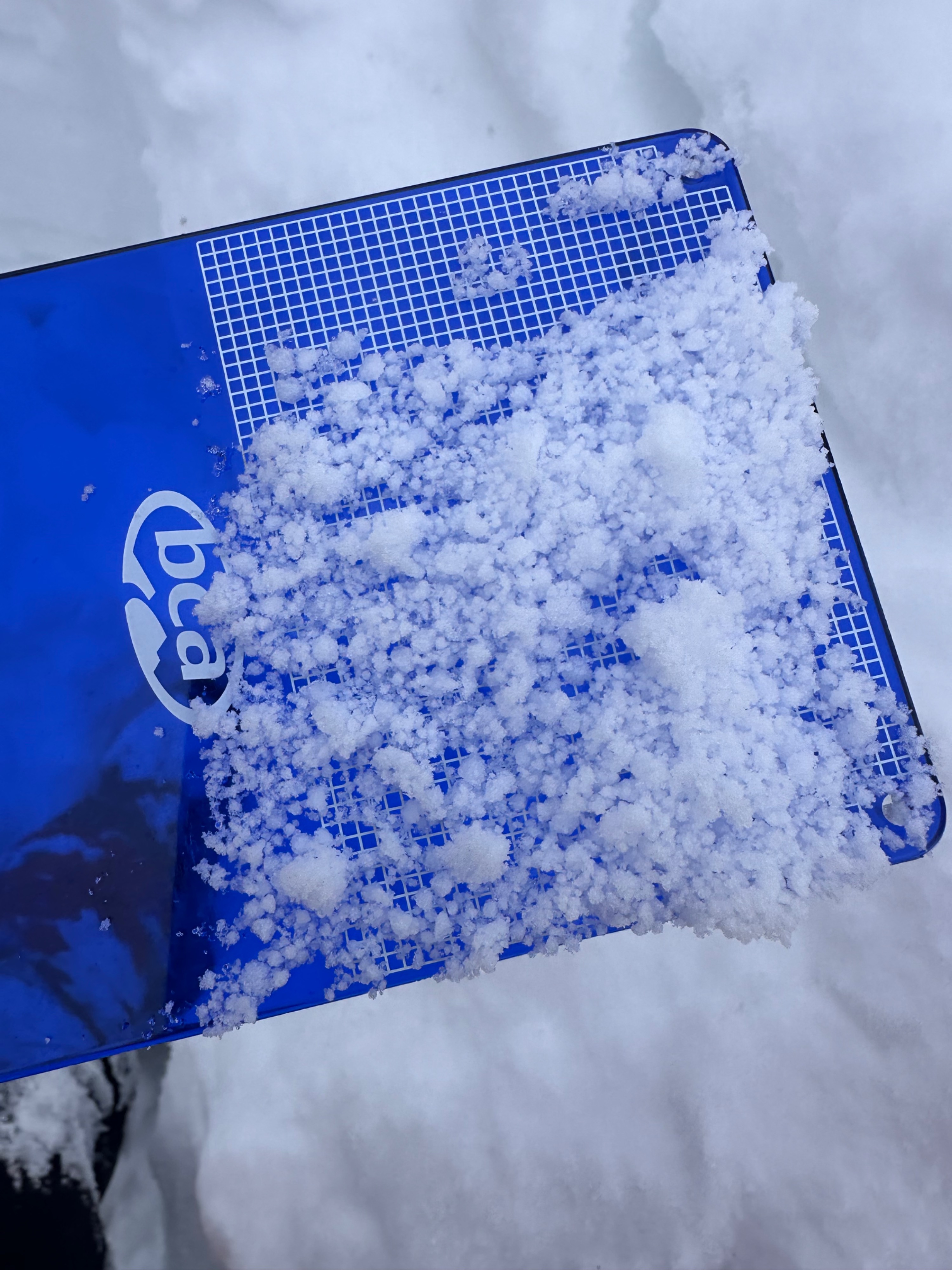
After some high moisture content snow and high winds, we observed three layers in our snow pack. About 10 cm of fresh snow was sitting on top of a 4 cm layer of graupel, which could pose another weak layer in the future. The second layer is our February 10 persistent week layer about 70 cm down in the snowpack. Also still present deep in the snowpack is our Christmas crust at 96 cm from the top. This layer is undergoing changes due to the additional weight and moisture content. We did not observe very much reactivity in our test however it was fairly easy to pull off the upper persistent week layer from the February 10 storm.