
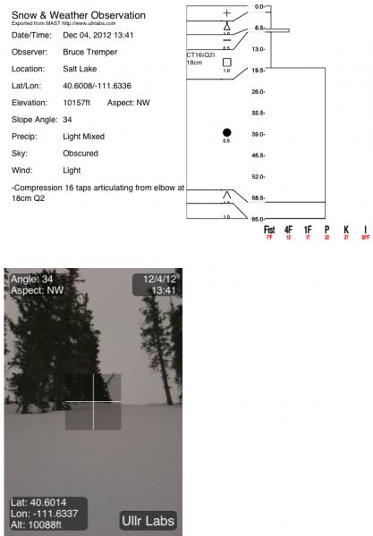
Quick report
- Aspect
- Northwest
- Red Flags
- Poor Snowpack Structure
- Elevation
- 3078 m
- Slope Angle
- 34°
- Red Flags Comment
- <p>Weak faceted snow remains buried about 20 cm down (6 inches) but there just is not enough weight on top to form a slab. In upper elevation wind loaded areas there are localized places where you should avoid wind drifted slopes because the wind slab is enough weight to collapse the faceted snow layer.</p>
Here's a quick video of the basic snowpack setup and the stability results of a snow profile.
Snowpack
- Instability Comment
- <p>The main avalanche problem is the stiff wind slabs mostly at upper elevation, wind exposed terrain when they overlie the weak layer of faceted snow about 20 cm deep (6 inches). As usual, be very suspicious of any steep slope with recent wind deposits. Most are dense, stiff and stubborn but there have been occasional avalanches triggered by explosives with this setup.</p> <p>The persistent weak layer does not have enough weight on it to be a problem in most areas with the exception of wind loaded areas (see problem #1). With expected more snow over the next several days, we may see enough of a slab laid down to make this layer active. Stay tuned...</p>
Just a skiff of new snow today at elevations above about 9,000' with rain below. The snow surface was getting damp at upper elevations and downright soggy below 9,000' with rollerballs. The snow at upper elevations was about 4 inches of dense, creamy snow that dramatically improved the riding conditions from a few days ago. Snow on the north facing slopes was best and other slopes had a buried crust that was tricky at times. The south facing slopes have very little snow where you have to walk many sections. North facing slopes above about 9,000' have about 70 cm of total snow (2 feet).