
Quick report
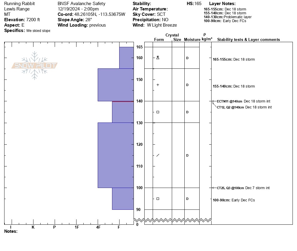
Yesterday it rained up to about 5500-6000’ and then cooled off overnight forming a rain crust on the snowpack surface. This crust disappeared at about 6000’ elevation. • Snowfall totals from the Dec. 18th storm above 6000’ were about 6-10” with easterly aspects favored. Westerly aspects above 5500’ were scoured heavily by the strong westerly winds. • Dug a hasty pit at 7200, on an easterly aspect. Had fracture, but no propagation with an Extended Column Test on the Dec. 18 storm interface (see pit profile below). • Light to moderate westerly winds were transporting very little snow as the snowpack surface was either a crust or more stiff powder and/or wind crust.
Weather
- Cloud Cover
- scattered
- Wind Loading
- previous
- Rain Elevation
- 6000
- Recent Snowfall
- 20
- Snow Avail For Transport
- small smounts
• Clear in the morning, increasing clouds, and mostly cloudy by sunset. • Calm winds in the gulch, light to moderate westerly winds above 7000’. • No precipitation. • Daytime high air temperatures reached the high-30s °F on the Canyon floor and the high-20s °F above 6000’.
Avalanche
- Size
- D2 R2
- Type
- SS
- Count
- 2
- Aspect
- E
- Trigger
- N
- Elevation
- 6700 ft
• Observed 2 destructive-size 2 (D2) soft slabs, and 4 more D1s that failed during yesterday’s storm. • These occurred on a steep easterly aspect at 6700’ and debris ran about 1000’ vertical feet. SS-N-R2-D1&2-I • These avalanches consisted of the newest storm snow and did not fail on, or step down to an older persistent weak layer. * Also observed 1 D2 SS from the Highway in Skiumah Creek. * Details in Avalanche section