
Quick report
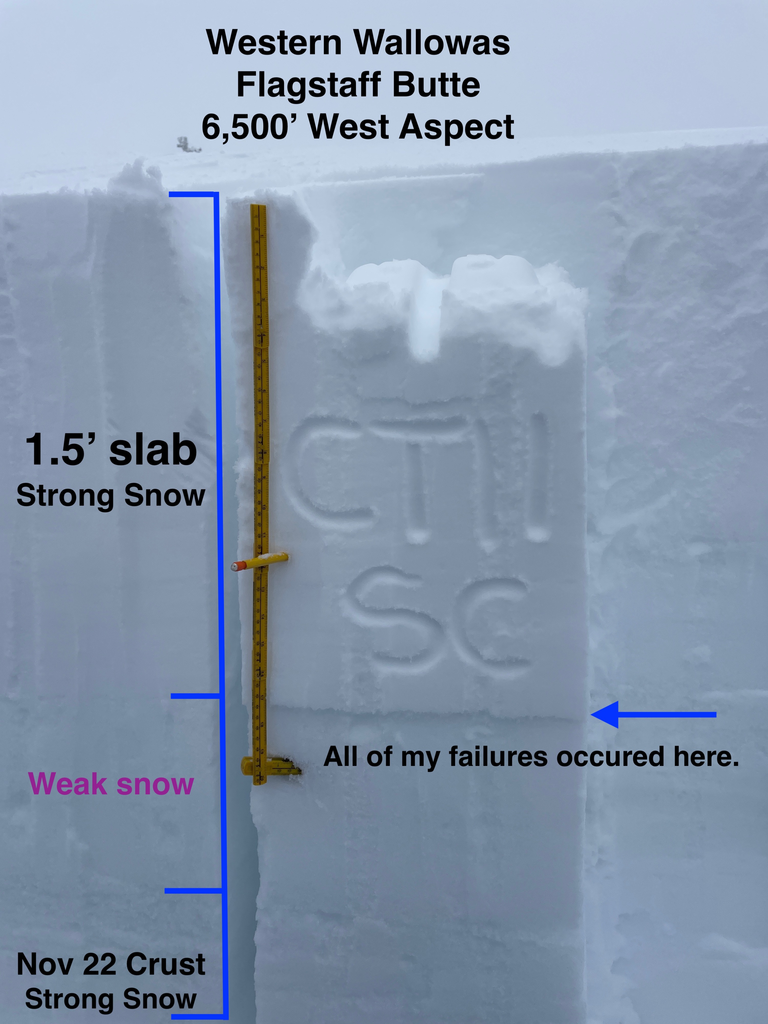
All of the key ingredients were found for a slab avalanche. A strong bed surface (Nov 22 rain crust), the early Dec drought layer (facets), and a 4-finger slab measuring 1.5' thick. Time will tell how widespread this snowpack structure is, but will likely get a great test from the recent and continued wind and snowfall.
Weather
- Air Temp
- 28
- Cloud Cover
- obscured
- Wind Loading
- light
- Rain Elevation
- 4000
- Recent Snowfall
- 30
- Snow Avail For Transport
- large amounts
Visibility was challenging for most of the day, with high humidity and fog. There were occasional breaks in the weather and I could catch glimpses of the high country in the Wallowas. It was a calm day, with very little new snowfall during daylight hours.
Snowpack
I found 1' or 30cm of storm snow, with another 15" of snow from last Sunday's (12/8) storm resting on a layer of faceted snow from the early Dec. drought. In my compression tests and Extended Column Test (ECT), I observed failure with moderate force and had full propagation in my ECT on the 12th tap. The failure was occurring right at the boundary of the facets and old storm snow. Below the layer of faceted snow which was 15" thick, was the Nov. 22 rain crust, which was knife hard.
This has all the characteristics of a persistent slab avalanche. It will take some time to determine if this layer combo is isolated, specific, or widespread in its distribution for the Southern Wallowas.