
Quick report
- Cracking
- isolated
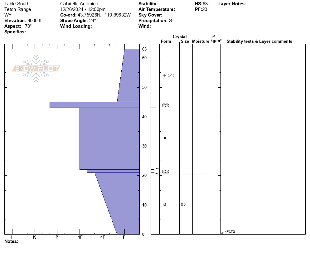
We ascended Table to check out the snowpack on an upper-elevation northerly aspect on the west side of the Tetons before this storm set in. I also dug on a southerly around the same elevation because why not. New surface snow on the southerlies above 8,000' was being wind-compacted, cracking, and sliding easily on an easily identifiable melt-freeze crust around 15-20cm (8-10") from the surface. Overall I expect this storm to bond better than predicted given the temps.
- The average snow depth on southerlies was around 60cm (a bit over 2'), consisting of crusts and consolidated old snow with some larger facets near the bottom of the snowpack (see attached).
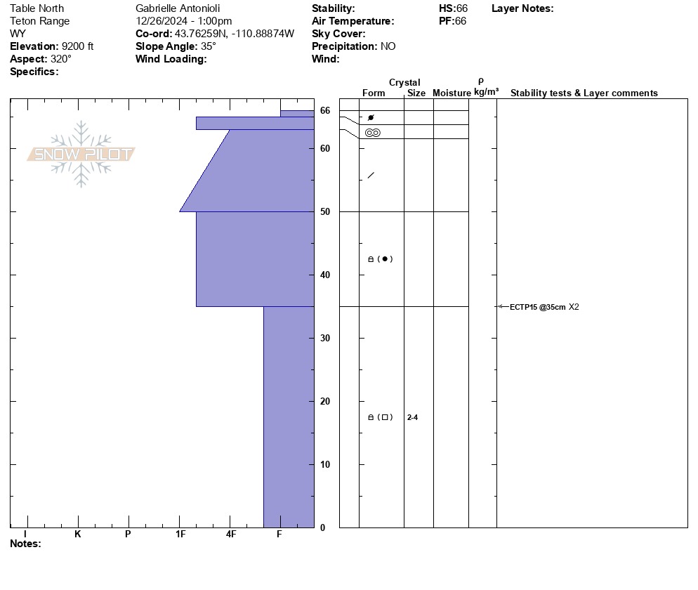
- The average snow depth on northerlies was surprisingly shallow, 9,100', ranging from 66-90cm (2-3'). Three snowpack tests on NW-NE aspects propagated in the medium range (ECTP 13-15) on basal facets that were trending better but well-developed (also see attached). This interface is worth tracking and looking for where you recreate.
- The snowpack I found here around the same elevation is far different than what I found on the east side of the range yesterday. Granted, these are simply point data, but the trend I continue to see is spatial diversity. This is a blessing and curse because not having a more widespread problem conceivably opens up more terrain. On the other hand, specific terrain features at different aspects (primarily N half of the compass but some due W and E) and elevations harbor very weak snow capable of producing avalanches as we move forward, which is less predictable than a broader overall pattern. This storm will fill in lower elevations, making it easier to access and travel to higher peaks. The snowpack in tight or rocky terrain features may have developed differently than average, as well as specific terrain features on the typical exits from upper-elevation terrain.
Weather
- Cloud Cover
- broken
- Wind Loading
- moderate
- Recent Snowfall
- 12
- Snow Avail For Transport
- small smounts
Mixed light precip throughout the day; generally warm air temps (high teens F), snow coming in lower density than forecasted.