Bulletin d’avalanche

Gunnison

Crested Butte Avalanche Center
Voir sur la carte

Danger d’avalanche

Wed
Alpin
2 · Modéré
Limite forestière
1 · Faible
Sous la limite
1 · Faible
Périmé — ce bulletin a expiré 5 years ago. Vous consultez des conditions passées, pas le bulletin en cours.

Points saillants

Expect to find 1 to 3 inches of fresh snow and winds just fast enough to drift.  Small, shallow slabs may have formed at upper elevations from recent strong winds.  If you see evidence of snow transport or feel stiffer snow on leeward features, expect to potentially trigger a small slab in the recent snow.  Triggering a larger avalanche deeper in the snowpack remains unlikely but lingers as a possibility on upper elevation, shaded slopes.  Your suspicions should be raised for slopes with characteristics like known previous avalanche activity or shallow and rocky appearance.  

Problèmes avalancheux

  • Persistent Slabs

    • Alpin
    • Limite forestière
    • Sous la limite forestière
    Probabilité
    Unlikely
    Taille
    1–2

    Incremental snowfall and windloading in the past month have formed an isolated distribution of slabs over persistent weak layers several feet deep.  Although avalanche activity has been infrequent, use extra caution on previously drifted, shady aspects where the snowpack is shallower than normal.  That's the type of terrain that most avalanches breaking into older snow have released on.   On Saturday, a natural persistent slab released on Whetstone from wind drifting.   Some avalanche paths that ran in February are suspect because they held shallower, weaker snowpacks that are now getting refilled.   Pay attention to the snowpack structure and assess the consequences of a rare but larger avalanche before riding in steep terrain.  

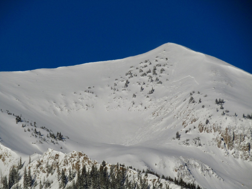
    3/27: A natural persistent slab on Mt. Whetstone, triggered by wind loading.

  • Wind Slabs

    • Alpin
    • Limite forestière
    • Sous la limite forestière
    Probabilité
    Possible
    Taille
    1

    Strong southwesterly winds kept snow moving throughout the day on Monday, but much of that snow was blasted into the atmosphere and did not load terrain.  However isolated features yesterday did pick up wind-loading like this feature that ran naturally on Monday.  Leeward features at the upper end of the near treeline elevation band to above treeline are where you can find this problem.  A few additional inches from last night will add a bit more fuel to the Wind Slab problem for today.  Southwesterly winds will shift to the northwest today changing the loading pattern.  Look for scouring in windward locations to help identify the adjacent leeward features that may harbor a shallow Wind Slab.  You will likely notice stiffer snow near the surface to help clue you into this small-sized avalanche problem at high elevations.  You may find this problem below ridgetops, cornices, and tucked behind ribs on other slopes.

    3/29: A natural Wind Slab avalanche from a northeast slope just above treeline. Many similar leeward features in this area were not loaded by Monday's strong winds, but this isolated feature had just the right terrain shape to accept wind-loading.

Avalanche Discussion

Today's weather will bring cloud cover and colder temperatures which will push wet snow avalanche problems off until clearer and warmer weather returns.  A few inches of new snow fell overnight which is likely to drift onto leeward features from westerly winds that will transition to the northwest during the day.  Yesterday the Wind Slab avalanche problem was not included on the list due to the expectation that southwesterly winds would have a hard time finding soft snow to move with all of the crusty surfaces, but observations from Monday showed plumes of snow off many peaks for much of the day.  Much of that blowing snow was shot into the atmosphere at did not load leeward features, but some isolated locations did receive loading.  A natural avalanche was observed out West Brush Creek yesterday that was big enough to take you for a ride, but not quite big enough to fully bury a person.  Expect to find isolated leeward slopes on the east half of the compass that contain sensitive Wind Slabs.  Overnight snowfall may obscure some surface clues on features with fresh Wind Slab formation so you may need to feel the snow for stiffer textures to identify.  Due to the strong winds, you may also find shallow slabs in more unusual places in addition to the typical places described in the problem discussion,  Take care to manage this problem if you are venturing into extreme or exposed terrain as even a small avalanche can have a serious consequence if you are carried over cliffs, or pushed into rocks/trees.

The lingering Persistent Slab problem continues to sit on the problem list.  Triggering a larger avalanche deeper in the snowpack should be on your mind for isolated slopes around the forecast area.  Slopes with increased concern are those at upper elevations that avalanched in February.  These slopes remained shallow and weak coming into March and have subsequently been refilled by frequent small storms and wind-loading.  Here are a couple of recent Persistent Slab avalanches that failed on slopes that ran in February ( Cement Mountain, Axtel, Whetstone). If you have a shaded, alpine objective in mind it is worth your time to sift through the observations page to see if it avalanched back in February.  Other slopes that remain suspicious are upper elevation and northerly-facing with a shallow or rocky appearance.  You are more likely to find these types of slopes in the Southeast Mountains as less snow has accumulated in these areas this winter, but you can also, less commonly, find it in the Northwest Mountains.  A good gauge for shallowness is around 4 to 5 feet or less of total snow depth.

Régions couvertes