Bulletin d’avalanche

Southeast Mountains

Crested Butte Avalanche Center
Voir sur la carte

Danger d’avalanche

Tue
Alpin
3 · Marqué
Limite forestière
3 · Marqué
Sous la limite
3 · Marqué
Périmé — ce bulletin a expiré 5 years ago. Vous consultez des conditions passées, pas le bulletin en cours.

Points saillants

The safest riding today is on sunny aspects that aren't recently wind loaded.  Dangerous conditions prevail on the northern half of the compass, where steep slopes that haven't previously avalanched are sensitive to human triggers, even from below the slope.  A large skier triggered avalanche yesterday near Lake Irwin and numerous reports of collapsing and shooting cracks are clear indicators that the snowpack is still unstable on shady aspects.   You can play safely in the shade by riding on slopes angles less than 30 degrees that don't connect to steeper terrain above you.  

Problèmes avalancheux

  • Persistent Slabs

    • Alpin
    • Limite forestière
    • Sous la limite forestière
    Probabilité
    Likely
    Taille
    1.5–2.5

    Slabs up to several feet thick have formed over a very weak foundation on slopes that face the north half of the compass. In steep terrain, the distribution of these slabs is highly variable because of a widespread cycle that occurred a few days ago.  On slopes where these slabs are still intact, you can easily trigger them.   You can remotely trigger a large persistent slab avalanche from adjacent flat terrain and avalanches might propagate much wider than you expect.  Collapsing snow and shooting cracks are warning signs telling you to stay on mellower slope angles or move to a southerly aspect.  

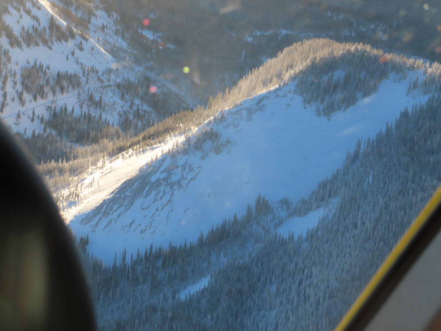
    This widely propagating persistent slab ran naturally during the recent storm on Mt. Whetstone. 

  • Wind Slabs

    • Alpin
    • Limite forestière
    • Sous la limite forestière
    Probabilité
    Possible
    Taille
    1–2

    West to southwest winds continue to drift snow at higher elevations.  Wind drifted slabs are becoming denser and harder to trigger now that the storm has passed, which also means they are harder to escape from if you get caught in one.  To avoid the problem, travel in wind-sheltered terrain or stay away from obvious pillows of drifted snow below corniced ridges or in cross-loaded gullies.  Stay away from slopes that are getting actively loaded today.  Wind slabs are most likely to be found on the eastern half of the compass above treeline, but you can find isolated exceptions around the compass and into near treeline as well.  

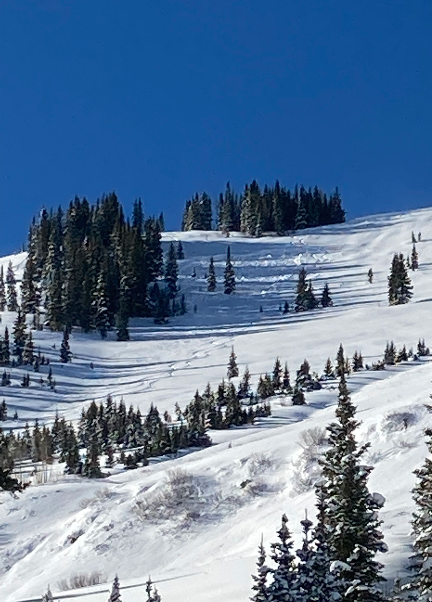
    This photo shows several wind slabs that ran recently on Mt. Owen.  

Avalanche Discussion

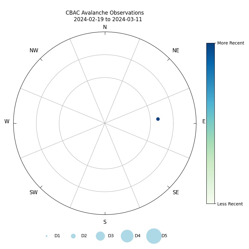
There has been A LOT of avalanche activity reported from the December 9 to 10th cycle, and a lot of great observations coming in with reports of shooting cracks and collapses.   Let's boil all of this mess into some useful travel advice.  We've tallied over 200 avalanches since the cycle began.  Check out the avalanche rose.  The bulk of activity has occurred on the northern half of the compass (where the snowpack was weak and rotten before the storm) or on high elevation, leeward terrain (where slabs formed more rapidly from wind loading, regardless of weak layer characteristics).  If you can avoid these two types of terrain, you should be able to enjoy a relatively low-risk day of moving about in avalanche terrain.  Wind slabs from early in the storm are mending and snow that fell on bare ground or thick crusts appears to be bonding well (Example A, Example B).   That leaves a lot of good options on the southern half of the compass if you stay away from the most recent drifts.  Remember our Lion King video from last week?  The colored diagrams in our media gallery below illustrate where there were thick crusts or bare slopes prior to this storm. 

On the northern half of the compass, the snow structure is downright nasty.  We've had several feet of snow quickly pile up onto fragile persistent weak layers that continue to produce obvious signs of instability. The good news is that so many terrain features naturally avalanched and the problem is no longer widespread.  The bad news is that identifying the slopes that haven't flushed can be a bit tricky, especially at higher elevations where the winds have concealed the evidence.  We also have uncertainty about repeat offenders on paths that ran early in the storm.   Ironically, it might not be the most classic-looking avalanche start zones that get you in trouble: so many of those flushed during the storm.  It's often the random pockets in sparse glades, or moderate angled terrain (~35 degrees) that catch people as they start inching out into slightly more aggressive terrain as the danger starts to slowly subside after a cycle.  That's the type of terrain that can hang on through the intense loading that we saw on Thursday night, and it will draw you in because it doesn't look quite as scary.  This avalanche from Camo Glades is a great example of  a surprisingly evil slope where you can get in trouble today. Or the slides in 7 Bowl or Coney's exemplify the moderate angled terrain that can feel less threatening.  So if you're travels take you to terrain with a northerly tilt to it, keep it low angle or be certain that you are traveling on a recent bedsurface that's lacking a slab over all the junk below.    

Régions couvertes