Avalanche forecast

Avalanche forecast

Payette Avalanche Center
View on map

Avalanche danger

Alpine
3 · Considerable
Treeline
3 · Considerable
Below
3 · Considerable
Out of date — this forecast expired 4 years ago. You’re viewing past conditions, not the current bulletin.

Highlights

Wind slab avalanches 1-2 feet deep are likely at middle and upper elevations. Underneath these dense slabs, we've found buried surface hoar, particularly on east-facing slopes. Although unlikely, a large and destructive avalanche on a weak layer near the bottom of the snowpack is not entirely out of the cards, especially on steep slopes where the snowpack is shallow.

Avalanche problems

  • Wind Slabs

    • Alpine
    • Treeline
    • Below treeline
    Likelihood
    Likely
    Size
    1.5–2

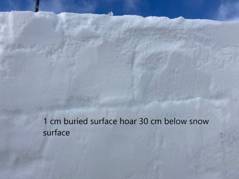
    The recent storm totals from Monday and Tuesday ranged from 6-12 inches with about 1" SWE. With this storm we had moderate winds out of the southwest drifting snow onto north and east-facing slopes. Yesterday, winds shifted and started blowing from the northwest moving surface snow onto south and east-facing slopes. You can expect to find sensitive wind slabs at middle and upper elevations. The photo to the right displays a small wind slab avalanche believed to have been naturally triggered around 7500' on an east aspect. This public observation was submitted yesterday north of Tamarack Resort. To complicate matters further, in some areas (particularly east-facing slopes), this wind slab is resting on a weak layer of buried surface hoar buried  30 cm (12 inches) from the snow surface (see photo here).

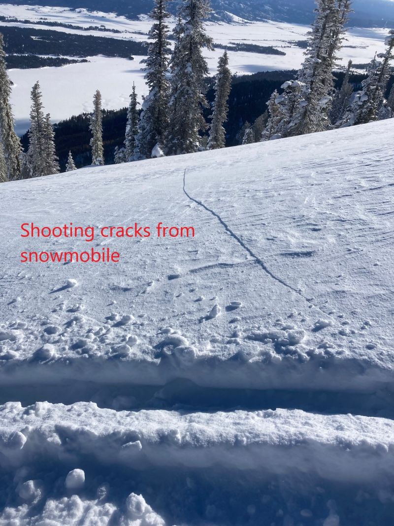
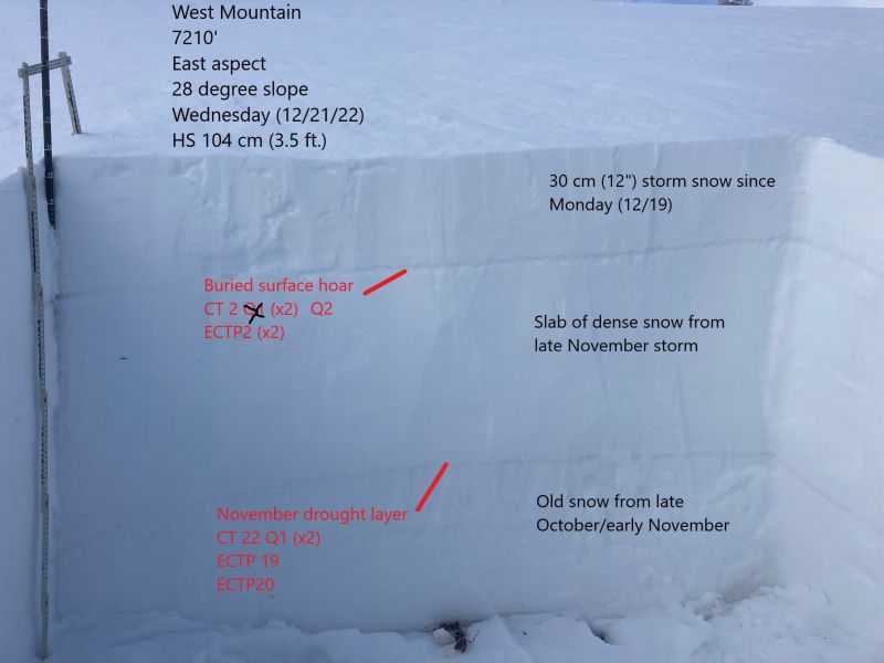
    Terrain features with wind drifted snow should be avoided. Wind slabs resting on buried surface hoar is a bad setup and we had very easy failures with propagation in our test pits yesterday (CT2 Q2 x2, ECTP 2 x2). If you see shooting cracks (like we did yesterday)or feel the snow underneath you become stiff or hollow feeling, then you need to find another slope to recreate on.

    (12/21/2022)

    Observation submitted of a small wind slab avalanche north of Tamarack Resort about 7500' on an east aspect, about 100 wide, depth range 6" to 2'

  • Persistent Slabs

    • Alpine
    • Treeline
    • Below treeline
    Likelihood
    Unlikely
    Size
    2–2.5

    Unfortunately, our November drought layer continues to rear its ugly head. We've been talking about this layer of persistent facets near the bottom of the snowpack for nearly three weeks now. Within the last 10-14 days we have not seen signs of instability on this weak layer. We've had no reports of avalanches on this weak layer since early December and we have not recorded propagation in any extended column tests on this weak layer in recent weeks. Until yesterday.

    In the West Mountain zone north of Tamarack Resort we found a shallow snowpack on an east aspect (see photo here) .  This persistent weak layer is widespread throughout all aspects and elevations. However, in the northern part of our advisory area, the snowpack is deeper and has not shown signs on instability on this weak layer. Although unlikely, an avalanche on this weak layer would be large and destructive. It would take a lot of force to initate an avalanche on this weak layer, the weight of a person may not be as likely as the weight of a snowmachine. You are most likely to encounter this persistent slab problem in areas similar to we found yesterday, on steep slopes where the snowpack is shallow (think trigger points around rocks). 

Avalanche Discussion

Today's avalanche forecast is sponsored by Brundage Resort. Thank you for supporting the Payette Avalanche Center.

Today's avalanche problems are more complex than we have seen in recent days and weeks. Sunday a well preserved layer of surface hoar was buried and is showing the ability to fail and propagate very easily. Wind slabs are resting atop this layer of buried surface hoar and if you encounter this setup on a steep slope, the likely result is an avalanche. Older snow from November buried near the bottom of the snowpack has recently displayed the ability to propagate with moderately hard force. Coupled together, these avalanche problems should give people pause before entering steep slopes today. 

Temperatures this morning are articly cold across the advisory area. As I write this morning, low temperatures are ranging from -10 to -15F around 6500'. That is a 30 to 40 degree temperature difference from yesterday morning. Guess what snow does not like? Sudden changes. Expect to see some weak layers forming on the snow surface and pay attention to where they are because a storm moving in on Friday might bury these weak layers.


Check out this great observation from yesterday north of Tamarack Resort.