Storm Slabs
- Alpine
- Treeline
- Below treeline
- Likelihood
- Possible
- Size
- 2
(Let's call it "new-ish" snow.) There are three possible issues to watch for with our snowfall from last Thursday:
1. Wet Loose Snow: Expect minor, wet-loose avalanche activity on solar/sunny slopes as the day warms. Although these should be minor, be sure not to get caught in a steep terrain trap or carried over rocks.
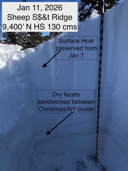
2. Wind Drifts: Although most wind drifts have settled out and are now unreactive, there are some upper elevation slopes where you can find dense wind drifts that formed Friday or Saturday that may be reactive, especially on slopes with a preserved layer of surface hoar down 1-2 feet deep.
3. Sluffing: The snow surface is quickly weakening with facets and surface hoar in the top few inches of snow on shady, northerly aspects which may sluff easily on steep slopes. Just as with minor wet, loose snow, even a small sluff could carry you over rocks in steeper terrain.