Avalanche forecast

Northwest Mountains

Crested Butte Avalanche Center
View on map

Avalanche danger

Tue
Alpine
3 · Considerable
Treeline
3 · Considerable
Below
3 · Considerable
Out of date — this forecast expired 4 years ago. You’re viewing past conditions, not the current bulletin.

Highlights

Large natural and triggered avalanches continue to steal the headlines.  Recent naturals on Ruby Peak, Mineral Point, and Castle Peak, and a remotely triggered avalanche in Red Lady Bowl yesterday highlight how weak layers near the ground are still struggling.   The threat of naturals will increase later this afternoon with snow and wind drifting.   Dangerous conditions exist on or near steep slopes with old, weak snow near the ground.    

Avalanche problems

  • Persistent Slabs

    • Alpine
    • Treeline
    • Below treeline
    Likelihood
    Likely
    Size
    2–3

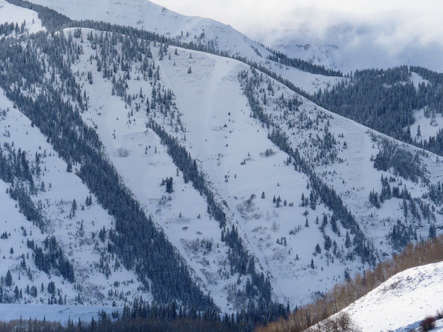
    Storms this month built large persistent slabs that are sensitive to human triggers and could release naturally today.  There's a widespread weak layer of facets and faceted crusts buried by 2 to 3-foot slabs on west to north to southeast aspects. Concerns also exist on some alpine south and southwest-facing terrain features.  Slabs are largest in leeward terrain at higher elevations.   Persistent slabs are notorious for erratic feedback and unusual behavior, such as remote triggering and wide failures.   To avoid the problem, choose routes that keep you off and out from under terrain steeper than about 30 degrees that hold old, weak snow near the ground.    

    A recent persistent slab that wrapped from shady to sunny aspects and broke on weak layers near the ground. This a good example of the potential size and widely propagating behavior of our current persistent slab problem. 

  • Wind Slabs

    • Alpine
    • Treeline
    • Below treeline
    Likelihood
    Possible
    Size
    1–1.5

    New snow and increasing winds today will form fresh drifts on leeward terrain features.  Slabs will grow thicker and more sensitive as the day progresses.  Watch for blowing snow to clue you into developing instabilities.  Small wind slabs have the potential to step down and trigger a larger persistent slab avalanche where the problems overlap.     

    Look for blowing snow like this to warn you of fresh wind slab formation.

Avalanche Discussion

Red Lady gracefully demonstrated what our persistent slab problem looks like yesterday without inflicting harm.  The skier who triggered the avalanche was over 1500 feet away from the start zone on low-angle terrain at the bottom of the first pitch.  This is the type of erratic and unusual behavior that just sucks about our snowpack right now.  If you're curious about the snowpack structure in Red Lady Bowl, or perhaps why only a portion of it slid this time, take a look at our pit work in the bowl from late November.  The pits document the loathsome crust/facet sandwiches which have been active recently on numerous southeast facing alpine slopes, such as Ruby Peak and Castle Peak.  Of course, the faceted crusts aren't a necessary ingredient, our facet/depth hoar layers are equally ugly on shady aspects too (see gallery below).  And we've seen all of these weak layers produce natural avalanche cycles with every loading event this month.  Although today's snowfall isn't as significant of a load, we expect at least a few large naturals with the heavier snowfall rates and gusty winds accompanying this afternoon's frontal passage.    

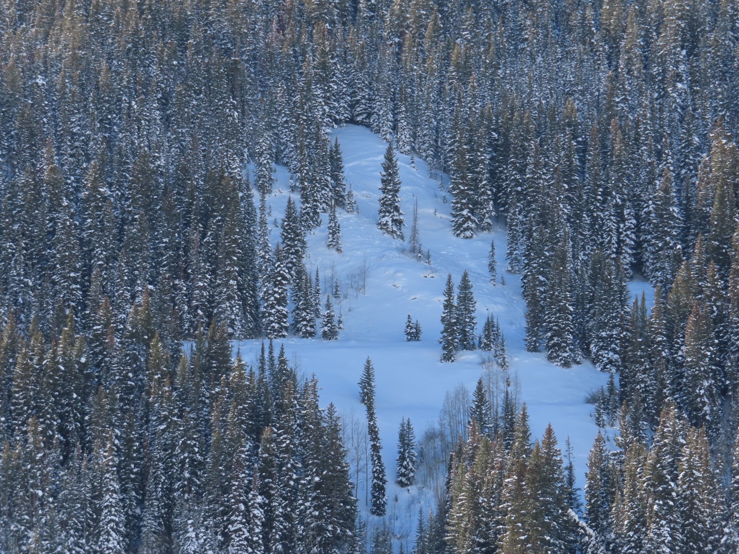
Let's talk about below treeline riding because that's where the flat light will steer most traffic over the next few days.  In the most snowfall-favored parts of our forecast area in the middle of the Northwest Mountains, slabs are approaching 3 feet thick and are becoming more stubborn to triggers.  The likelihood of triggering an avalanche below treeline there fits better with "possible".  You're most likely to trigger a large avalanche on an unsupported rollover or from a shallow area on an open slope such as near rocks or bushes.  As you radiate outwards from the snowfall bullseye, slabs are more reactive, and triggering is likely.  That's well evidenced by continued reports of frequent collapses (Example A, Example B).  In those areas, all terrain steeper than about 33 to 35 degrees that hasn't avalanched recently is suspect.  Under these conditions, often times the sneaky terrain features that catch people off guard are small openings in the trees, not just obvious start zones.    Continued snowfall over the next few days will subtly increase the sensitivity to human triggers across all of our forecast area because it will gradually add more stress.   The southerly aspects below treeline lack our concerning weak layers and offer a much safer alternative.  With a surface refresh coming later today and tonight, the riding quality will start to improve on those steep sunbaked slopes that got crusted yesterday.   

Regions covered