The bottom line: Fresh, shallow and reactive wind slabs will form due to strong and shifting winds Saturday night. Larger wind slabs linger from the previous storm. Hard wind slabs can be tough to assess and may lure you onto a slope before breaking above your head. Avoid wind-loaded slopes steeper than 35 degrees.
Avalanche and Snowpack Discussion
We have not had any direct snowpack observations from the Hurricane Ridge area in three weeks. If you travel in the Olympic Mountains, please help your local forecast by submitting an observation.
Forecast schedule
For the 2018-19 winter season, avalanche hazard ratings will be issued for the Olympics Friday through Sunday and during holidays. We are not issuing ratings currently due to the National Parks closure.
General snowpack and weather summaries will be available on days that the Hurricane Ridge road is closed.
Regional Synopsis
January 4, 2019
The first few days of 2019 were active here in the Northwest. A strong weather system impacted the region bringing warm temperatures, heavy precipitation, and strong winds. This weather system did not impact the forecast areas equally. Even within the same forecast zone we can see wide discrepancies in precipitation numbers. The snowpack you encounter this weekend will be largely dependent on where you go and the elevation at which you travel
Storm Precipitation Totals as of Friday Afternoon
Hurricane Ridge: 2.41â€
Mt Baker: 6.52â€
Stevens Pass: 2.58â€
Snoqualmie Pass: 2.27â€
Crystal Mountain: 0.52â€
Paradise: 2.23â€
White Pass: 0.55â€
Washington Pass: 1.05â€
Mission Ridge: 0.31â€
Mt Hood Meadows: 0.51â€
A few big stories stand out in the current snowpack: recent avalanche warnings in the northern zones, persistent slabs in the western areas, and a complex and weak snowpack in the eastern zones.
The northern zone experienced the brunt of this latest weather system. This led to two days of avalanche warnings and at least one large natural avalanche cycle. It's tough to say what the snowpack looks like in areas near and above treeline, but we know those areas received substantial new snow.
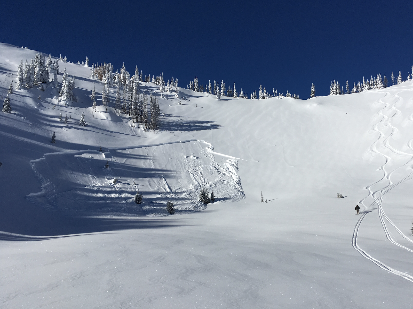
Photo: Large natural avalanche at Mt Baker Ski Area during the recent storm. -Mt Baker Ski Patrol
Earlier in the week we began forecasting a new persistent slab in our west-slope zones. A layer of buried surface hoar produced avalanches last Saturday, Sunday, and Monday. How did that layer fair after this recent round of weather? In locations like Mt Baker and Paradise, it was well tested with heavy precipitation. In other locations, less water may not have adequately stressed the weak layer. As visibility improves and more observation come-in the picture may become more clear.
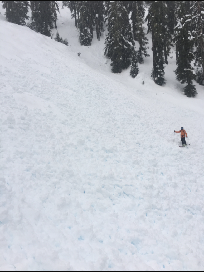
Photo: Large remotely triggered persistent slab avalanche in the Crystal backcountry: Jeremy Allyn
In the eastern zones a complicated and weak snowpack exists. Several persistent weaklayers have plagued these regions most of the winter. Don’t expect this to change anytime soon. Snow profiles and snowpack test can give you a glimpse into the persistent layer. Remember, snow profiles cannot prove the absence of a weak layer or that a layer has “healed.â€