Avalanche forecast

Northwest Mountains

Crested Butte Avalanche Center
View on map

Avalanche danger

Tue
Alpine
3 · Considerable
Treeline
3 · Considerable
Below
3 · Considerable
Out of date — this forecast expired 4 years ago. You’re viewing past conditions, not the current bulletin.

Highlights

A potent storm featuring heavy snowfall and strong winds will increase the avalanche danger throughout the day.  Natural and human-triggered avalanches breaking in the new and recent snow are likely.  They'll be largest and most hazardous on wind-loaded slopes at higher elevations.  There is isolated potential for a very large avalanche to break on deeply buried weak layers today.  Dial back your terrain choices during this final, hard-hitting pulse of the storm.   Seek out wind-sheltered terrain less than about 35 degrees without overhead hazards for lower-risk riding.  

Avalanche problems

  • Storm Slabs

    • Alpine
    • Treeline
    • Below treeline
    Likelihood
    Likely
    Size
    1–2.5

    Heavy snowfall and strong winds will make it easy to trigger slab avalanches breaking in the new and recent snow.     Slabs could break in today's new and drifted snow, or on the faceted interface at the base of this week's storm, several feet thick.   Slabs are largest and are more likely to fail naturally on leeward terrain at higher elevations.  This week's storm instabilities have been releasing on slopes steeper than about 35 degrees at all elevations.  Choose mellower slope angles and smaller terrain features away from wind loading to manage the hazard.  

    An example of a storm instability triggered earlier this week.  Slabs have grown significantly thicker since then.

  • Deep Persistent Slabs

    • Alpine
    • Treeline
    • Below treeline
    Likelihood
    Unlikely
    Size
    2.5–3.5

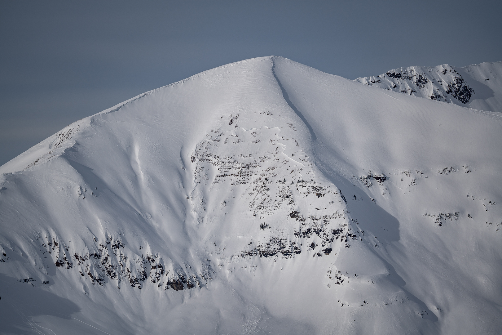
    On most slopes in the Northwest Mountains, faceted weak layers are buried deeply and unreactive to human triggers.  Some slopes have unusually shallow or variable snow depths where riders may be able to trigger a hard slab several feet thick or more.  Be cautious of windward terrain features with variable depths, rock bands, and slopes that previously avalanched in early December where you are most likely to find a thin trigger point.   The safest riding is where the snowpack is uniform and consistently deeper than about 5 feet (150 cm).   Intense wind loading and the heightened threat of cornice falls today are increasing concerns for a random deep slab failure.  

    This avalanche was triggered by explosive work in the Irwin Cat-Ski tenure on Thursday, 1/26.  It is representative of the type of terrain (shallower than normal, full of trigger points, and unsupported from below) where an unlikely chance remains for you to trigger a deep avalanche.

Avalanche Discussion

The final pulse of this multi-day system slams into the Elk Mountains today, with avalanche danger expected to peak later this afternoon or evening.   The storm is coming in behind schedule and snowfall has trended down a bit, thus a few adjustments compared to yesterday's outlook. Don't be fooled, conditions will become increasingly dangerous throughout the day.  See the weather tab for details on the storm.  

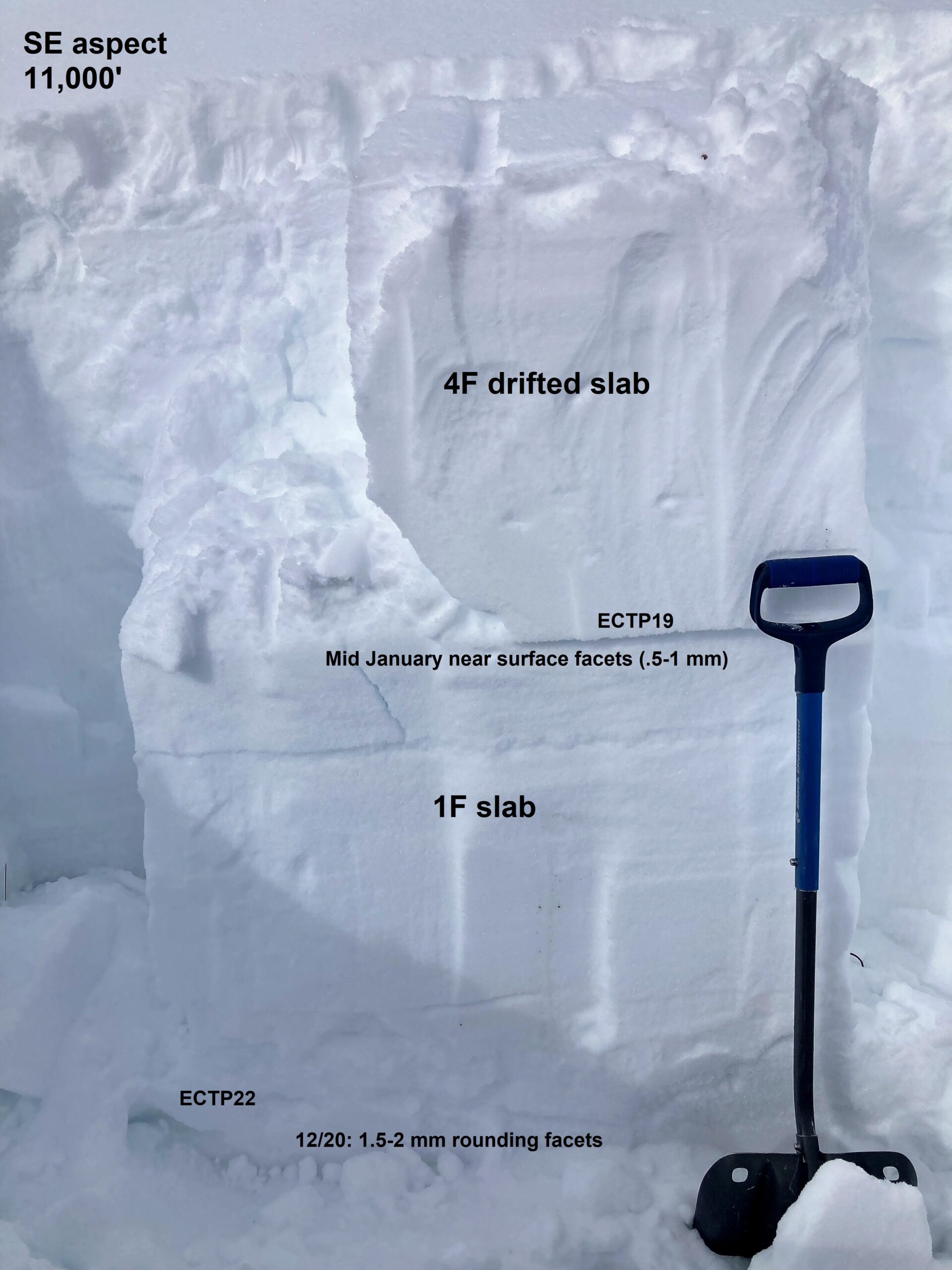
We saw a wave of triggered storm slab avalanches with the first major pulse of this stormy period on Friday and Saturday (see video).  Now, our storm slab problem is growing thicker and harder to manage in the Northwest Mountains and on wind-loaded slopes in the Southeast Mountains. You can expect avalanches to break within today's new and drifted snow, but they could also fail on the layer of small-grained facets that was buried at the start of the storm a few days ago.   This snow pit yesterday demonstrates what that structure looks like on a drifted slope before adding today's additional snow and wind.  Storm slabs are just starting to develop below treeline in the Southeast Mountains and could become active with today's additional snow.  

During each of the major loading events in January, we've seen a few avalanches release on deeply buried weak layers.  Though the chances of triggering a deeper layer are relatively low,  they pose a high consequence threat that is most concerning where the snowpack is relatively shallow and variable in snow depths.  The snowpack structure tends to be thinner and more susceptible to human triggers in parts of the Southeast Mountains.  Here are a few examples of avalanches this month that failed on early-season weak layers from the Northwest Mountains (Ruby Peak, Robinson Basin)  and the Southeast Mountains (CBMR, Walrod).    

Regions covered