Avalanche forecast

Southeast Mountains

Crested Butte Avalanche Center
View on map

Avalanche danger

Mon
Alpine
2 · Moderate
Treeline
2 · Moderate
Below
2 · Moderate
Out of date — this forecast expired 3 years ago. You’re viewing past conditions, not the current bulletin.

Highlights

It's a great day for backcountry travel: most avalanche problems are small and easy to recognize.  Travel early or move to northerly aspects to find the highest quality powder free from wet avalanche instabilities.  Yesterday's blowing snow continued to form wind slabs at higher elevations, some of which were triggered or ran naturally.  Use caution in consequential terrain where a relatively shallow avalanche involving the recent snow could cause harm.  

Avalanche problems

  • Wind Slabs

    • Alpine
    • Treeline
    • Below treeline
    Likelihood
    Possible
    Size
    1–1.5

    Several natural and skier-triggered wind slabs were observed yesterday on slopes that are leeward to west and northwest winds.  Most slabs will be small.  Features of concern will show signs of drifting that look and feel thicker.  They'll be most common below high-elevation ridgelines or in cross-drifted gullies or rollovers.   You can avoid the problem in wind-protected terrain.  

    4/15: A couple of small wind slabs triggered in Red Lady Bowl.  A slide like that is harmless unless it carries you into a terrain trap.  

  • Loose Wet

    • Alpine
    • Treeline
    • Below treeline
    Likelihood
    Possible
    Size
    1

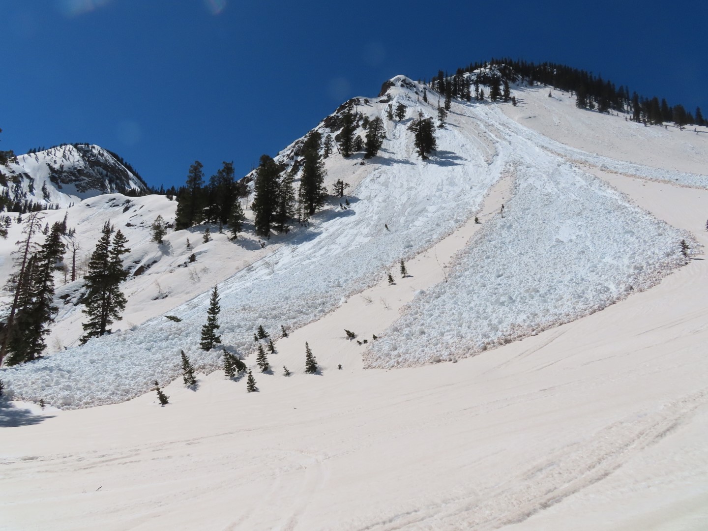
    As the recent snow moistens or gets wet on sunbaked slopes, it will be easy to trigger sluffs running above the dust layer and some could run naturally. Wet loose avalanches will be most dangerous in high-consequence terrain above cliffs, trees, or gullies. At low elevations later today, we have isolated concerns that a shallow wet loose avalanche could start gouging into older saturated snow resulting in a larger avalanche. If the snow surface is producing rollerballs, pinwheels, or natural sluffs, use sluff management techniques or move to lower-angle terrain. You can avoid the problem on colder aspects where the snow stays dry.  

    4/15: Several skier triggered wet loose avalanches running on the dust layer.  

Avalanche Discussion

Yesterday we observed a mix of wintery wind slabs up high and spring-like wet loose concerns developing down low, summarized in this observation.  Similar conditions involving the recent snow are expected today but with wetting snow expanding to higher elevations.  The Northwest Mountain saw the most snow out of the storm, so problems will be a bit larger and more common there.  Wind slab sensitivity is trending down; it's expected to be stubborn today and off the list tomorrow.   Wet loose avalanches will become more widespread today due to higher temperatures, lighter winds, and less cloud cover compared to yesterday.  This weekend's wet loose activity is generally small and shallow, involving just the recent white snow above the brown crust.  At low elevations, we have isolated concerns that a shallow wet loose could gouge deeper through the saturated snowpack left over by last week's warmup, creating a more destructive slide like this.  Even though our wet issues this weekend aren't nearly as dangerous as what we observed last week, you can easily avoid them by traveling early or moving to cold aspects as the day warms up.  

Tomorrow the danger will be Low in the morning and looks to rise to Moderate as the day warms up with similar wet avalanche concerns as today.  It'll be another great day to get into the mountains with the safest travel on sunny aspects early in the day.  

Cornice falls remain a low-likelihood threat on slopes with overhung cornices, exemplified by this recent cornice fall off of Mt. Axtell.

Regions covered