The Bottom Line: Strong winds will drift the new snow into thick slabs. In places these are sitting on a hard, refrozen crust, and may not bond well. Identify wind slabs by their shape, texture, and feel. Look to avoid these slabs on steep slopes.
Regional Synopsis
20191204 Regional Synopsis The first few days of 2019 were active here in the Northwest. A strong weather system impacted the region bringing warm temperatures, heavy precipitation, and strong winds. This weather system did not impact the forecast areas equally. Even within the same forecast zone we can see wide discrepancies in precipitation numbers. The snowpack you encounter this weekend will be largely dependent on where you go and the elevation at which you travel
Storm Precipitation Totals as of Friday Afternoon
Hurricane Ridge: 2.41â€
Mt Baker: 6.52â€
Stevens Pass: 2.58â€
Snoqualmie Pass: 2.27â€
Crystal Mountain: 0.52â€
Paradise: 2.23â€
White Pass: 0.55â€
Washington Pass: 1.05â€
Mission Ridge: 0.31â€
Mt Hood Meadows: 0.51â€
A few big stories stand out in the current snowpack: recent avalanche warnings in the northern zones, persistent slabs in the western areas, and a complex and weak snowpack in the eastern zones.
The northern zone experienced the brunt of this latest weather system. This led to two days of avalanche warnings and at least one large natural avalanche cycle. It's tough to say what the snowpack looks like in areas near and above treeline, but we know those areas received substantial new snow.
Photo: Large natural avalanche at Mt Baker Ski Area during the recent storm. -Mt Baker Ski Patrol
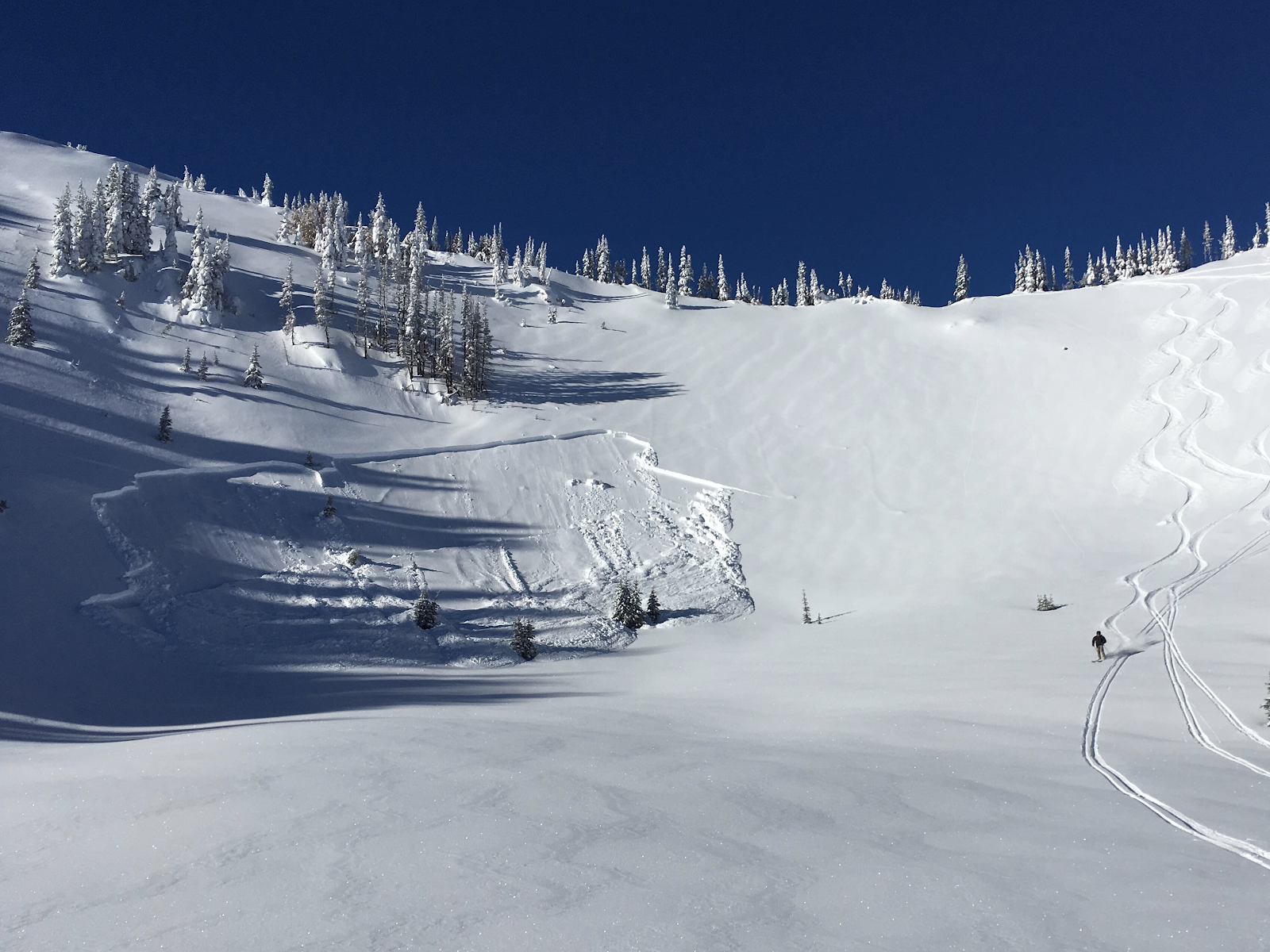
Earlier in the week we began forecasting a new persistent slab in our west-slope zones. A layer of buried surface hoar produced avalanches last Saturday, Sunday, and Monday. How did that layer fair after this recent round of weather? In locations like Mt Baker and Paradise, it was well tested with heavy precipitation. In other locations, less water may not have adequately stressed the weak layer. As visibility improves and more observation come-in the picture may become more clear.
Photo: Large remotely triggered persistent slab avalanche in the Crystal backcountry: Jeremy Allyn
In the eastern zones a complicated and weak snowpack exists. Several persistent weaklayers have plagued these regions most of the winter. Don’t expect this to change anytime soon. Snow profiles and snowpack test can give you a glimpse into the persistent layer. Remember, snow profiles cannot prove the absence of a weak layer or that a layer has “healed.â€
Photo: Large remotely triggered slide on buried surface hoar from Christmas above Leavenworth on 12/31: Matt Primomo
Avalanche Problems
Wind Slabs
With strong winds, fresh snow, and cool temperatures, wind slabs will be the main concern for Sunday. Use extra caution at upper elevations on leeward, wind loaded slopes steeper than 35 degrees. Look for fresh drifts and areas of variable snow depth as indicators that you could trigger a wind slab avalanche. Use surface texture and feel to help identify where you can find these on the slopes. Steer around thickly pillowed areas and convex rolls where the slopes steepen. Use small, inconsequential test slopes to clue you in to how well the new snow is bonded. In some locations, the new snow may be poorly bonded to a firm, refrozen crust. In other places, it may be sitting on lower density snow. Below treeline, there may not be enough new snow and wind drifting to create an avalanche problem.