

Avalanche forecast

Northwest Mountains

Crested Butte Avalanche Center
View on map

Avalanche danger

Sun
Alpine
3 · Considerable
Treeline
3 · Considerable
Below
3 · Considerable
Out of date — this forecast expired 5 years ago. You’re viewing past conditions, not the current bulletin.

Highlights

We're at the tail end of a historic storm.    Give the snowpack time to catch its breath.  Shifting winds could spur further natural activity that runs to valley floors.    If you trigger an avalanche today, it has potential to be very large and unsurvivable.  The safest riding is on low angle terrain.  Low elevation, southerly aspects without overhead hazards pose fewer hazards.

Avalanche problems

  • Persistent Slabs

    • Alpine
    • Treeline
    • Below treeline
    Likelihood
    Likely
    Size
    3–4

    You can trigger very large and destructive avalanches today from on or below steep terrain, and there is lingering potential for natural releases in wind-loaded terrain.  These widely propagating and long-running avalanches will break 6 to 9 feet thick or more on weak layers near the bottom of the snowpack.    Persistent slabs are most likely on northerly and east aspects, where buried layers are most fragile.  The distribution rose also includes southerly and west aspects where there is a smaller potential for faceted crusts near the bottom of the snowpack to fail.  Given how thick these slabs are, you may not observe any obvious signs of instability, and you are most likely to trigger one from a shallow spot where the slab thins out.  Triggered or natural avalanches today have the potential to run full track to valley floors.  

    A persistent slab, from Christmas Day, triggered from a low-angle ridgeline on Red Lady Glades. The slide broke 3 to 4 feet deep and ran far.

  • Storm Slabs

    • Alpine
    • Treeline
    • Below treeline
    Likelihood
    Likely
    Size
    2–3

    Upwards of 3 feet of new snow has accumulated since Thursday, accompanied by strong southwest winds.  The new snow and wind drifting have formed instabilities in the upper snowpack.  Storm slabs will be larger and more sensitive near and above treeline where winds have stiffened or drifted the snow.   New snow instabilities are easier to recognize: you are likely to see cracking in the snow or get feedback on steep terrain.  However, any moving snow in the upper snowpack could step down and trigger a larger persistent slab.  You can avoid triggering storm slabs by riding on slopes less than 30 degrees.  

    An example of an avalanche earlier this season, that propagated widely below a wind-loaded ridgeline.  

Avalanche Discussion

We're emerging from the tail of a historic storm.  Schofield Pass has picked up 14.4" SWE in the past 9 days (over 15 feet of snow), which is just shy of a total accumulated precip record for all mega-storms since 1986. Maybe we'll pass the record today!

With very limited visibility all week and few backcountry observations, our forecast confidence is lower than normal.  We are yet to find out what has unraveled with this storm, but I think billy barr's reaction yesterday morning, as a powder cloud was coming off of Gothic, sums it up pretty well:  "I ducked down under the solar panels not because I was afraid, but because, um, I dropped my contact lens, yes, that is why. Imagine how silly I felt when I remembered- I don’t wear contacts!?! Anyway, safe to say it’s a war out there."

Here's what we do know:

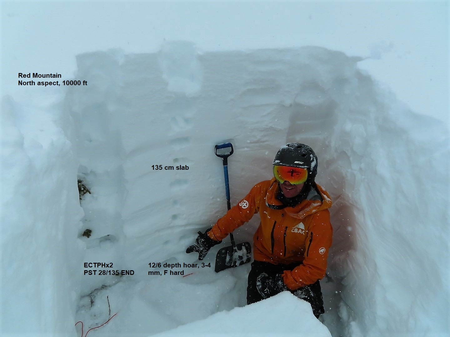
  • Persistent slab sizes are enormous and deadly right now.  They are 2 to 5 feet thick in the shallowest regions of our forecast area (in the Southeast Mountains below treeline) and easily exceed 10 feet in leeward start zones of the favored Ruby Range (in the Northwest Mountains).  The sensitivity to human triggers is also decreasing due to thickening slabs, especially where the snowpack is deeper. Today's danger rating reflects catastrophic consequences and a decreasing likelihood. Tomorrow's danger trends highlight the shallower areas as most prone to see continued human-triggered activity.    
  • Buried persistent weak layers are worse on the northern half of the compass.  We don't know how widespread these layers are after all of the avalanche cycles this month, but we do know that they have repeatedly produced significant avalanche activity with each major loading event.  This video from a few days ago demonstrates those layers.  They're ugly where they are intact.  
  • On the southern half of the compass, weak layers exist but they aren't as well developed.  We don't yet know how much avalanche activity they produced over the last 5 days, or if today's northwest winds will spur any more natural persistent slab natural activity that runs full track.  This is the first time the winds have blown from the northwest during this storm, so it's something I would be cautious of.
  • It's pretty clear that the snowpack will be unseasonably deep and significantly more trustworthy once it has a bit of time to recover from this loading event.  This is especially true for the deeper snowpack areas (the Northwest Mountains) and the southern half of the compass.  The loading event is only just coming to an end, so give it some more time and you'll reap the rewards of patience soon enough. The snowpack will adjust and our forecast confidence in pointing you towards the safest steep riding will come together shortly.  Until then, keep a conservative mindset on any aspect and any elevation.    

Regions covered