Avalanche forecast

Southeast Mountains

Crested Butte Avalanche Center
View on map

Avalanche danger

Tue
Alpine
3 · Considerable
Treeline
3 · Considerable
Below
3 · Considerable
Out of date — this forecast expired 4 years ago. You’re viewing past conditions, not the current bulletin.

Highlights

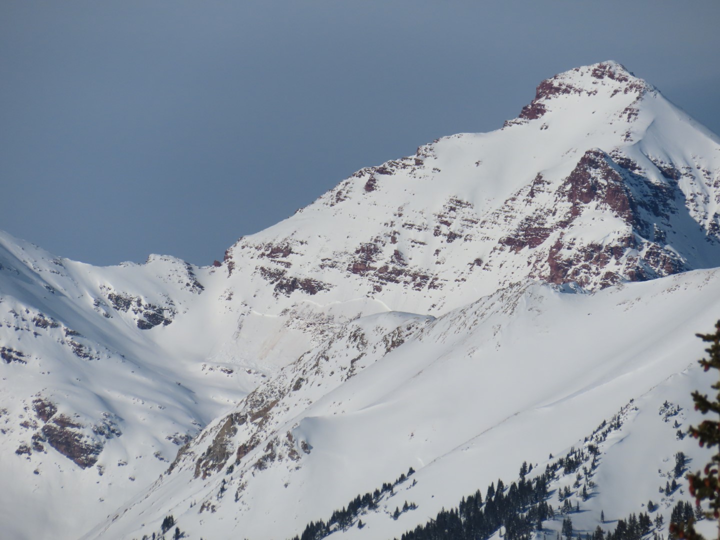
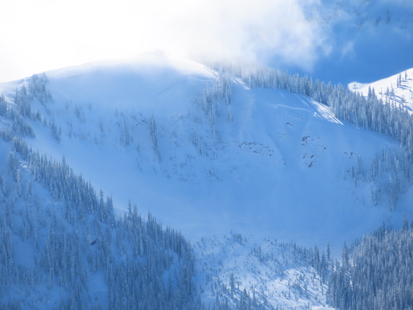
In the Southeast Mountains, large to very large slab avalanches remain sensitive to human triggers today, such as this natural avalanche that reached valley floor yesterday off of Gothic Peak.  Slabs are most dangerous in drifted near and above treeline terrain, such as this very large avalanche that was triggered near Marble on Saturday (original observation + additional photos).  However, slabs can be easily triggered at any elevation.  Conservative terrain selection is essential for managing this tricky snowpack.  

Avalanche problems

  • Persistent Slabs

    • Alpine
    • Treeline
    • Below treeline
    Likelihood
    Likely
    Size
    1.5–3

    Slabs ranging from 3 to 6+ feet thick have formed around the compass and at all elevations over faceted weak layers in the lower snowpack.  The poor snowpack structure produced widespread activity during stormy weather in early January.   Today, these slabs are sensitive to human triggers on some slopes.  Give yourself a wide margin for error given how active and consequential the problem is right now.   Persistent slab avalanches can propagate widely through the terrain, or be remotely triggered from low-angle slopes connected to steeper slopes.  You can reliably avoid the problem by traveling on slope angles that are consistently less than 30 degrees.

    1/4:  A destructive natural avalanche in Red Lady Bowl broke full width on Wednesday.  This avalanche would be hard to survive.
Avalanche Discussion

On Saturday, two snowmobilers were buried and killed in an avalanche near Winter Park.  Yet another tragic accident that brings the fatality count in Colorado up to four in recent weeks.  This is a sad reminder that our snowpack continues to catch people by surprise this winter.  

In the Northwest Mountains, we are starting to see the benefits of a deeper snowpack and our travel advice is shifting towards avoidance of more specific terrain features.  Our mid-December weak layers are showing improvements, and signs of instability on our depth hoar layer (Nov 28th layer) have been rare because overlying slabs are so thick.  Although instabilities are becoming much less common, if you do find the wrong slope, the resulting avalanche will certainly be large enough to bury you or much worse.  The terrain that worries me the most is the slopes that held a shallow snowpack prior to our most recent onslaught of storms.  That type of terrain is most commonly found on windward aspects, such as this explosive-triggered avalanche at Irwin on Saturday.  Or in the case of the Marble avalanche, the slide was triggered from near a wind-scoured ridgeline where the slab is thinner.  Previous avalanche activity in early to mid-December left some slopes with a shallower and weaker snowpack as well.  Given the serious consequences right now, it's wise to default to mellow slope angles when in doubt. 

The travel advice is different in the Southeast Mountains, where the snowpack is shallower and weaker.  We continue to get evidence that persistent slabs are reactive in some terrain.  This very large natural avalanche off of Gothic Peak and this large natural above Twin Lakes both likely ran yesterday.  Yesterday, our forecast team on Double Top experienced numerous large collapses and shooting cracks at all elevations.  The only steep slopes that I trust in our shallower zone are ones that avalanched during our most recent cycle, which effectively removed the troublesome slab, or the very shallow slopes with sagebrush still poking through the snowpack. 

The avalanche danger will start to rise again on Tuesday and Wednesday with additional snow and windloading.  Changes to the danger ratings will depend on how the storm evolves, so stay tuned. 

Regions covered