

Avalanche forecast

Gunnison

Crested Butte Avalanche Center
View on map

Avalanche danger

Thu
Alpine
1 · Low
Treeline
1 · Low
Below
1 · Low
Out of date — this forecast expired 5 years ago. You’re viewing past conditions, not the current bulletin.

Highlights

The primary avalanche hazard today will be an unlikely chance at triggering an isolated slab avalanche at upper elevations on northerly aspects.  In these locations, you could trigger a small avalanche in extreme terrain or on slopes with a shallow snowpack with depths around 4 feet or less.  A shallow snowpack could be due to previous avalanche activity, wind effect, or just a generally dry portion of the forecast area.  A good freeze last night and cool temperatures today will reduce the threat of wet snow avalanches on sunny slopes.

Avalanche problems

  • Persistent Slabs

    • Alpine
    • Treeline
    • Below treeline
    Likelihood
    Unlikely
    Size
    1–2

    Incremental snowfall and windloading in the past month have formed an isolated distribution of slabs over persistent weak layers several feet deep.  Although avalanche activity has been infrequent, use caution on previously drifted, shady aspects where the snowpack is shallower than normal.  That's the type of terrain that most avalanches breaking into older snow have released on.   On Saturday, a natural persistent slab released on Whetstone from wind drifting.   Some avalanche paths that ran in February are suspect because they held shallower, weaker snowpacks that are now getting refilled.   Pay attention to the snowpack structure and assess the consequences of a rare but larger avalanche before riding in steep terrain.  
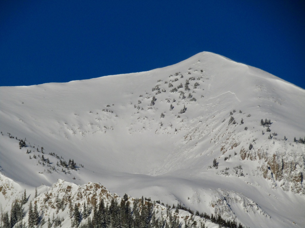
    3/27: A natural persistent slab on Mt. Whetstone, triggered by wind loading.

Avalanche Discussion

The danger rating has dropped back to LOW for all elevations. You should monitor for wet and dry avalanche problems today even at LOW danger. 

Wet snow problems are not expected to create much trouble today due to the solid freeze last night (12 hours or more of below-freezing temps and lows in the single digits) and cooler temperatures today (high temperatures reaching into the 30s).  Some isolated, sunny slopes may become wet enough today for minor Wet Loose avalanches.  Terrain characteristics that will help clue you in to the potential for triggering a small wet avalanche will be sunny, steep, rocky, or protected from the wind.  Ideal conditions for 'corn harvesting' will be just an inch or two of soft, moist snow resting above supportive crusts.  Finding surface snow that is punchy and unsupportive to skis or boots on sunny slopes is a good indicator that you could trigger a wet loose avalanche.  

On shaded slopes at upper elevations, there is a lingering chance for you to trigger a slab avalanche.  Look for slopes with a shallow snowpack to indicate a slight increase in concern.  Some slopes are shallow from previous avalanche activity others might be shallow because of their location in a dry part of the forecast area.  By choosing slopes with a deep and uniform snowpack you will help to further reduce the chance of triggering this unlikely avalanche problem.

Lastly, remember that LOW danger includes the chance for triggering small slabs in extreme terrain.  If you are choosing to venture into very steep and consequential terrain then you need to be confident that you will not trigger an avalanche.  Being swept off your feet by a small avalanche above cliffs, or complex terrain can have dire consequences.  Enjoy the lower threat of avalanches today, but remember to keep thinking about the consequences of triggering a small avalanche.  

Regions covered