Avalanche forecast

Gunnison

Crested Butte Avalanche Center
View on map

Avalanche danger

Fri
Alpine
2 · Moderate
Treeline
2 · Moderate
Below
2 · Moderate
Out of date — this forecast expired 5 years ago. You’re viewing past conditions, not the current bulletin.

Highlights

Thanks to another good freeze last night, the avalanche danger rating will start out LOW this morning. The avalanche danger will rise to MODRATE this afternoon as temperatures climb above freezing and that strong April Sun makes its rounds. Small loose wet avalanches will become possible to trigger on steep slopes where you find a wet snow surface. The threat of triggering a slab avalanche remains isolated in the big picture view and rated unlikely. The most suspect areas to trigger a slab avalanche would be in extreme terrain or on slopes holding a shallow snowpack with depths around 4 feet or less. A shallow snowpack could be due to previous avalanche activity, wind effect, or just a generally dry portion of the forecast area.

Avalanche problems

  • Persistent Slabs

    • Alpine
    • Treeline
    • Below treeline
    Likelihood
    Unlikely
    Size
    1–2

    Incremental snowfall and windloading in the past month have formed an isolated distribution of slabs over persistent weak layers several feet deep.  Although avalanche activity has been infrequent, use caution on previously drifted, shady aspects where the snowpack is shallower than normal.  That's the type of terrain that most avalanches breaking into older snow have released on.   On Saturday, a natural persistent slab released on Whetstone from wind drifting.  Some avalanche paths that ran in February are suspect because they held shallower, weaker snowpacks that are now getting refilled.   Pay attention to the snowpack structure and assess the consequences of a rare but larger avalanche before riding in steep terrain.  

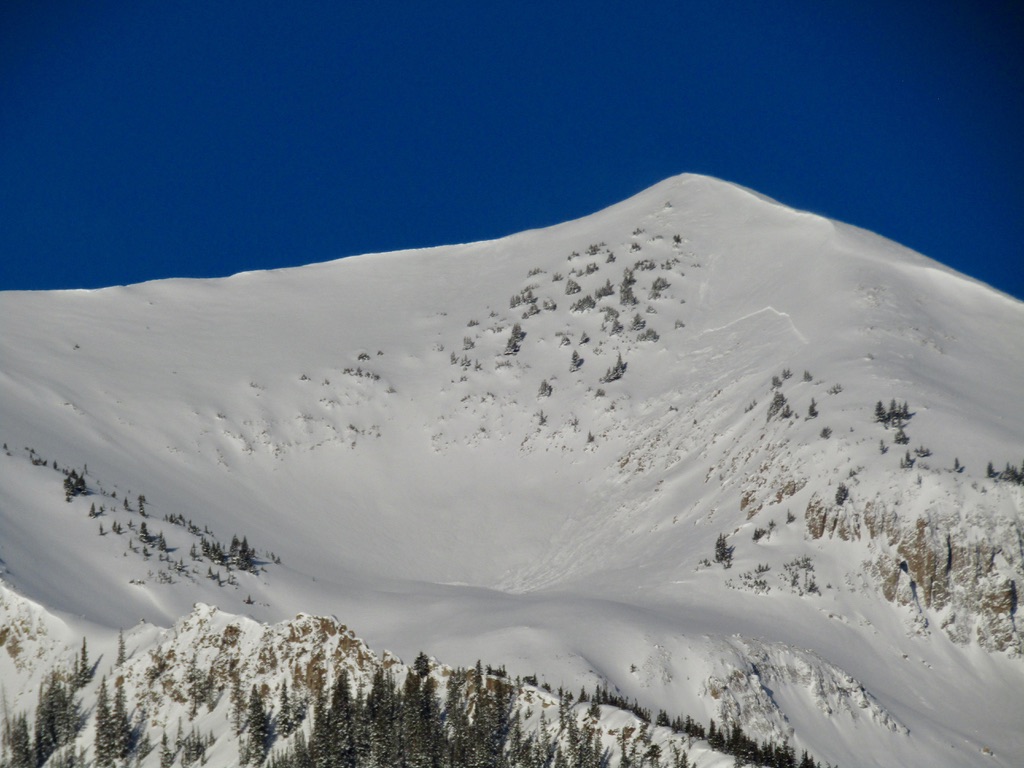
    3/27: A natural persistent slab on Mt. Whetstone, triggered by wind loading.

  • Loose Wet

    • Alpine
    • Treeline
    • Below treeline
    Likelihood
    Possible
    Size
    1

    In steep, sunbaked terrain, small wet avalanches will become possible to trigger as temperatures climb above freezing and that strong April Sun makes its rounds. The warm temps and the high angle of the sun will even extend this avalanche problem onto some northerly-facing slopes. Most wet loose avalanches will generally be harmless unless they push you over cliffs, into trees, gather volume in a gulley, or trigger a slab avalanche. You can easily identify unstable snow if you see the snow surface producing rollerballs and small sluffs. Move to colder snow or less consequential terrain when the snow gets hot and mushy. 

    Example of small wet avalanche debris from last weekend.

Avalanche Discussion

High temperatures today at 11,000ft look to reach near 40 degrees, while the freezing level will extend up into the alpine near 12,000ft. Similar high temperatures last weekend delivered a round of natural wet avalanche activity as cold snow was transitioning to wet snow for its first time. Going into today, we have less cold snow to transition so natural avalanche activity is either not expected or should remain isolated. However, today's warm temps will make human triggering small wet avalanches possible and that may influence your terrain selection this afternoon. 

As we look ahead to the next several days, wet avalanche concerns will continue to grow. Early starts will become necessary to limit your exposure to those wet avalanches. Friday night could be an interesting one, as low temperatures look to just drop below freezing, while some high clouds could move in overnight and limit the snowpack's ability to cool. We could see a rise to CONSIDERABLE avalanche danger on the weekend and an increased threat for large wet slab avalanches. 

Regions covered