Avalanche forecast

Southeast Mountains

Crested Butte Avalanche Center
View on map

Avalanche danger

Sat
Alpine
3 · Considerable
Treeline
3 · Considerable
Below
3 · Considerable
Out of date — this forecast expired 3 years ago. You’re viewing past conditions, not the current bulletin.

Highlights

Avalanche conditions remain dangerous.  Only one day has passed since a major storm and natural avalanche cycle.  You are likely to trigger a large avalanche on steep slopes.  Most avalanches will only involve the recent storm snow, but some slopes may break deeper and produce a destructive avalanche.  Your safest bet is to choose slopes around 30 degrees or less.

Avalanche problems

  • Storm Slabs

    • Alpine
    • Treeline
    • Below treeline
    Likelihood
    Likely
    Size
    1.5–2.5

    Settled storm snow depths since Monday 3/20 range from 2 to 3 feet.  Snowfall densities increased throughout the storm creating denser snow above lighter snow; a clear recipe for Storm Slab avalanches.  The old snow surface (3/20 interface) consisted of near-surface facets and a collapsible crust which may help maintain sensitive avalanche conditions in the upper snowpack and allow for wider propagation.  Low elevation due south-facing slopes having thicker crusts and they will be less likely to collapse. A triggered avalanche will have lots of snow available for entertainment and quickly grow in size as it runs through the terrain.  As time increases from the loading event, the likelihood of triggering a Storm Slab slowly decreases, but the consequence, if you do, remains dangerous.

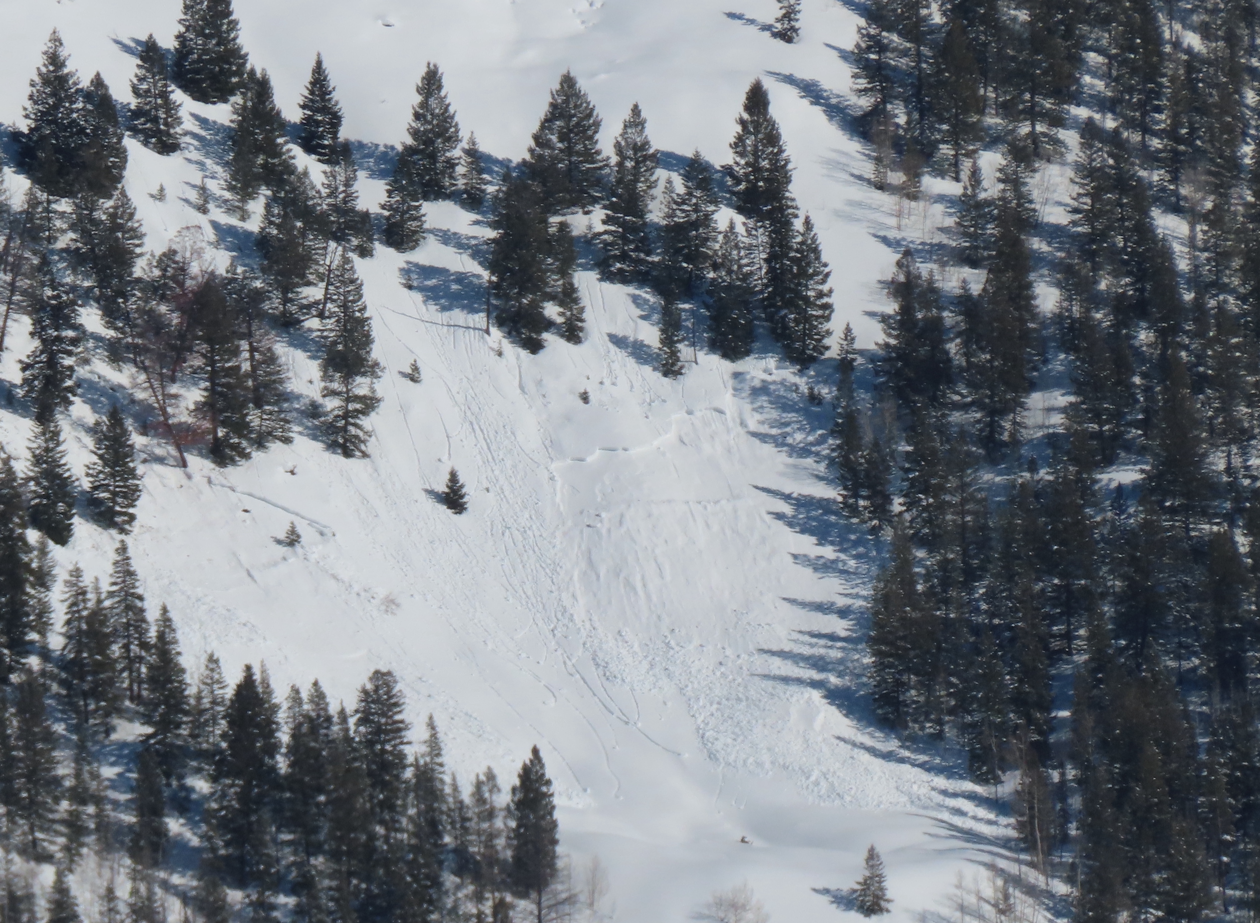
    3/23:  A recent large, natural avalanche in the storm snow.  This avalanche occurred just above the town of Crested Butte near the water supply reservoir.  

  • Persistent Slabs

    • Alpine
    • Treeline
    • Below treeline
    Likelihood
    Likely
    Size
    2–3

    There are several faceted weak layers in the snowpack that remain a concern in some terrain. The most concerning slopes include those that held an unusually shallow and weak snowpack prior to our March storms (like Round Mountain), where snow depths are currently less than about 5 feet (150cm) deep, or in wind-effected terrain with variable snow depths (like Teo or Carbonate Hill).  There are also recently buried faceted crusts in the upper snowpack on easterly and westerly-facing slopes that are just developing an issue (like Whetstone). A natural or human-triggered avalanche in the recent storm snow could further step down to these deeper weak layers and produce an unsurvivable avalanche. 

    The most recent example of a Persistent Slab in the Southeast Mountains occurred on Whetstone's Barcelona Bowl.  This north-facing bowl produced a destructive avalanche Wednesday night.


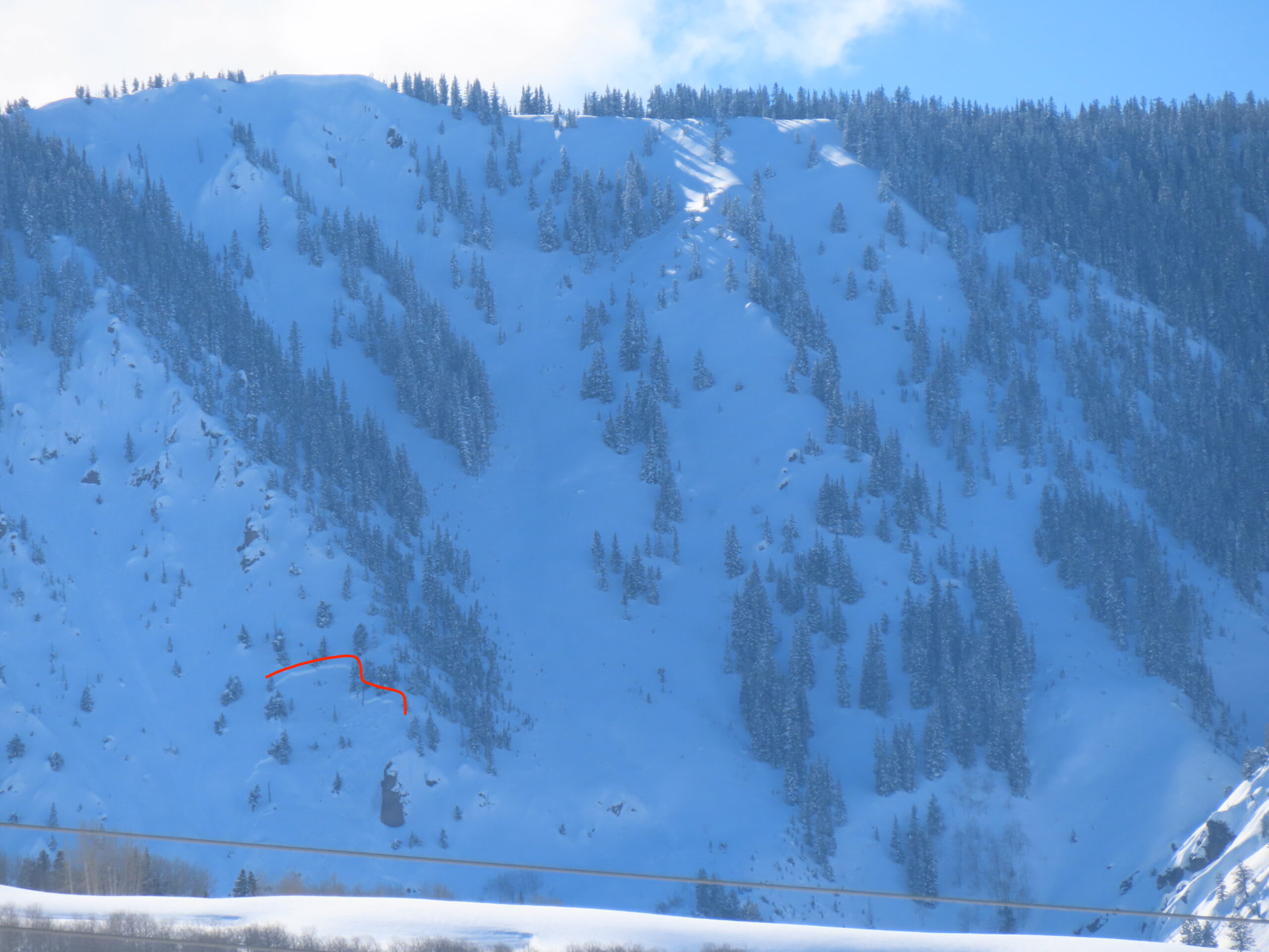
    3/23:  The deep and wide avalanche that ran Wednesday night.  Northerly aspect of Mount Whetstone.  You would not survive an avalanche of this size.

Avalanche Discussion

The recent storm from Monday, 3/20 through Wednesday, 3/22 deposited a slab that is up to 30 inches thick in sheltered terrain and much deeper on drifted slopes.  Modest visibility on Thursday provided evidence of widespread natural avalanche activity.  Take a look through the observations page to see the carnage or look at a few highlighted images in the gallery below.  Many avalanches failed in drifted terrain throughout the storm, but sheltered terrain appeared to fail near the tail end of the storm late on Wednesday.  Two separate observers reported natural avalanches occurring on Schuylkill Ridge and Ruby Peak on Thursday morning.

Most avalanche activity is expected to break at the storm interface about 2-3 feet deep in sheltered areas.  There is more than enough volume in the dense storm snow to kill you.  Yesterday, snowpack tests from near Elkton suggest that human-triggered avalanches remain likely.  Time will slowly decrease the likelihood of you triggering a dangerous avalanche on steep slopes, but not enough time has passed to significantly improve instabilities with the storm snow.

In addition to avalanches breaking in the storm snow, there is a threat of avalanches breaking deeper into the snowpack and creating very large avalanches that grow to a destructive size.  The most recent examples occurred late Wednesday night in north-facing alpine terrain on Mount Whetstone's Barcelona Bowl and Thursday morning on Ruby Peak.  These destructive avalanches broke deeply on weak layers far below the recent storm snow.  Last week, Persistent Slab issues caught numerous groups by surprise in the Elk Mountains just prior to the arrival of the recent storm, and unfortunately, two of the accidents resulted in fatal outcomes. One accident was near Marble and the other near Aspen Highlands.  In the NW Forecast area, the issues appear to be tied to a near-crust faceted layer at the base of previous storms from mid-March (March 10th interface), about 3 to 5 feet deep now.  Our forecast team recently checked out an impressive snowmobile-triggered avalanche on Mt. Baldy,  which was notably thicker due to extensive wind drifting.  This issue has been particularly challenging to forecast because the layer was not obvious on the snow surface prior to its burial, so we don't have a clear map of its distribution.  Furthermore, it has provided very limited feedback in the way of collapses or unstable pit results.  Our best tool right now for plotting the problem is observing avalanche activity patterns, which have been most common on east-to-south aspects. In our shallower SE Forecast area, we are painting a broader distribution because we are also concerned about issues on northerly terrain where the snowpack is shallow and/or variable in depth.  The avalanche in Barcelona Bowl is a good example of this.

Continue to use caution and make conservative terrain choices.  The calendar suggests that it's springtime, but the snowpack continues to shout winter conditions.  


Regions covered