Avalanche forecast

Southeast Mountains

Crested Butte Avalanche Center
View on map

Avalanche danger

Thu
Alpine
3 · Considerable
Treeline
3 · Considerable
Below
3 · Considerable
Out of date — this forecast expired 3 years ago. You’re viewing past conditions, not the current bulletin.

Highlights

It's falling apart out there! Dangerous wet avalanche activity is expected to continue on Wednesday after another poor refreeze and unseasonably warm temperatures.  Your window for finding frozen snow and safer riding will be brief in the morning.   The danger will rise to Considerable after surface crusts melt.   Wet avalanches are gouging deeply or failing as wide slabs, producing deadly piles of cement-like debris.  Large cornices are more likely to fall during the peak of our warmup.   Start and finish your day early, and move to colder aspects and simpler terrain before the snowpack loses strength.  

Avalanche problems

  • Wet Slabs

    • Alpine
    • Treeline
    • Below treeline
    Likelihood
    Likely
    Size
    1.5–3

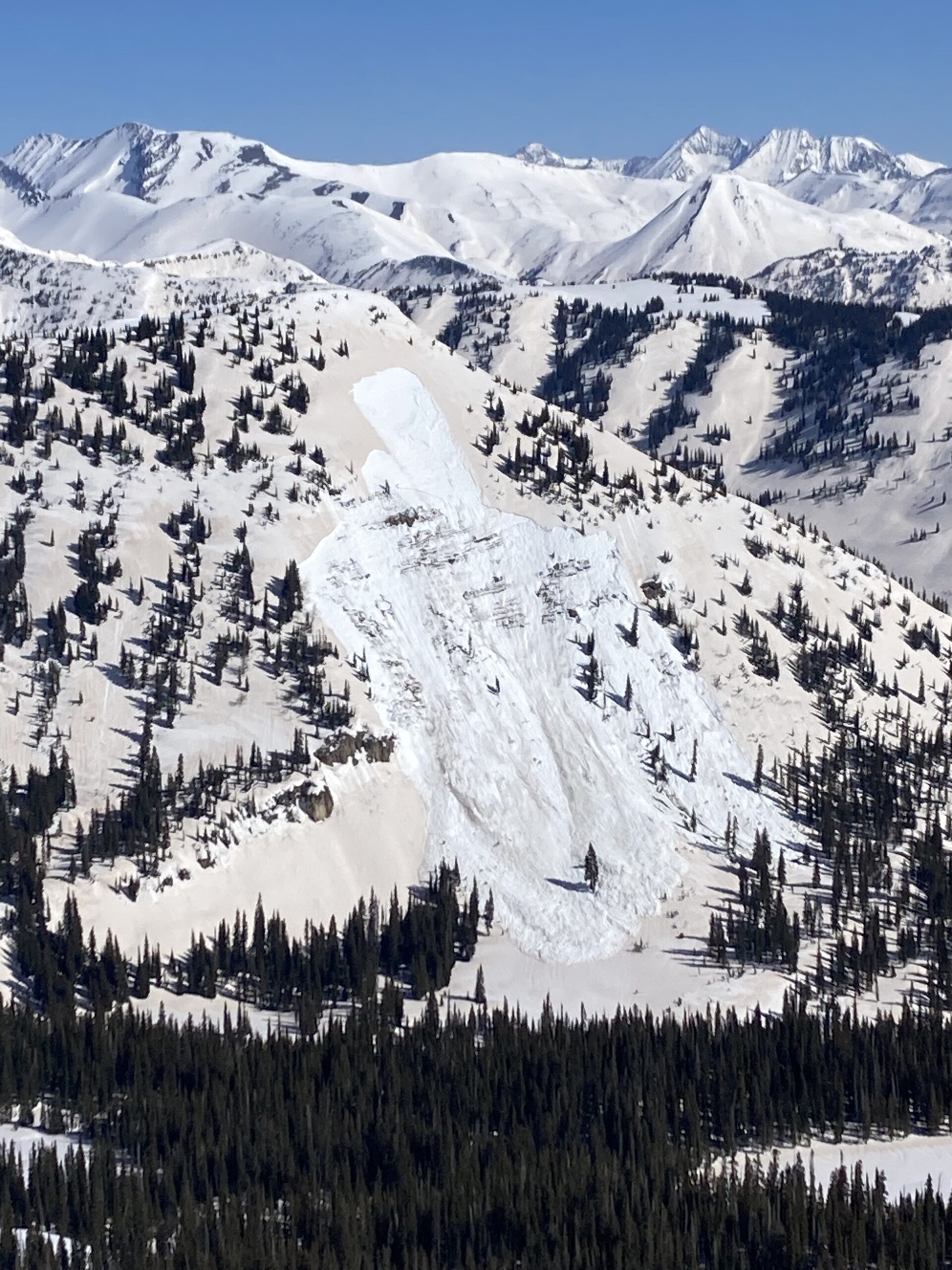
    Numerous large and dangerous wet slabs have been failing naturally this week on the aspects highlighted above.  This pattern is expected to continue on Wednesday following another poor refreeze.  Because the timing and amount of meltwater draining into buried weak layers vary significantly from slope to slope, there is a high amount of variability and uncertainty in predicting Wet Slabs.  Give yourself a wide buffer.  You can reduce your risk by traveling early if the upper snowpack is frozen solid and supports your weight, or moving to north aspects where there is currently limited meltwater.  

    A very large wet slab on Peeler Peak ran around 4/10.  

  • Loose Wet

    • Alpine
    • Treeline
    • Below treeline
    Likelihood
    Likely
    Size
    1–2

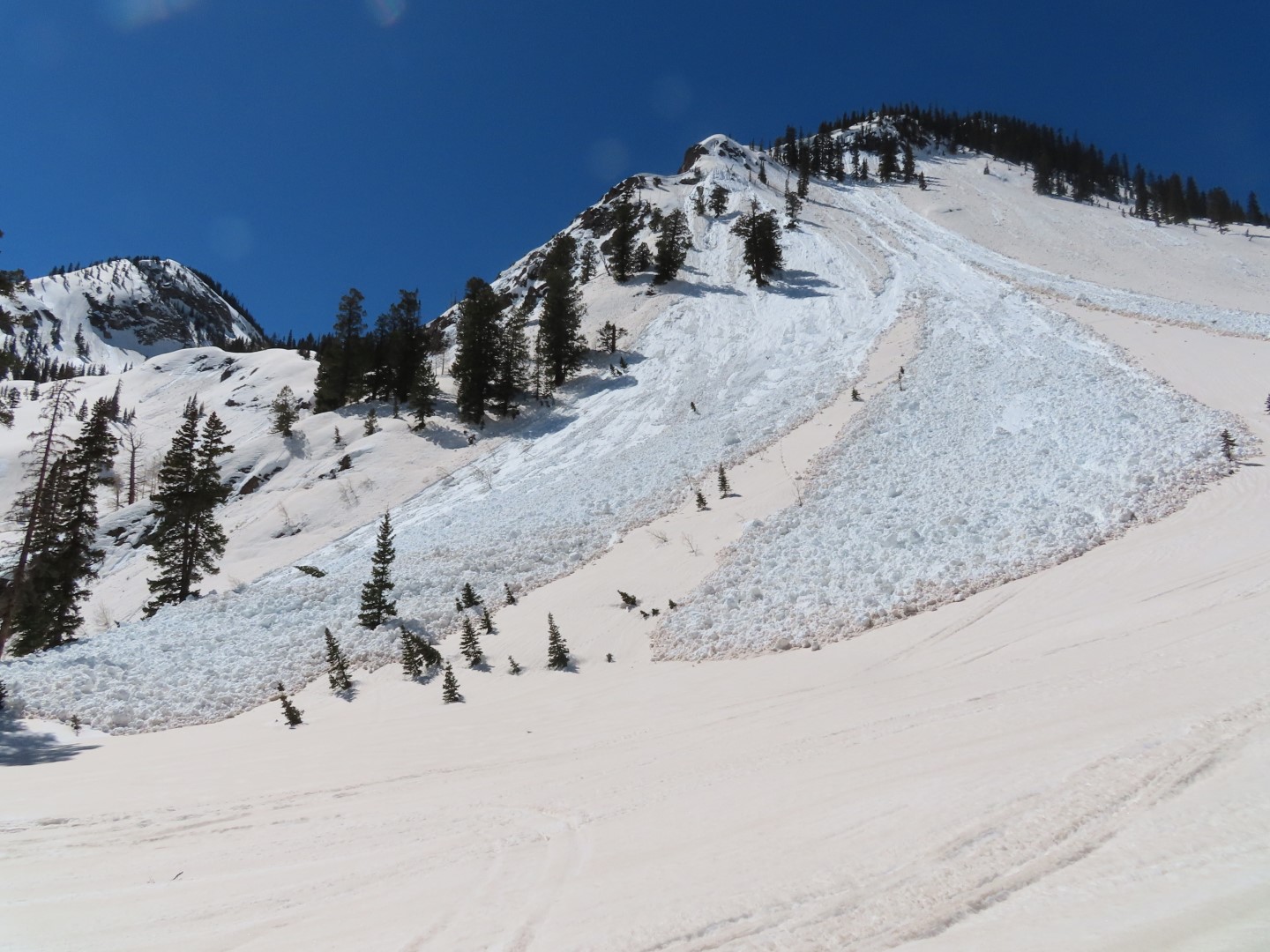
    Wet Loose avalanches have been occurring on all but the highest, coldest slopes.  At mid and lower elevations, they are gouging through significant amounts of saturated snow producing large and dangerous debris piles.   Frozen snow surfaces early in the morning will make for safer travel, but stability will quickly deteriorate from east to south to west slopes throughout the day.  Time your travel while the snow surface is supportive and just starting to soften.  You're too late if you are sinking past your ankles or if you see rollerballs, pinwheels, or natural activity.  You can avoid the problem on lower slope angles or aspects that are still in the shade.

    Large, gouging wet loose avalanches like this are occurring at mid and low elevations, especially on the east, south, and west aspects.  

  • Cornices

    • Alpine
    • Treeline
    • Below treeline
    Likelihood
    Possible
    Size
    1.5–3

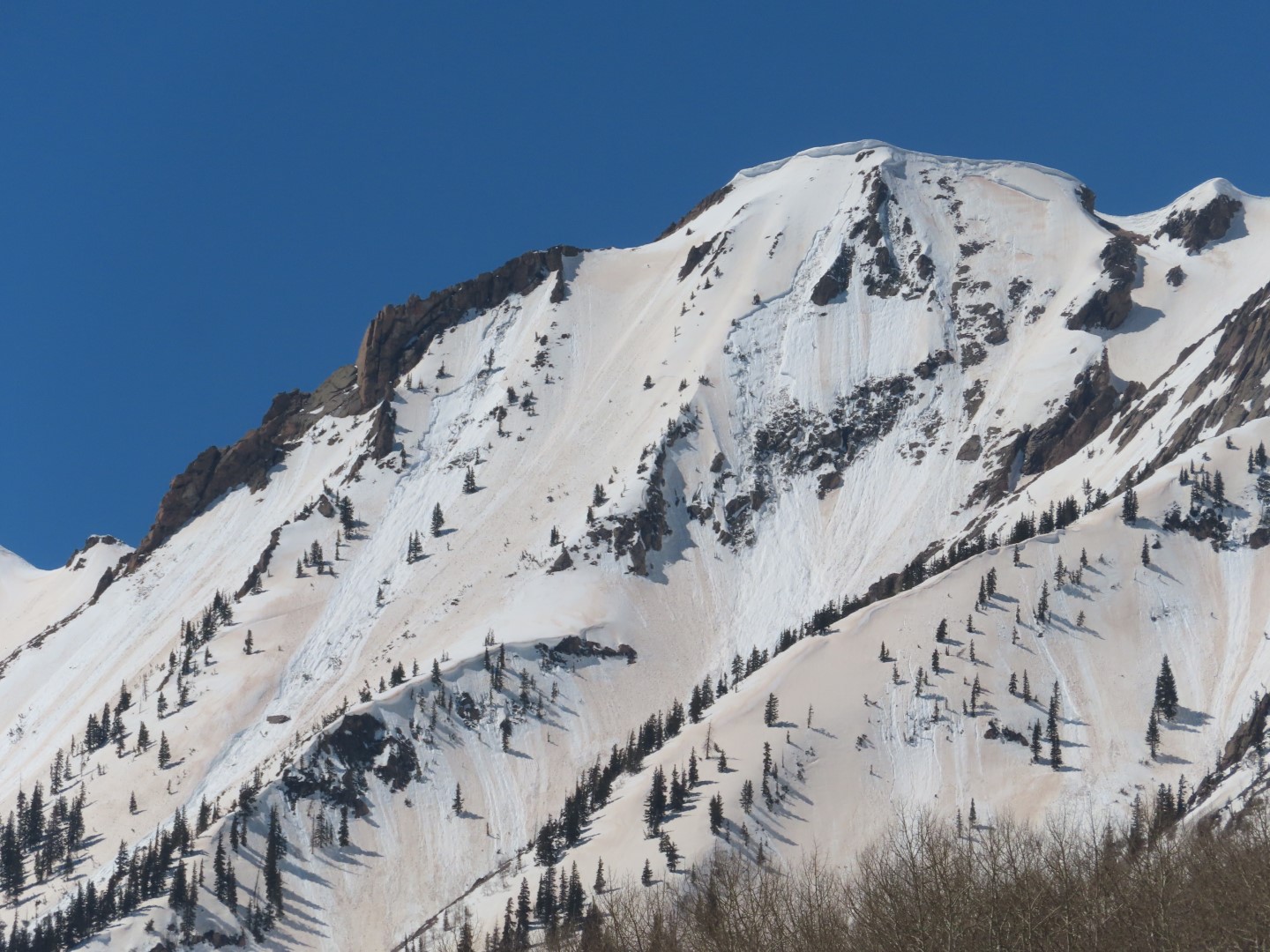
    Large, overhanging cornices continue to fall on a daily basis under our current warming trend.   Some are capable of triggering destructive slab avalanches, while others are trundling down slope entraining large amounts of snow with car-sized chunks of cornice debris.  Limit your exposure on slopes with large cornices above, and give them a wide berth if you are traveling along corniced ridgelines.  

    A recent cornice fall in Redwell Basin.  Minimize your exposure to terrain like this.  

Avalanche Discussion

It's disheartening to watch our near record snowpack fall apart this week, as the dust layer and near-record temperatures are accelerating melt and an ongoing wet cycle.  With another poor refreeze expected on Tuesday night, all of the red flags are flying for continued natural wet slab activity and deeply gouging wet loose avalanches, provided cloud cover holds off for a decent portion of the day.  Scroll through our observations page and gallery below to get a taste of what to expect in the backcountry. A few highlights include these tree snappers in the Anthracites, a D3 off of Peeler Peak, and Gibson Ridge selfishly trying to get more attention, again.  The most dangerous activity thus far has been on east, south, and west aspects near and below treeline where meltwater is most severe.  On Tuesday, we saw indications of the snowpack starting to cross the threshold into dangerous territory above treeline as well, with a few wet slabs releasing from shallow/rocky terrain.   Although we haven't seen any wet slabs or deep gouging wet loose activity on northerly aspects, a wet slab was observed on a northeast aspect below treeline in the San Juans on Tuesday.

With clear skies overnight, there will be a shallow surface freeze that will provide a short window of safer travel in the morning. Have an exit strategy so that you are off and out from under steep terrain before it gets too hot.  High northerly aspects haven't seen the meltwater production to cause larger wet avalanches; some of those high northerly slopes are just starting to get wet and could produce shallow, more manageable wet sluffs, or could still be holding dry powder.  Continue to manage cornice fall hazards as well; warm temperatures make them more susceptible to falling.  Because of increasing winds and afternoon cloud cover,  wet instabilities may not be as active on high elevation, westerly aspects on Wednesday.  

Conditions are quite challenging and out-of-the-ordinary as our wintery snowpack is rapidly transitioning to a wet snowpack.  This too shall pass, with colder temperatures coming this weekend.  

*We will return to normally scheduled forecasts on Thursday morning*

Regions covered