Avalanche forecast

Northwest Mountains

Crested Butte Avalanche Center
View on map

Avalanche danger

Sat
Alpine
2 · Moderate
Treeline
2 · Moderate
Below
2 · Moderate
Out of date — this forecast expired 5 years ago. You’re viewing past conditions, not the current bulletin.

Highlights

Another warm, sunny day will revive wet avalanche concerns on sun-baked slopes.  Although wet sluffs will be the most common problem today, they will be small and easy to recognize.  A trickier problem lurks on north and east aspects: the potential for slabs to break on weak layers in the upper snowpack on some slopes.  A skier had a near-miss with a persistent slab yesterday on Mt. Axtell, and a natural slab was triggered by a small wet avalanche yesterday on Schuylkill Ridge.   Carefully evaluate the snowpack structure and terrain consequences before riding in steep terrain.  

Avalanche problems

  • Persistent Slabs

    • Alpine
    • Treeline
    • Below treeline
    Likelihood
    Possible
    Size
    1–2

    Skiers and riders have triggered a handful of soft slab avalanches that released on buried weak layers in the upper snowpack this week (Example A, Example B, Example C).   Avalanche activity has been most common on the northeast quadrant of the compass, where there are thin crusts surrounding facet layers paired with more favorable wind loading from the last storm. You can also find isolated instabilities on the northwest quadrant of the compass, particularly on paths that avalanched back in February.  Instabilities only exist on some slopes, but slabs are soft and shallow enough to be easily triggered if you find the wrong ingredients: enough recent or windblown snow to form a slab over sugary facets or faceted crusts.  Monitor potential slab thickness and terrain consequences as you move through steeper terrain, treating suspect aspects as guilty until snow assessments have proven them innocent.  

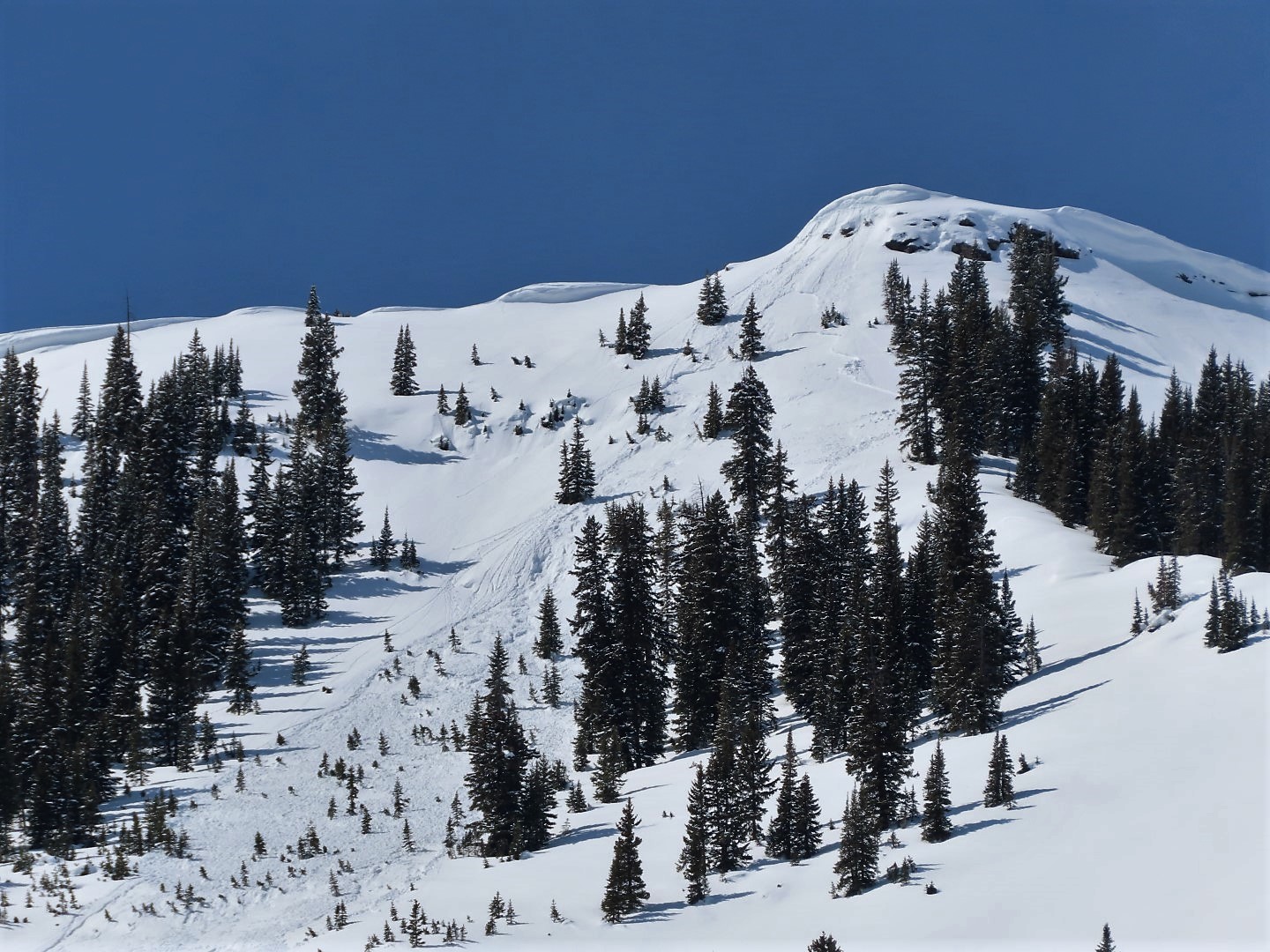
    3/18: A skier was caught by surprise by this persistent slab on Mt. Axtell.

  • Loose Wet

    • Alpine
    • Treeline
    • Below treeline
    Likelihood
    Likely
    Size
    1

    Dozens of small wet loose avalanches ran yesterday in the Northwest Mountains.  With warmer temperatures today, expect more natural activity and easily triggered sluffs later in the day on sunbaked slopes.  Wet loose instabilities are easy to recognize and avoid:  If you see rollerballs, pinwheels, or small sluffs starting from rocky terrain features, move towards colder aspects or lower slope angles to avoid the problem. Wet loose avalanches will generally be small, but they can cause trouble if they drag you into rocks, trees, or into a gulley.   Instabilities will develop by late morning on easterly aspects, and move south and west around the compass as the day progresses.  

    3/18: Small wet loose avalanche activity on Peeler Peak.

Avalanche Discussion

The Ruby Range saw the most extensive wet loose activity yesterday, with fewer wet avalanches in the peaks closer to town and at lower elevations.  With temperatures starting warmer and rising roughly 5 degrees warmer today, expect wet loose activity to continue following the same pattern as yesterday.  Terrain that saw more snow from last weekend's storm will see more action.  I don't expect as much natural activity today, but slides will be just as easy to trigger.  If you're in the type of terrain where a small wet avalanche can have serious consequences, exit avalanche terrain before the snow surface gets sticky or starts to rollerball.  

We are going on consecutive days of unintentionally triggered persistent slabs - or in short, surprises. The most recent could have turned ugly given the terrain consequences.   Our newest generation of persistent slabs is currently isolated and reactive.  Isolated means that instabilities only exist on a few slopes:  a lot of terrain lacks either a slab, a weak layer, or both.   Reactive means that you can easily trigger it.  This can be a tricky situation that often leads to surprises:  you can ski or ride a lot of steep terrain without seeing signs of instability until you get unlucky and find a slope where all the wrong ingredients come together.  Often, those slopes are hard to identify or don't give clear warnings until you are on the slope itself.  If avalanche terrain is on the menu today, the best way to hedge against surprises is to either go to the terrain where you have high confidence in the snowpack (slopes that we aren't highlighting in the persistent slab rose) or to choose terrain with survivable consequences in case you find the wrong slope.  Slabs are relatively shallow right now: 6" to 24" thick. That means you have a good chance of riding the debris out without incident if the slope fans out into a clean runout without trees, cliffs, or gullies.   Although slab activity has been relatively infrequent, we have seen the most avalanches on northeast and east-facing terrain where there are thin crusts helping to amplify failures on facet layers.  We are also concerned about "repeat offenders" on other northerly aspects: slopes that avalanched in February leaving an unusually shallow and weak snowpack in their wake. This video from yesterday highlights this issue.  

Although it has been several weeks since we have observed an avalanche breaking on deeply buried weak layers, on Wednesday, an observer triggered a collapse and shooting crack that would have produced a deeply failing avalanche if it were on a steeper slope.  This is the first obvious sign of instability we've observed on deeper layers this month: a stark reminder that there are still a few land mines out there.  Our travel advice for unlikely deep slabs remains the same: seek out deeper, more uniform snowpacks and don't dilly dally below large cornices.  

Regions covered