Avalanche forecast

Gunnison

Crested Butte Avalanche Center
View on map

Avalanche danger

Tue
Alpine
2 · Moderate
Treeline
2 · Moderate
Below
1 · Low
Out of date — this forecast expired 5 years ago. You’re viewing past conditions, not the current bulletin.

Highlights

Warm and windy!  Watch for small wet instabilities in sunbaked, windsheltered terrain.  If you see winds actively blowing and loading the snow, it means you might find small pockets of fresh wind slab in steep terrain.    Isolated potential exists for larger avalanches on higher elevation terrain that faces north or east.   Be wary of shady aspects harboring shallow and variable snow depths and large overhanging cornices.  

Avalanche problems

  • Persistent Slabs

    • Alpine
    • Treeline
    • Below treeline
    Likelihood
    Unlikely
    Size
    1–2

    Incremental snowfall and windloading in the past month have formed an isolated distribution of slabs over persistent weak layers several feet deep.  Although avalanche activity has been infrequent, use extra caution on previously drifted, shady aspects where the snowpack is shallower than normal.  That's the type of terrain that most avalanches breaking into older snow have released on.   On Saturday, a natural persistent slab released on Whetstone from wind drifting.   Some avalanche paths that ran in February are suspect because they held shallower, weaker snowpacks that are now getting refilled.   Pay attention to the snowpack structure and assess the consequences of a rare but larger avalanche before riding in steep terrain.  

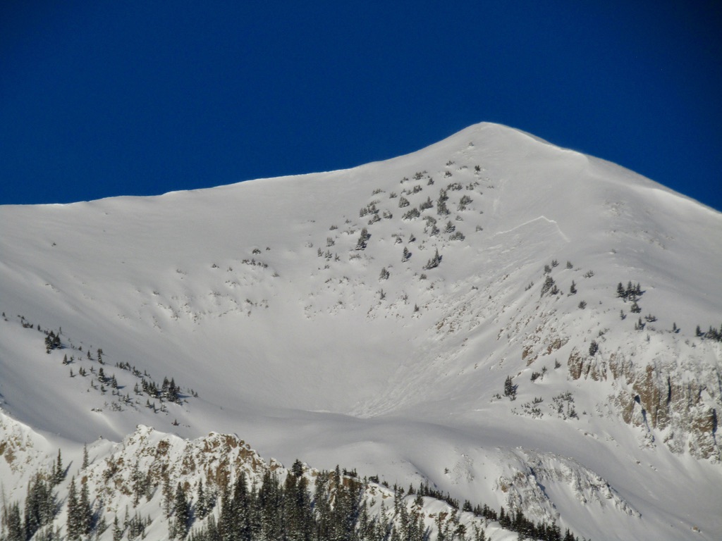
    3/27: A natural persistent slab on Mt. Whetstone, triggered by wind loading.

  • Loose Wet

    • Alpine
    • Treeline
    • Below treeline
    Likelihood
    Possible
    Size
    1

    Another warm and sunny day will keep the threat of wet loose avalanches going in steep, sunbaked and windsheltered terrain.  You can trigger shallow sluffs as the snow surface becomes wet.  Most wet loose avalanches will generally be harmless unless they push you over cliffs, into trees,  or gather volume in a gulley.  You can easily identify unstable snow if you see the snow surface producing rollerballs and small sluffs.  Move to colder snow or less consequential terrain when the snow gets hot and mushy.  

    3/27: Wet avalanche debris below a steep, sunbaked slope.

Avalanche Discussion

We're expecting a few changes to the weekend pattern, largely driven by today's strong southwest winds.

We've lowered the likelihood of wet loose avalanches and narrowed their distribution to reflect the cooling effect from today's winds.  With plenty of sun and temperatures rising above freezing, snow surfaces will thaw again, but not on as many slopes.  Slopes that stay out of the wind but catch good sun will get the warmest: expect east-facing cirques near treeline and sheltered below treeline slopes that face away from the wind to develop the most common wet instabilities, with isolated exceptions elsewhere.  As always, monitoring the snow surface is the easiest way to avoid this problem. If you see rollerballs, pinwheels, or start sinking past your boots into wet, mushy snow, it's time to move to a colder slope.   

The wind slabs that formed from Saturday's northwest wind event have been thoroughly cooked and are no longer an issue in most terrain.  Today's southwest winds are even stronger, but they will have little snow available to transport given how crusty windward aspects are right now.  My biggest concern is if today's winds swirl into north facing basins and drift the dry snow on those aspects into small pockets of slab in gulleys or behind ribs.  This will be a relatively isolated and small issue so it is not listed as a problem, but something to monitor for if you are riding in extreme or high-consequence terrain.  The biggest clue will be if you see blowing snow actively loading or drifting into steep terrain.       

We've listed the persistent slab problem at "possible" for the past several days due to continuous snowfall last week, then wind transport on Saturday, and then significant warming on Sunday: all stressors for buried weak layers.  We saw a natural persistent slab release on Saturday on Whetstone, and a recent cornice fall on Mt. Owen looks to have pried into older weak layers.  Outside of our forecast area, there were several triggered or natural persistent slabs yesterday, including a large persistent slab near Aspen.  Now that we are several days out from loading, and with alpine snow surfaces staying cooler today from the winds, we've lowered the likelihood a notch for persistent slabs.  We are still recommending cautious travel today, consistent with MODERATE danger, given some uncertainty with this problem along with other warming related concerns, such as cornice falls.  Yesterday, a skier had a close encounter with a schoolbus-sized cornice.    Tonight's cold front will help reduce the warming-related concerns, and we are trending the danger to LOW.  That could change if we see more snow with this quick-hitting system than expected.  

Regions covered