Avalanche forecast

Salt Lake

Utah Avalanche Center
View on map

Avalanche danger

  • Alpine
  • Treeline
  • Below treeline
Out of date — this forecast expired 2 years ago. You’re viewing past conditions, not the current bulletin.

Highlights

The avalanche danger is EXTREME on upper-elevation northwest-north-northeast aspects and HIGH on all other mid-elevation terrain. There is a CONSIDERABLE danger on all other slopes. Natural avalanches are certain, with human-triggered avalanches very likely. Heavy snowfall and strong winds have created dangerous avalanche conditions, and avalanches may break several feet deep and hundreds of feet wide on any number of buried weak layers in the snowpack.

For today, I will avoid being on or underneath avalanche terrain at any elevation. There is plenty of great travel and good snow to be had on lower angle slopes less than 30 ° in steepness.

Avalanche problems

  • Wind Slabs

    • Alpine
    • Treeline
    • Below treeline
    Likelihood
    Very Likely
    Size
    3

    Strong winds have created sensitive wind drifts on all aspects at the mid and upper elevations. Cornices have grown large and sensitive and may break further back from ridgelines than you expect. On northerly-facing slopes, any avalanche involving wind-drifted snow may step down to a deeply-buried persistent weak layer. Avoid any wind-drifted slope.


  • Storm Slabs

    • Alpine
    • Treeline
    • Below treeline
    Likelihood
    Almost Certain
    Size
    3

    Yesterday there were reports of cracking and collapsing within the new snow, this is a sign of unstable conditions and if you see cracking and collapsing avoid being on or underneath steep slopes. The storm snow will be reactive today; failing within density inversions, or at the interface with the old snow surface. On northerly-facing slopes, any avalanche involving storm snow may step down to a deeply-buried persistent weak layer.

  • Persistent Slabs

    • Alpine
    • Treeline
    • Below treeline
    Likelihood
    Very Likely
    Size
    3

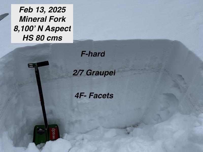
    There are a number of buried weak layers in our snowpack this season, with additional snow and wind any of these layers are weak enough that they could avalanche deep enough to bury a human. We have a weak layer of sugary facets near the ground, formed in November/December and has caused many large avalanches this season. This layer is most likely to be triggered in steep, thin snowpack areas, and on repeater slopes. We have a layer of near surface facets that are now buried 2'–3.5' feet deep, formed during the cold weather at the end of January. We also have a layer of dirty graupel that is showing full propagation in extended column tests and may have facets involved. To top it off, we have a layer of buried near surface facets that is more likely to be found in mid and low elevation terrain.

    Photo (M. White) of cracking and a remote triggered avalanche from a low elevation 7,000'-8,000' north facing aspect.

Additional Info

Nikki's Week in Review is available. Please use this valuable resource as a regular part of your backcountry planning.

Special Announcement

In the last two weeks we have had two avalanche fatalities. Both reports are now available on our website, last Saturday's avalanche in the East Bowl of Silver Fork can be found (HERE) and the report for the February 3rd avalanche fatality on Monte Cristo (Ogden Mountains) is (HERE).

Recent Activity

Yesterday, there were 14 backcountry avalanches reported to the Utah Avalanche Center. Ski area and highway operations reported dozens more. These new and wind-drifted snow avalanches ran on an assortment of facets and new/old interfaces. We have a number of weak buried layers that are now being tested by a large storm and expect to see natural avalanches today. Check out all avalanches and observations HERE.

Photo (Burr) of remote triggered repeater wind-drifted snow avalanche failing on facets in Depth Hoar Bowl (well named slope).

Snow and Weather

Currently, under overcast skies trailhead temperatures are in the mid-teens °F and the highest peaks are in the low-teens °F. Winds are blowing from the north and northwest in the teens gusting to the 30's at the lower ridgelines and from the northwest in the 50's gusting to the 70's MPH at the highest ridgelines. Today, look for partly cloudy skies with continued snowfall, 4"-7" additional snow expected and .4"-.6" of water. Temperatures will be 20-25 °F and winds will blow from the west-northwest 20 gusting to 30 MPH at the lower ridgelines and 40 gusting to 50 MPH at the highest ridgelines with the off chance of gusts to the 60's MPH. Clouds and snowfall may slow down later this afternoon. Storm totals as of 5 am range from 15"-33" of snow and 1.25"-3" of water.

Avalanche Warning

What: The avalanche danger for the warning area is HIGH today and may rise to EXTREME in some areas this weekend.

When: In effect from 6am MST this morning to 6am MST Sunday

Where: For all the mountains of Utah and Southeast Idaho, including the Wasatch Range, Bear River Range, Uinta Mountains, Wasatch Plateau, Manti Skyline, the La Sal Mountains, the Tushar Range....

Impacts: Heavy snow and drifting by strong winds have created widespread areas of unstable snow and very dangerous avalanche conditions at all elevations. Natural and human-triggered avalanches are certain. People should avoid travel in all avalanche terrain and keep out of avalanche runouts. Avoid being on or under terrain steeper than 30 degrees.

General Announcements

CLICK HERE FOR MORE GENERAL INFO AND FAQ

This information does not apply to developed ski areas or highways where avalanche control is normally done. This forecast is from the U.S.D.A. Forest Service, which is solely responsible for its content. This forecast describes general avalanche conditions and local variations always occur.

Observations and Avalanches

Backcountry Emergency Procedures

SMS Notifications

Instagram

Facebook

Get Forecast Email

Previous Forecasts

Contact via email

Submit Observation

Regions covered