Wind Slabs
N
NE
E
SE
S
SW
W
NW
- Alpine
- Treeline
- Below treeline
- Likelihood
- Possible
- Size
- 2
Southwest winds may create pockets of fresh wind-drifted snow in exposed open terrain at the upper elevations. Watch for cracking as signs of unstable snow.
Most slopes have a LOW avalanche danger, with a MODERATE danger on upper-elevation slopes facing northwest through north and southeast for triggering fresh soft slabs of wind-drifted snow.
Although unlikely, there is a chance of triggering a soft slab avalanche 1-2' deep on isolated steep slopes facing west to south to southeast.
Southwest winds may create pockets of fresh wind-drifted snow in exposed open terrain at the upper elevations. Watch for cracking as signs of unstable snow.

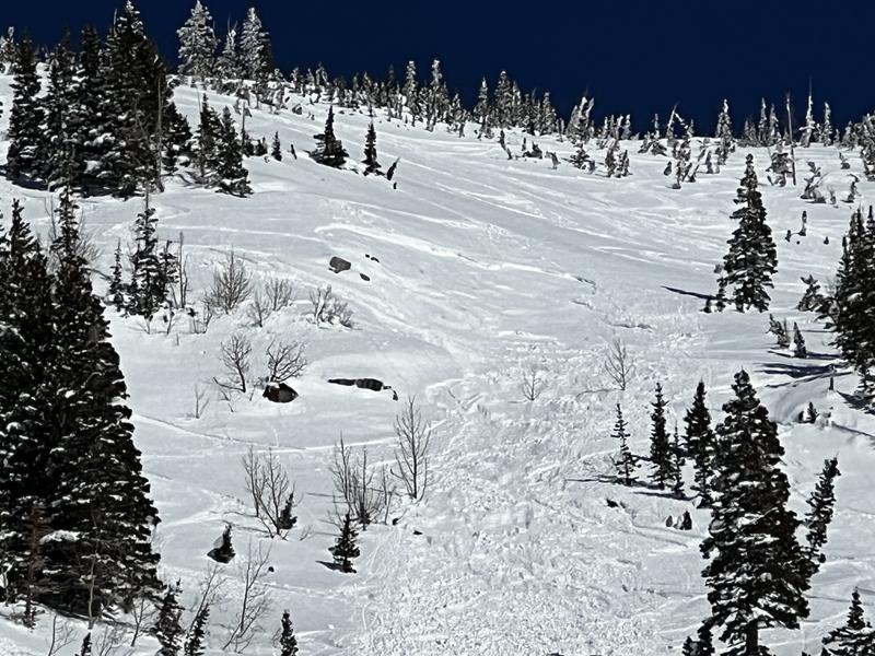
A thin layer of faceted snow sits above an ice crust and is buried 1-2' deep on slopes facing west to south to southeast (see photo below). This weak layer was involved in many natural and human triggered avalanches from this past weekend and the recent skier-triggered slide on Patsey Marley also likely failed on this weak layer.
My field work yesterday in upper Little and Big Cottonwood canyons focused on this PWL and overall I was finding this weakness is gaining strength and that triggering an avalanche on this weak layer is unlikely. This situation is likely to be similar in the Provo mountains as well.
For those interested in the snow metamorphism, watch Mark Staples describing the process that created this PWL on a sunny aspect,
Visit the UAC at Aspen Grove Trailhead today, from noon to 4 pm. You will have a chance to discuss current avalanche conditions and practice transceiver skills. We hope to see you there!
An observation from Utah Valley looking up at the Hourglass Couloir on the south end of Timpanogos showed wet avalanche activity on Wednesday and Thursday (photo below)
Further north in the Salt Lake mountains, a skier-triggered avalanche occurred on either Wednesday or early Thursday morning on Patsey Marley just above the Summer Road. The avalanche was 12-18" deep and 60' wide on a southwest aspect at about 9,500'.
See the full list of avalanche activity where you can filter avalanches by region and date.
Skies are partly-cloudy with a temperature inversion with low elevations in the teens and 20's F and some upper elevation stations in the low 30's F. Winds are from the southwest and generally light through the mid elevations, with a few weather stations gusting into the low 20's mph. A different story at the upper elevations where wind speeds are averaging in the 30's and gusting into the upper 40's mph at 11,000'.
A weak system moves through the region later today with partly-cloudy skies and temperatures rising into the 30's F. Winds will be from the southwest and light to moderate at mid elevations, averaging in the teens with gusts in the 20's mph. Along upper-elevation ridges and peaks, winds will average near 30 mph with gusts into the upper 40's mph. The strongest period of winds should occur later this afternoon where you may even see an errant snowflake or two.
For this weekend, sunny and breezy on Saturday with cooler temperatures. A promising-looking storm later Sunday into Monday, with 6-8" of snowfall likely by Monday.
CLICK HERE FOR MORE GENERAL INFO AND FAQ
This information does not apply to developed ski areas or highways where avalanche control is normally done. This forecast is from the U.S.D.A. Forest Service, which is solely responsible for its content. This forecast describes general avalanche conditions and local variations always occur.