

Avalanche forecast

Salt Lake

Utah Avalanche Center
View on map

Avalanche danger

  • Alpine
  • Treeline
  • Below treeline
Out of date — this forecast expired 7 years ago. You’re viewing past conditions, not the current bulletin.

Highlights

The avalanche hazard is MODERATE at the mid and upper elevations for fresh wind drifts. Although any drifts you encounter are likely to be found on aspects facing north through southeast, cross-loading may create drifts on any aspect. Outside of wind-drifted terrain, the hazard is generally Low.

Watch for wet loose activity today in the lower elevations as the cold, dry snowpack may be reactive to today's warmth and cloud cover.

Avalanche problems

  • Wind Slabs

    • Alpine
    • Treeline
    • Below treeline
    Likelihood
    Likely
    Size
    2

    Westerly winds will continue to drift snow at the mid and upper elevations. Although most drifts will be found on leeward aspects facing north through southeast, cross-loading and the winds being channeled through terrain mean drifts may be possible on any aspect at the mid and upper elevations. These drifts will generally be 6-12" thick, and may break out widely in open, exposed terrain, possibly breaking above you.

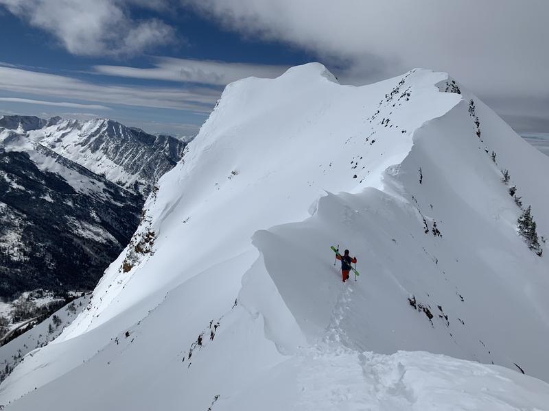
    Cornices are quite large along upper elevation ridgelines - avoid traveling anywhere near the edge of ridges as cornices may break back much further than expected. (Click to view this photo from Nathan Chaszeyka which illustrates how cornices have formed on both sides of an upper elevation ridgeline.)
Special Announcement

Recent Activity

Backcountry observations from Sunday reported small pockets of fresh wind drifts at the mid and upper elevations. These drifts were up to 6-8" thick and 30' wide. [photo: Tomasz Stefankowski]

We also received reports of minor wet loose activity in the lower elevations.

Snow and Weather

Currently: Skies are mostly cloudy and temperatures have been on the rise overnight, with most mountain stations in the 20’s F. Westerly winds began to increase yesterday are averaging in the teens, with gusts in the 20’s and 30’s mph at mid and upper elevations. At 11,000' winds are gusting in the 40’s.

For Today: Snow showers are possible today, and we'll be lucky to pick up a a trace to 1” new snow. Skies will be mostly cloudy and temperatures warming into the 30’s. Winds will continue to blow out of the west, averaging in the teens and 20's mph at the mid and upper elevations, with gusts in the 30’s. At 11,000' gusts in the 40's mph can be expected.

For This Week: A mild westerly flow with warm temperatures and windy conditions. We may pick up a trace to 1" of new snow every occasional 12-hour period. Nothing to get excited about. A hint of a promising colder storm late this coming week, but waiting for weather models to come into agreement before we get any confidence in that system.

Excellent riding can still be found at the mid elevations that are sheltered from the wind and sun.

Additional Info

Observations from Sunday included reports of wet loose activity in the lower elevations. We fortunately have a deep low-elevation snowpack, but the cold dry snow may be reactive to today's warmth and cloud cover . I am not expecting this to be a widespread problem, but pay attention for wet snow in steep, low elevation terrain.

General Announcements

CLICK HERE FOR MORE GENERAL INFO AND FAQ

This information does not apply to developed ski areas or highways where avalanche control is normally done. This forecast is from the U.S.D.A. Forest Service, which is solely responsible for its content. This forecast describes general avalanche conditions and local variations always occur.

Regions covered