
Provo
Avalanche danger
- Alpine
- Treeline
- Below treeline
Highlights
Overall the avalanche danger is generally LOW and normal caution exists. You may encounter small sensitive wind drifts at mid and upper elevations and loose-dry snow (sluffing) within the steepest terrain on wind-protected north-facing aspects. Continue to maintain normal safe travel protocols of only exposing one person at a time to avalanche terrain. If you were to trigger a slide, your only hope of surviving will be having partners watching you from a safe location.
Special Announcement
Thanks to the generous support of our local resorts and Ski Utah, discount lift tickets are now available. Support the UAC while you ski at the resorts this season. Tickets are available here. FREE AVALANCHE BEACON AND GEAR TRAINING
Saturday, January 29th: 9am to 12pm
North Skyline Drive parking lot at the top of Fairview Canyon.
Show up anytime between 9AM and noon and we will teach you how to effectively use your avalanche beacon. We will also show you probing and digging techniques.
Recent Activity
No backcountry avalanches were reported.
You can find all observations HERE.
Snow and Weather
Currently: Skies are clear and temperatures dropped significantly overnight, ranging in the single digits F. Winds have winds decreased and transitioned East Southeast since yesterday now averaging 0-10 mph, with the highest ridgeline gusts near 20 mph.
For today, skies will remain clear and it should become a beautiful bluebird day. Temperatures will slowly climb into the mid-20s F. The winds will transition northwest winds and begin to increase, with an average in the low teens with gusts below 25 mph at the mid-elevations, while averaging in the low 20s mph with gusts near 40 mph along the exposed ridges at the upper elevations.
Riding conditions have been yet again refreshed. We now have 1-2" of new snow sitting atop the 2-4" of snow from this past Thursday/Friday that was turning to facets and surface hoar. Although this means soft, dry snow can still be found on the sun and wind-sheltered slopes providing decent travel and riding conditions, the snow at and near the surface may be a potential weak layer with any future storms. With more cold clear nights in the future, yesterday's new snow will soon begin to weaken as well.
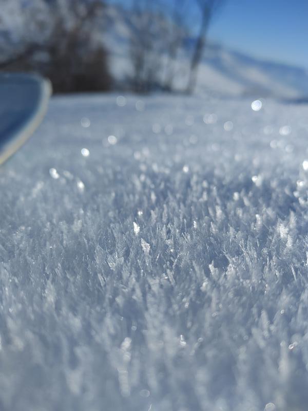
Drew's photo from Tuesday in Main Porter shows the top 4-6" of the snowpack:
General Announcements
Who's up for some free avalanche training? Get a refresher, become better prepared for an upcoming avalanche class, or just boost your skills. Go to https://learn.kbyg.org/ and scroll down to Step 2 for a series of interactive online avalanche courses produced by the UAC.
CLICK HERE FOR MORE GENERAL INFO AND FAQ
This information does not apply to developed ski areas or highways where avalanche control is normally done. This forecast is from the U.S.D.A. Forest Service, which is solely responsible for its content. This forecast describes general avalanche conditions and local variations always occur.