Avalanche forecast

Southeast Mountains

Crested Butte Avalanche Center
View on map

Avalanche danger

Fri
Alpine
2 · Moderate
Treeline
1 · Low
Below
1 · Low
Out of date — this forecast expired 3 years ago. You’re viewing past conditions, not the current bulletin.

Highlights

You are most likely to get into trouble on a wind-drifted slope above high-consequence terrain, or if you get involved in a cornice fall or its resulting debris.  Stay cautious of lingering wind slab instabilities, developing wet loose issues, and slopes with unusually shallow snow depths.  High-quality riding and the safest snow are in wind-protected, northerly terrain.   

Avalanche problems

  • Persistent Slabs

    • Alpine
    • Treeline
    • Below treeline
    Likelihood
    Unlikely
    Size
    2–3.5

    Large, stubborn slabs several feet thick or more exist over faceted weak layers in the snowpack.  Avalanches failing on deeply buried weak layers have become infrequent in recent weeks.  The most concerning slopes are shallow and rocky or where large cornice falls could act as triggers. The greatest number of avalanches have occurred on easterly-facing slopes where wind loading this month has overlapped with faceted crusts.  Early warning signs for this avalanche problem are rare and feedback is infrequent.  Safer riding is where the snowpack is deep and without cornices above.  

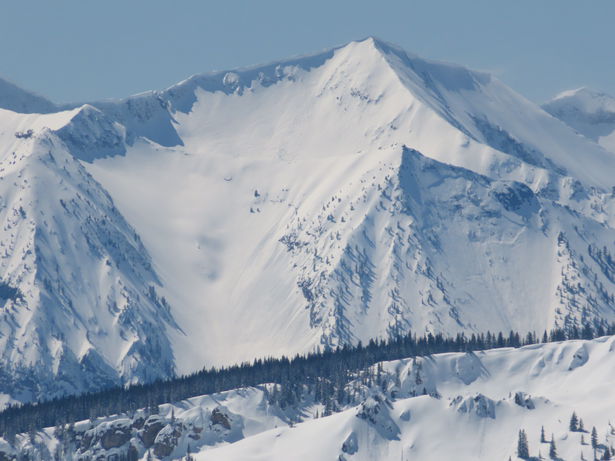
    Very large persistent slab on the east face of Gothic Mountain. 3/31. This avalanche was likely triggered by a cornice falling onto the slope. 

  • Wind Slabs

    • Alpine
    • Treeline
    • Below treeline
    Likelihood
    Possible
    Size
    1–1.5

    A few inches of snow and strong southwest to west winds formed small drifts earlier this week, most commonly at high elevations  These slabs are becoming stubborn to triggers now.  Slopes with large, productive fetches are most concerning for finding a lingering wind slab.  Assess the amount of recent drifting and terrain consequences before riding in wind-affected terrain.  Look for stiffer/thicker deposits below ridges and in cross-loaded gullies to identify the problem.  You can avoid the problem by traveling where the snow is sheltered from the wind.  

    Example of a wind slab from earlier this season.

Avalanche Discussion

Observations from the past two days suggest wind slab formation wasn't as large or extensive as expected. Lingering concerns are most pronounced at higher elevations in the Northwest Mountains, where storm totals and snow available for transport were up to 8".  The same issues could exist in isolated areas of the Southeast Mountains, particularly terrain with large fetches for gathering snow and depositing it below ridges or concave catchments.

The likelihood of persistent slabs is gradually becoming increasingly stubborn and isolated under quieter loading patterns than we saw in March.  We've made a few adjustments to the distribution to highlight our areas of greatest concern: slopes with huge cornices overhanging, and unusually shallow slopes.  The Gothic avalanche is a good example of the former, and the Beckwith slide is a good example of the latter.  

Today's warmup is modest and will fall significantly short of last weekend's high temperatures.  Thus, we are only expecting minor wet loose activity to involve the recent storm snow, sliding above last weekend's crust.  These issues are most likely to develop on sunbaked terrain that received more than about 5" of recent snow, generally in the Northwest Mountains.  

Party for the People! Join us this Friday, April 7 at the Talk of the Town from 5-9 p.m. so we can thank everyone for their support this season with free beer and music from Atmospheric Whiskey River.

Regions covered