Avalanche Forecast

Issued: Jan 20th, 2019 6:35PM

The alpine rating is considerable, the treeline rating is considerable, and the below treeline rating is moderate. Known problems include Persistent Slabs and Wind Slabs.

Josh Hirshberg,

Email
The Bottom Line: Dangerous conditions have developed in the East Central Cascades. Incremental loading has stressed multiple persistent weak layers to their breaking point. This is a good time to step back, and avoid recreating in avalanche terrain.

Summary

Snow and Avalanche Discussion

On Saturday, Mission Ridge Ski Patrol triggered multiple avalanches up to 3 feet deep on northwest through northeast aspects between 6-6500ft. To the north, a skier was caught and carried in an avalanche near Washington Pass.

Toward the end of the cold and dry period, shaded aspects harbored surface hoar and facets east of the crest. One observer reports skiing on a ‘glass carpet’ of surface hoar between 4,000 and 5,500ft. Another noted ‘dramatic faceting’ near and below treeline on shaded aspects. The new snow doesn't appear to be bonding very well, especially where it sits over facets and surface hoar. A few natural avalanches occurred overnight on the 18th at Mission Ridge, these ran on a crust from early January. Observers have noted loud whumphs and collapses near Blewett Pass the past few days. As the snow accumulates with warming temperatures and the winds blow into Saturday, we will create a cohesive slab and further stress these layers. More on the recently buried snow surface in this observation here.
 
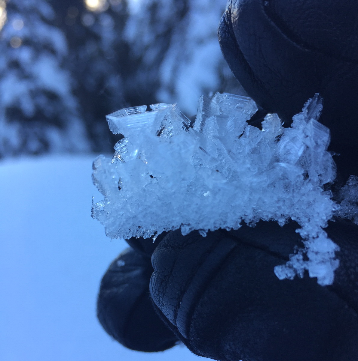
Recently buried layer of large surface hoar (1/17). Where a slab sits over this layer, expect dangerous conditions to exist.


Weather Forecast

Mon 21st Jan 14:50 - Robert Hahn

Weather Synopsis for Monday night through Wednesday

A weak high pressure arrives Monday night as frontal boundaries ride over the top. The first will weaken and fizzle Monday night, bringing clouds and a chance of very light precipitation to the Olympics and Mt. Baker area by Tuesday morning. The second, a far more significant and moisture-laden frontal system, will bring a warm front into the region during the day on Tuesday while the associated low tracks toward the north end of Vancouver Island. The system will spread snow, which will eventually change to rain in many low to mid elevation areas later Tuesday and Tuesday night. We expect a changeover to rain at Snoqualmie in the early evening, Stevens later in the evening, and Mt. Baker base after midnight. Increased precipitation will occur throughout the day on Tuesday, continuing Tuesday night as the low tracks WSW toward Washington State.

Tuesday evening, the heaviest precipitation will hit the west slopes of the Cascades north of Stevens Pass on an SW flow before targeting the entire west slopes as the flow shifts westerly. On Wednesday, light post-frontal snow showers, heaviest in possible convergence bands near or north of Stevens will decrease. Storm totals of 1-2" of snow water equivalent are forecast throughout the west slopes of the Cascades by the end of the day on Wednesday. Don't expect much cooling behind this storm as a ridge offshore keeps warm air moving over the region.

Regional Synopsis

Sun 20th Jan 09:00

January 20, 2019

The recent weather pattern of lower accumulation storms (by NW standards) and longer stretches of calm weather should continue as we move into late January. Since January 17th, incremental snow accumulations punctuated with rising freezing levels favored the south and eastern parts of the region. Storm instabilities have risen with storms and gradually subsided.

A storm slab at Mt Baker.


New Snow Problems

Storms over the past week have brought a range of layers from rain crusts, to heavy moist snow, to stiff drifts, to light dry powder. Some storm days, like the 18-19th, saw reactive, but very short-lived avalanches caused by heavy precipitation and wind. Even the longer-lasting avalanche problems, wind slabs, haven't persisted for more than a few days. Where the recent snow is stressing underlying weak layers, more dangerous avalanche conditions have prevailed.

Surface hoar in the East Central zone


Old Snow Problems

Persistent weak layers (PWLs) have been a constant in the eastern zones of the Cascades this winter. As usual, they have been much less problematic at the Passes and west of the Cascade Crest. The latest PWL is a layer of surface hoar, buried around January 17th and found generally east of the Cascade Crest. Buried surface hoar is an active weak layer in the eastern zones and can be found to a limited extent on the eastern edge of the Stevens and Snoqualmie Pass zones. There few, if any, avalanches have been reported on the buried surface hoar. It may be most problematic in open, wind-sheltered terrain, especially well above the valley floor.

You are most likely to find other layers of old weak snow the further you move east from the Cascade crest. Here snowpacks are shallower, more variable, and generally weaker. In some locations, weak snow near the ground can still be found. These basal facets have hung around all season. Digging profiles and using snowpack tests is the best way to gain information about these old persistent weak layers. However, snowpack tests are just one piece of the puzzle. Your terrain decisions shouldn't hinge on any given test result. Because of the size of our forecast zones and the variability in the snowpack, it's important to make snow observations as you travel. We’ll keep watching these old layers, but let us know what you see while you are in the mountains.

Problems

Persistent Slabs

An icon showing Persistent Slabs
The snowpack has become ripe for large, human triggered avalanches. There are multiple persistent weak layers that all have the potential to fracture and avalanche with this incoming storm. These layers are tricky because they’ve sat around for weeks not producing avalanches. Just the past few days they have been incrementally loaded and appear to be ‘waking up’ with large whumphs being reported near Blewett Pass -even as low as 5,000ft. They are likely to be doing the same in other areas on the eastern edge of the range where less than 3 or 4 feet of snow is on the ground. Slides could fail a few feet down, or on the ground, taking the entire seasons snowpack with it. Slides could be very wide and encompass entire terrain features. Don't get lured onto slopes steep enough to avalanche, don't be the trigger. Avoid runout zones below steep slopes, as it may be possible to trigger slides from below as well. 

Further west, the main layer of concern will be surface hoar that has been recently buried by new snow in the past few days. Slides may wrap around terrain features and surprise you and your group.

Aspects: All aspects.

Elevations: All elevations.

Likelihood

Possible

Expected Size

3 - 3

Wind Slabs

An icon showing Wind Slabs
Gusty winds drifted snow on Saturday. Anticipate that these slabs won’t bond well with the old, weak snow surface that recently got buried. Look for shooting cracks within the new snow. Does the snow sound hollow? Are there deep dunes of drifted snow? What is underneath that slab, is there strong over weak? If so, it is time to avoid slopes steep enough to avalanche.

Aspects: All aspects.

Elevations: Alpine, Treeline.

Likelihood

Likely

Expected Size

2 - 2

Valid until: Jan 21st, 2019 5:00PM