

Avalanche forecast

Northwest Mountains

Crested Butte Avalanche Center
View on map

Avalanche danger

Thu
Alpine
2 · Moderate
Treeline
2 · Moderate
Below
2 · Moderate
Out of date — this forecast expired 5 years ago. You’re viewing past conditions, not the current bulletin.

Highlights

We are in an extending stretch of dry weather that is allowing last weeks concerning avalanche problems to either facet away in some areas or become far less reactive to human triggering in others. Either way, the threat of human triggering a large slab avalanche is still lurking. If you are riding in avalanche terrain, stay vigilant and continually assess for those lurking slabs that could still release and ruin your day. The most likely area to find the avalanche problem is on the northern half of the compass and in previously wind-loaded terrain. While the safest riding can be found on slopes that previously avalanched earlier this month, and on southerly facing aspects. 

Avalanche problems

  • Persistent Slabs

    • Alpine
    • Treeline
    • Below treeline
    Likelihood
    Possible
    Size
    1–2

    Persistent slabs up to several feet thick are becoming more stubborn to human triggers and they may not alert you to their presence with obvious signs of instability. The problem is on the north half of the compass, where the foundation to our snowpack is weak and faceted. In steep terrain, the distribution of these slabs is variable because of a widespread cycle earlier this month.  Be cautious of steep terrain where you find strong over weak structure, especially in terrain with recent wind loading.  Remember, persistent avalanches can also be remotely triggered from flat terrain below a steep slope, and avalanches might propagate much wider than you expect. Choosing lower slope angles or southerly facing slopes is the easiest and most reliable way to avoid this problem.

    This widely propagating persistent slab ran naturally on December 10th on Mt. Axtell. 
Avalanche Discussion

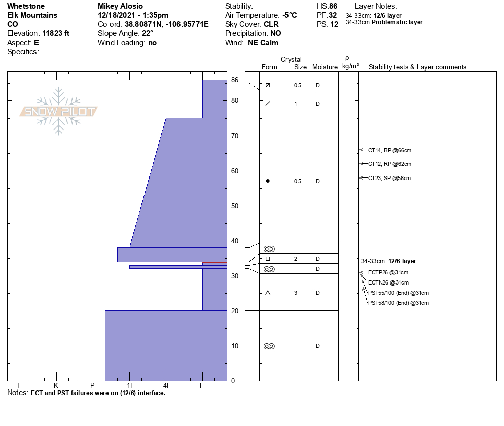
Wednesday is looking to be the last day where you could stay in the stepping-out mindset. With each passing day of dry and calm weather, the sensitivity of persistent slabs gradually decreases. In shallow areas, slabs are decaying, and in deeper areas, the snowpack is settling and gaining some strength. Stability tests from the last few days are showing improvements compared to earlier in the week (Example AExample B). While the weekend passed with fewer reports of collapses than last week and more reports of a weakening snowpack structure. Our last reported persistent slab avalanche was skier triggered on December 12th. This all highlights an improving trend for now. 

Looking ahead, very dangerous conditions are on the horizon: On Thursday we'll see snow showers starting up. Current snow forecasts don't look like there will be notable changes to the avalanche danger throughout the day. However, as we look to Friday, the avalanche danger is going to begin to rapidly spike. The snowpack is weak around the compass and it is not ready for any form of a loading event. Get ready for a prolonged and complicated natural avalanche cycle and the potential for an extended period at HIGH avalanche danger. We further look to be building up to the potential for avalanche activity to be reaching valley bottoms by Friday Night and into Saturday. If things stay on track and we reach those criteria, travel out many of the valley roads will not be recommended by Christmas Day. That list would include Kebler Pass, Peanut Lake Rd, the nordic tracks in the Slate River Valley, and Gothic Rd. Warnings may further be issued for smaller slopes around Crested Butted and Mt Crested Butte. This is a note to prepare, and begin planning ahead.

PSA: Red Lady Glades tresspassing.  In an effort to preserve everyone's access to Red Lady, we are asking backcountry travelers to respect the restricted access boundaries around the Mt. Emmons Wastewater Treatment Plant Site.  Increased trespassing this year could threaten our access to the Red Lady skin track, as well as negatively impact water resource data collection conducted by the NRCS.  Please familiarize yourself with the property boundaries and details here.  

Regions covered