Avalanche forecast

Northwest Mountains

Crested Butte Avalanche Center
View on map

Avalanche danger

Thu
Alpine
2 · Moderate
Treeline
2 · Moderate
Below
2 · Moderate
Out of date — this forecast expired 4 years ago. You’re viewing past conditions, not the current bulletin.

Highlights

You can trigger an avalanche in the recent storm snow several feet deep.  Wind-loaded slopes offer the largest avalanche size due to drifting during the storm.  Much of the natural activity over the past few days came from leeward terrain.  On wind-sheltered slopes, carefully assess the bonding between recent storm snow and the old surface below before committing to terrain steeper than 35 degrees.  The avalanche danger is trending downward, but the threat of human-triggered avalanches remains.

Avalanche problems

  • Storm Slabs

    • Alpine
    • Treeline
    • Below treeline
    Likelihood
    Possible
    Size
    1–2.5

    The Northwest Mountains have picked up over 2 feet of snow since Friday, accompanied by strong winds Monday.  Storm slabs are up to several feet thick.  They'll be larger and may be more sensitive to triggers on wind-loaded slopes: be extra cautious of leeward terrain.  Storm slabs are smaller and less common in wind-sheltered terrain.  Use small, steep slopes to assess storm instabilities at any elevation.  You can generally avoid the problem on slopes less than about 35 degrees.

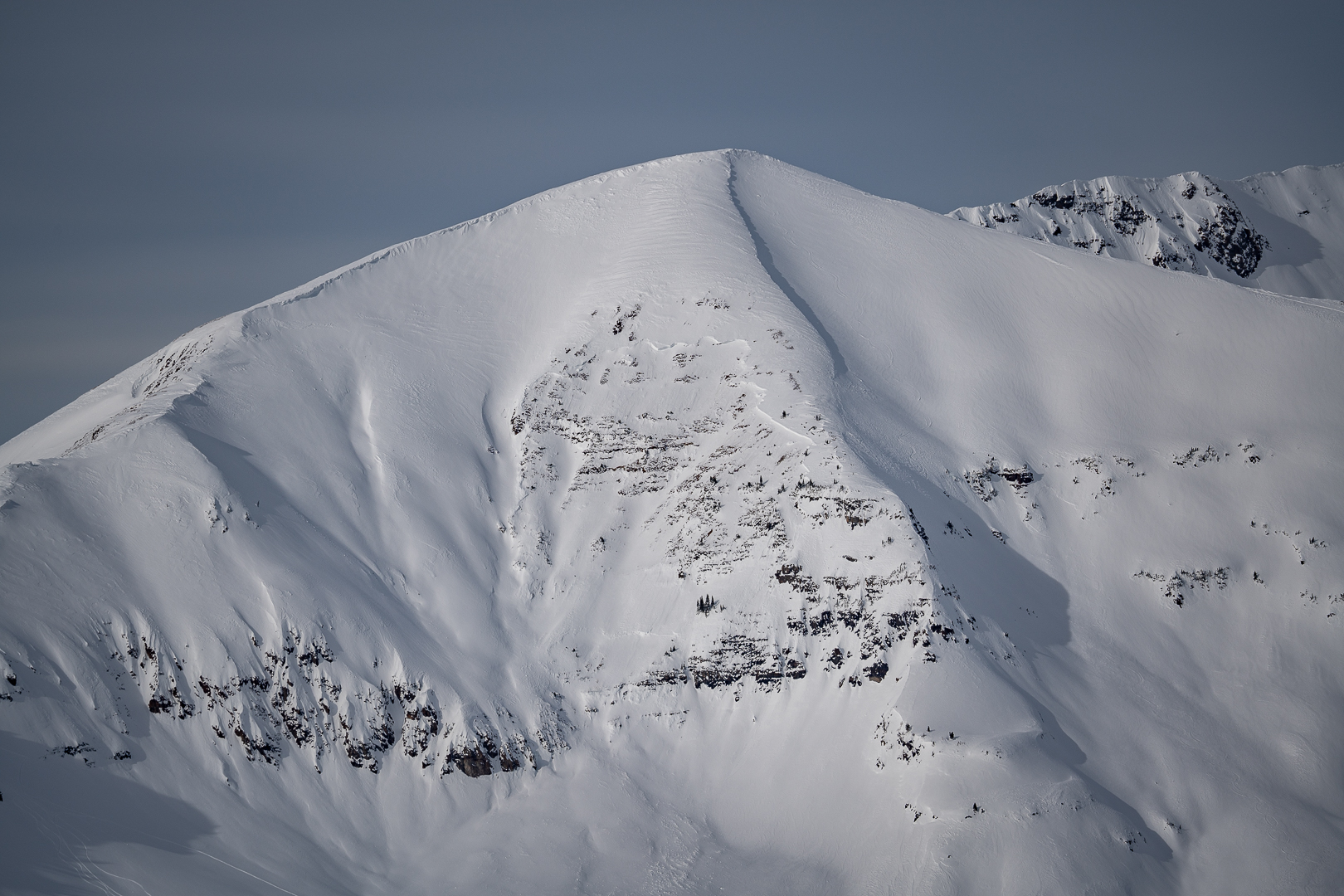
    1/31: A trio of natural avalanches on Schuylkill Ridge.  This image highlights the dangerous size potential of avalanches in leeward terrain.

  • Deep Persistent Slabs

    • Alpine
    • Treeline
    • Below treeline
    Likelihood
    Unlikely
    Size
    2.5–3

    On most slopes in the Northwest Mountains, faceted weak layers are buried deeply and unreactive to human triggers.  Some slopes have unusually shallow or variable snow depths where riders may be able to trigger a hard slab several feet thick or more.  Be cautious of windward terrain features with variable depths, rock bands, and slopes that previously avalanched in early December where you are most likely to find a thin trigger point.   The safest riding is where the snowpack is uniform and consistently deeper than about 5 feet (150 cm).   

    This avalanche was triggered by explosive work in the Irwin Cat-Ski tenure on Thursday, 1/26.  It is representative of the type of terrain (shallower than normal, full of trigger points, and unsupported from below) where an unlikely chance remains for you to trigger a deep avalanche.

Avalanche Discussion

A stormy period from Friday, 1/27, through Monday, 1/30, deposited up to 3 feet of snow in the Northwest Mountains and up to 2 feet in the Southwest Mountains.  Yesterday, clear skies provided an opportunity to view the natural avalanche activity from the storm cycle.  A large portion of the natural avalanches came from drifted terrain near and above treeline however, there were some avalanches in sheltered areas.  Take a look at these observations to see some of the natural activity (Schuylkill Ridge, views from Mount Crested Butte, other Ruby Range activity), or look through the media gallery below to see some of the action.

The good news is avalanche activity appears to only involve recent storm snow and did not break on deeply buried layers; the bad news is avalanches are large enough to bury, injure, or kill you just from the recent storm snow.  Drifted terrain is the most dangerous as slabs are the thickest and therefore capable of producing larger avalanches.  Sheltered slopes can produce avalanches as well, but a bit smaller than those in drifted areas, yet still have the potential to be big enough to bury you.

Prior to the recent storminess, the weather was cold and dry for around a week which caused faceting to occur at the old snow surface.  Slabs 1 to 3 feet thick formed above this weak layer in recent days.  The Near Surface Facets are relatively small, around .5mm to .7mm, in size but may keep human-triggered avalanches a threat for longer than usual.  This also explains why the threat of human-triggered avalanches remains in sheltered areas in addition to drifted locations.  We have kept the Storm Slab avalanche problem for Wednesday and dropped the likelihood to 'Possible'.  If snowpack tests and observations point to the threat lingering through the weekend, the problem may shift to a Persistent Slab.

During or in the wake of each of the major loading events in January, we've seen a few avalanches release on deeply buried weak layers.  Though the chances of triggering a deeper layer are relatively low,  they pose a high consequence threat that is most concerning where the snowpack is relatively shallow and variable in snow depths.  The snowpack structure tends to be thinner and more susceptible to human triggers in parts of the Southeast Mountains.  Here are a few examples of avalanches this month that failed on early-season weak layers from the Northwest Mountains (Ruby Peak, Robinson Basin)  and the Southeast Mountains (CBMR, Walrod).

Your observations are especially helpful as skies clear and we assess how the multiple weak layers in our snowpack responded to the most recent storm.  You can submit observations here, or by texting photos to 970-444-2170. 


Regions covered