Natural avalanches unlikely, human triggered possible.
Treeline
Natural avalanches unlikely, human triggered possible.
Below Treeline
Natural avalanches unlikely.
Alpine
Natural avalanches unlikely, human triggered possible.
Treeline
Natural avalanches unlikely, human triggered possible.
Below Treeline
Natural avalanches unlikely.
Regions
Snoqualmie Pass.
The Bottom Line: The snowpack in the Snoqualmie Pass area seems to be gaining strength. That doesn’t mean we are out of the woods yet. You may still find pockets of unstable storm snow at higher elevations, and in wind prone areas. When the sun comes out, snow conditions can change quickly, and may produce loose wet avalanches.
Snow and Avalanche Discussion
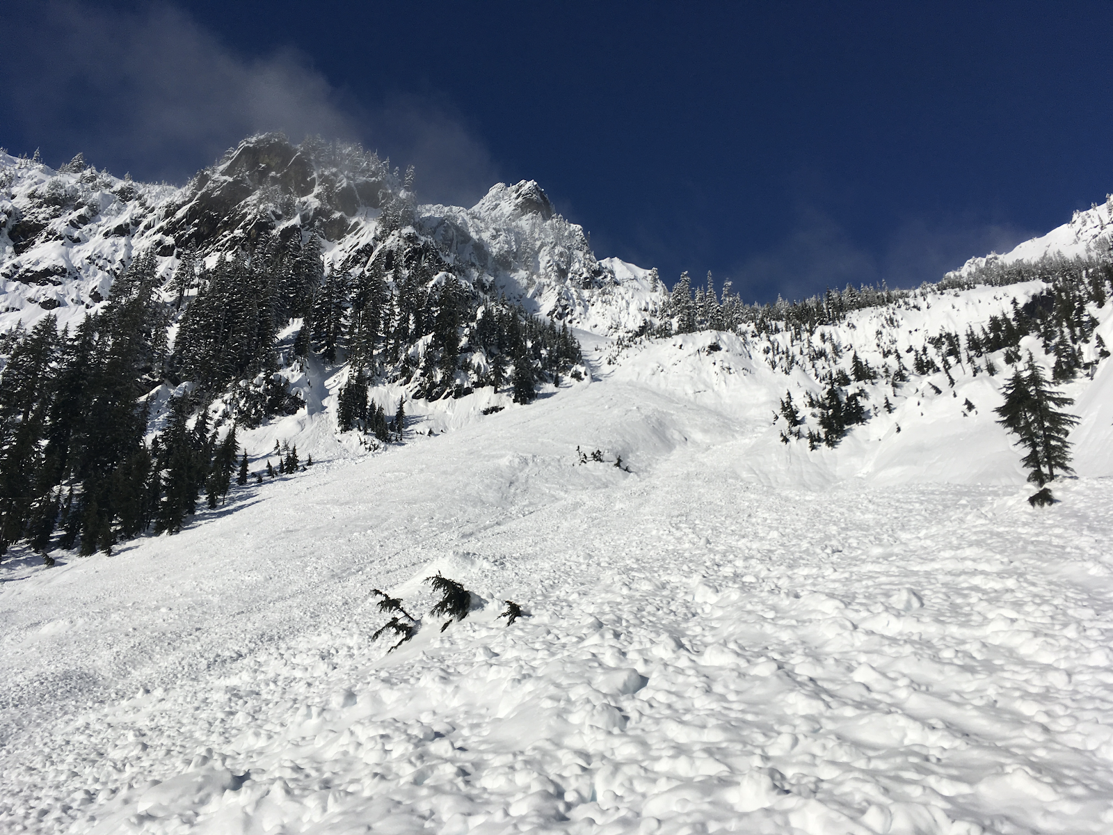
Thursday was pretty quiet in the Snoqualmie Pass area. We did not receive reports of any new, notable avalanches. However, evidence of Wednesday’s avalanche cycle was easy to find. Debris from several large and very large avalanches was observed on Denny Mountain and around Source Lake.
Very large natural avalanches on Chair Peak from Wednesday’s avalanche cycle: Photo: Jeremy Allyn
The layer of buried surface hoar from January 17 is not as prevalent near Snoqualmie Pass, as it is in the nearby Stevens Pass and East-Central zones. That doesn’t mean it is absent. You would be most likely to find this persistent weak layer 1-2 ft below the snow surface in areas near Stampede Pass, or valleys outside of the main Pass locations.
The lower elevation snowpack continues to creep and glide under the weight of recent rains. While no glide avalanches have been reported, they are on our mind. If you see crevasse like features on a slope, limit you exposure by avoiding traveling on or below these areas.
Expect difficult travel conditions at lower elevations including breakable crust, wet heavy snow, and open creeks.
Problems
Storm Slabs
Storm Slab avalanches are the release of a cohesive layer (a slab) of new snow that breaks within new snow or on the old snow surface. Storm-slabs typically last between a few hours and few days (following snowfall). Storm-slabs that form over a persistent weak layer (surface hoar, depth hoar, or near-surface facets) may be termed Persistent Slabs or may develop into Persistent Slabs.
Loose Wet
Loose Wet avalanches are the release of wet unconsolidated snow or slush. These avalanches typically occur within layers of wet snow near the surface of the snowpack, but they may quickly gouge into lower snowpack layers. Like Loose Dry Avalanches, they start at a point and entrain snow as they move downhill, forming a fan-shaped avalanche. Other names for loose-wet avalanches include point-release avalanches or sluffs. Loose Wet avalanches can trigger slab avalanches that break into deeper snow layers.