Avalanche forecast

Salt Lake

Utah Avalanche Center
View on map

Avalanche danger

  • Alpine
  • Treeline
  • Below treeline
Out of date — this forecast expired 6 years ago. You’re viewing past conditions, not the current bulletin.

Highlights

The avalanche danger is CONSIDERABLE on all aspects at the mid and upper elevations. On aspects facing west through north and southeast, very large and dangerous avalanches breaking down 2-6' deeply into old snow are possible at the mid and upper elevations. Stay off of and out from underneath slopes approaching 30° and steeper on these aspects. The avalanche danger is MODERATE at low elevations.

Stay alert for rapidly-changing avalanche conditions as the avalanche danger may rise to HIGH today during any period of heavier precipitation or stronger winds.

Expect an elevated avalanche danger at least throughout the holiday weekend with additional storms forecasted.

Avalanche problems

  • Persistent Slabs

    • Alpine
    • Treeline
    • Below treeline
    Likelihood
    Likely
    Size
    4

    Storm snow and winds will overload buried persistent weak layers, with large and dangerous avalanches 2-6' deep breaking out several hundred feet wide possible. It's pretty simple - you need to stay off of and out from underneath slopes approaching 30° and steeper at the mid and upper elevations on aspects facing northwest through east as well as upper elevation aspects facing west through southeast. Avalanches may be triggered remotely and run long distances.

    Keep in mind:

    • Existing tracks on the slope offer zero signs of stability.
    • Avalanches can be triggered from a distance or below.
    • Any fresh wind slab or new snow avalanche may step down several feet into older snow.

    Particularly dangerous areas would include Snake Creek, upper American Fork, upper Mill Creek, and much of the Park City ridgeline.


  • Wind Slabs

    • Alpine
    • Treeline
    • Below treeline
    Likelihood
    Likely
    Size
    3

    Westerly winds will drift snow at the mid - and especially upper - elevations today creating sensitive wind drifts. Although you are most likely to find these on aspects facing north through southeast, wind can work around terrain and create drifts on any aspect. On aspects where there is a persistent weak layer, wind drifts may step down several feet into older snow, creating very large and dangerous avalanches.

    Pay attention to cornices: Cornices are developing along many ridgelines and we have seen a few avalanches triggered from cornice falls. Be sure to give cornices a wide berth as they typically break much further back than expected and could trigger a much larger avalanche below if they fail.

  • Storm Slabs

    • Alpine
    • Treeline
    • Below treeline
    Likelihood
    Possible
    Size
    2

    Snowfall today may create sensitive soft slabs, especially during any period of higher precipitation intensity. Although any avalanching in new snow is likely to be shallow (< 1'), avalanches may step down into old snow on aspects where the persistent layer is present, creating large and dangerous avalanches.

Special Announcement

The final report about the Wilson Glade avalanche in Millcreek Canyon has been published. Our deepest condolences go out to the friends and families involved in this tragic accident.

Recent Activity

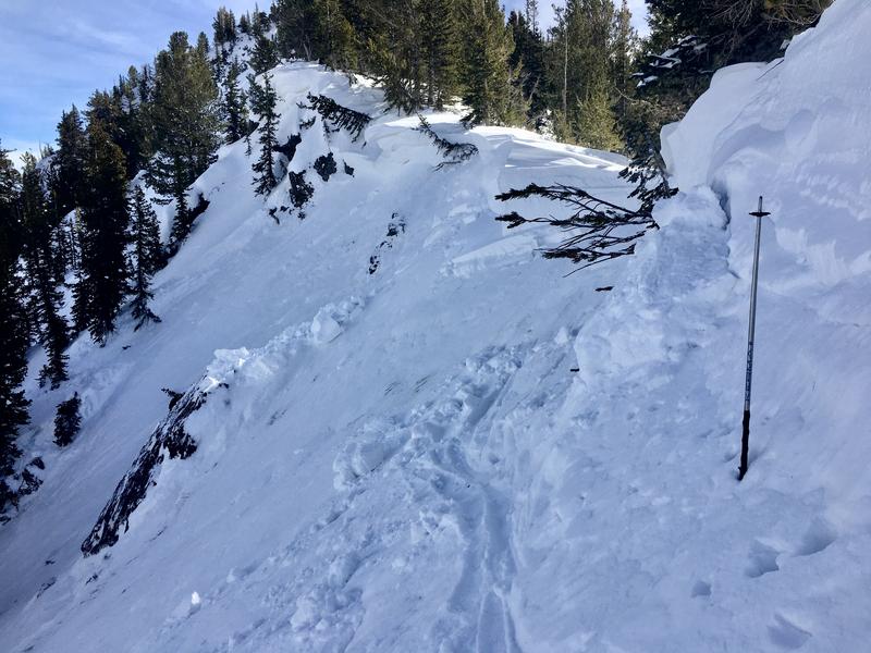
Other than some small fresh wind slabs cracking, no backcountry avalanches were reported. Yesterday, my partner and I found additional evidence of recent avalanching in Mineral Fork, with avalanches on steep northeast aspects at the tops of Highline and Moonlight. Both of these slides appeared to be natural avalanches occurring on wind-loaded slopes. These are in addition to the very large slide reported in Barrieto that reached the creek bottom in Mineral Fork. All of these avalanches likely occurred sometime during the storm sometime between February 5-7.

Our Week in Review - where we highlight significant avalanche and snow events for the past week - is published.

Snow and Weather

This morning temperatures are in the low to mid 20's F and winds are westerly. At the mid-elevations, winds are averaging in the teens with gusts in the 20's mph. At 11,000' winds are much stronger, averaging in the low 30's and gusting in the low 50's mph.

Snowfall began overnight and as of 6 am 2-6" of dense (8-10%) snow has fallen in the Cottonwoods and along the Park City ridgeline.

The National Weather Service has issued a Winter Storm Warning effective through 11:00 pm tonight. For today, 4-8" of dense snow is forecasted with temperatures in the 20's. Winds will shift to the northwest and at the mid-elevations average in the teens with gusts in the 20's mph. Along the uppermost ridges, winds will average in the 20's with gusts near 50 mph.

Looking ahead, a very active pattern is expected with storms forecasted Saturday into Sunday and again Monday into Tuesday. Additional storms are expected later this coming week.

General Announcements

Please visit this website with information about Responsible Winter Recreation by the Utah Office of Outdoor Recreation.

CLICK HERE FOR MORE GENERAL INFO AND FAQ

This information does not apply to developed ski areas or highways where avalanche control is normally done. This forecast is from the U.S.D.A. Forest Service, which is solely responsible for its content. This forecast describes general avalanche conditions and local variations always occur.

Observations and Avalanches

Backcountry Emergency Procedures

Instagram

Facebook

Get Forecast Email

Previous Forecasts

Contact via email

Submit Observation

Regions covered