

Avalanche forecast

Ogden

Utah Avalanche Center
View on map

Avalanche danger

  • Alpine
  • Treeline
  • Below treeline
Out of date — this forecast expired 2 years ago. You’re viewing past conditions, not the current bulletin.

Highlights

The avalanche danger is MODERATE the mid and upper elevations on slopes with new and recent slabs of wind-drifted snow. Fresh wind drifts may be found on all aspects, including well-down into drainage bottoms which are usually wind-protected. The avalanche danger is LOW at low elevations.

Stay well back from ridgelines as cornices are large and sensitive, including breaking off naturally.

The avalanche danger will be on the rise through this weekend with strong winds and heavy snowfall arriving by Saturday afternoon.

Avalanche problems

  • Wind Slabs

    • Alpine
    • Treeline
    • Below treeline
    Likelihood
    Possible
    Size
    2

    Strong winds will sculpt the snow surface at the mid and upper elevations, scouring some slopes while creating shallow slabs of wind-drifted snow on others, with no pattern to wind-drifting. With more loose snow available for transport, fresh wind drifts may be more likely at the mid - rather than upper - elevations. Stay well back from ridgelines as cornices are large and sensitive.
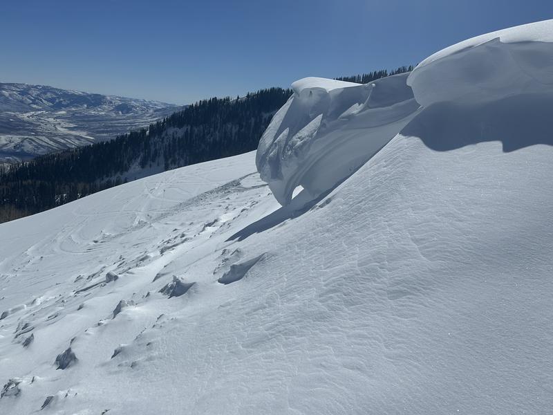
    Although snowfall today is forecast to be light (and inch or two), any new snow will quickly be transported into fresh wind drifts which may be sensitive.

Recent Activity

Thursday's strong winds had little soft snow available for transport and most observations indicated little wind drifting. However, to our south in the Salt Lake mountains, a party triggered a small, 6" wind slab in steep terrain in Days Fork where a rider was caught and carried (photo below). I recommend reading their thoughtful write-up about the consequences of getting caught in a small slide in steep, complicated terrain.

Special Announcement

We are seeking a passionate individual to join us as Executive Director of the nonprofit Utah Avalanche Center.

Did you know we record a ~530AM Dawn Patrol hotline? (888-999-4019 option 6)

Snow and Weather

Nina Simone's "Wild is the Wind" is fitting as strong winds from the south/southwest highlight this morning's weather, with gusts exceeding 60 mph along exposed upper elevation ridgelines. These strong winds are also getting down into the mid and lower elevations, with gusts in the 40's mph. Temperatures range from 25°-35° F.

For today, strong sustained winds from the south/southwest with average wind speeds in the 30's mph, gusting to near 60 mph along the upper elevation ridgelines. Light snow is possible this afternoon, with 1-2" expected; good luck trying to measure it in these winds.

Overnight into Saturday: Our partners at the National Weather Service have issued a Winter Storm Warning for the Wasatch mountains. Continued strong winds with a cold front arriving sometime Saturday afternoon, accompanied by heavy snowfall. Forecast snowfall amounts vary due to how this storm may set up, but 1' - 2' of snow is forecast for the Ogden mountains by Sunday afternoon, with up to 3' for the Bear River Range.

General Announcements

CLICK HERE FOR MORE GENERAL INFO AND FAQ

This information does not apply to developed ski areas or highways where avalanche control is normally done. This forecast is from the U.S.D.A. Forest Service, which is solely responsible for its content. This forecast describes general avalanche conditions and local variations always occur.

Observations and Avalanches

Backcountry Emergency Procedures

Instagram

Facebook

Get Forecast Email

Previous Forecasts

Contact via email

Submit Observation

Regions covered