Avalanche forecast

Salt Lake

Utah Avalanche Center
View on map

Avalanche danger

  • Alpine
  • Treeline
  • Below treeline
Out of date — this forecast expired last year. You’re viewing past conditions, not the current bulletin.

Highlights

The avalanche danger is CONSIDERABLE at the mid and upper elevations where triggering an avalanche in a sensitive soft slab of new snow or wind-drifted snow is likely. On some isolated north-facing slopes, avalanches may break down several feet to a more deeply buried persistent weak layer. Low elevations have a MODERATE danger.

I expect the new storm slab to become less sensitive as the day progresses, but also watch for sudden increases in avalanche danger - including natural avalanches - during any period of heavy snowfall.

Avalanche problems

  • Persistent Slabs

    • Alpine
    • Treeline
    • Below treeline
    Likelihood
    Possible
    Size
    3

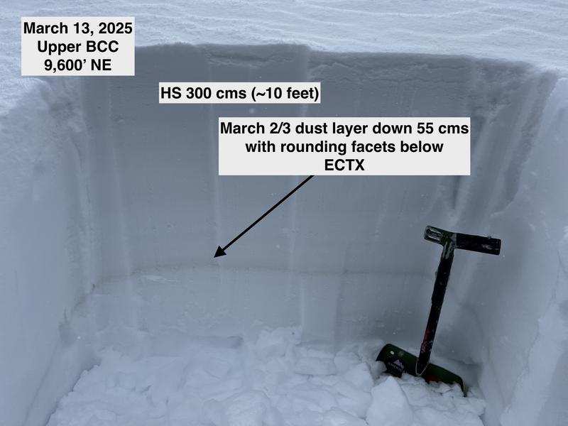
    Reactivity in our season-long persistent weak layers (PWLs) is becoming less-likely, but remains possible, especially with this fresh load of new and wind-drifted snow. The first PWL is a thin brown stripe buried down two to three feet and easy to identify. A second layer is down near the ground and can be found in thinner (less than about three or four feet) snowpack areas, especially on slopes that have avalanched one or more times this season.


  • Wind Slabs

    • Alpine
    • Treeline
    • Below treeline
    Likelihood
    Likely
    Size
    2

    Strong winds at the mid and upper elevations will create sensitive soft slabs of wind drifted snow on all aspects, including well down off of ridgelines. Cornices will be sensitive.

  • Storm Slabs

    • Alpine
    • Treeline
    • Below treeline
    Likelihood
    Likely
    Size
    2

    This storm has come in "right-side up" with lower-density snow on top of heaver/denser snow, so I am expecting instabilities within the storm snow to settle out as the day progresses. However, the new snow will quickly become reactive during any period of heavy snowfall, especially if accompanied by winds, with natural avalanches possible. Watch for sensitive soft slabs of new snow and long-running sluffs. Avalanches may run further than expected.

Special Announcement

Our Spring Campaign is in full swing, and there are two great ways to support forecasting, awareness, and education across Utah: Donate to our Spring Campaign, or Bid on items in our Spring Auction. Every dollar helps keep the backcountry community on top. Thank you for your support!

Recent Activity

It was a quiet day in the backcountry on Thursday, with only a few observations and a small, skier-triggered avalanche on the south-facing Emma Ridges.

Observations and Avalanches

Be sure to catch up on significant weather and avalanche events with Nikki's Week in Review:

Snow and Weather

This Morning: Winds are from the west/northwest and strong, with gusts in the 30's mph at the mid elevations and 50's mph at the highest elevations. Temperatures are 10 - 15° F, with wind chills below zero. Hello, March.

24-hour snow/water totals:

Cottonwoods 15-20"/1.5-2"

Park City Ridgeline 10-12"/1"

Today: The National Weather Service has issued a Winter Storm Warning through 6 pm this evening. Temperatures will be in the mid and upper 20's F and winds will be from the west and should diminish, but remain elevated, with gusts of 40 mph at the upper elevations near 30 mph at the mid elevations. Snow showers are expected throughout the day, with a few inches of new snow likely. But a cold northwest flow in March can overproduce - especially in upper Little Cottonwood Canyon - with periods of heavy snowfall possible, especially this morning.

Extended: If you like snowfall in March, you've come to the right place. A small storm on Saturday with 6-12" of new snow possible. A brief break Sunday into Monday, followed by a larger storm early next week. More snow is possible again later next week.

General Announcements

CLICK HERE FOR MORE GENERAL INFO AND FAQ

This information does not apply to developed ski areas or highways where avalanche control is normally done. This forecast is from the U.S.D.A. Forest Service, which is solely responsible for its content. This forecast describes general avalanche conditions and local variations always occur.

Observations and Avalanches

Backcountry Emergency Procedures

SMS Notifications

Instagram

Facebook

Get Forecast Email

Previous Forecasts

Contact via email

Submit Observation

Regions covered