
Quick report
We (BTAC) transitioned to a persistent slab problem today. In many places, a soft slab sits on top of faceted snow at middle and upper elevations. There is some uncertainty as to how reactive recent storm snow will be as it continues to settle onto old buried surfaces. This uncertainty is reflected in the distribution of the avalanche problem, which is currently all aspects at middle and upper elevations. As we get a better handle on the spatial distribution and sensitivity of this problem, we will be able to be more precise with the location. In the meantime, continue to use caution around steep slopes as the snowpack adjusts.
Still plenty of snow to shed if we get strong periods of sun in the next couple of days before temperatures cool off.
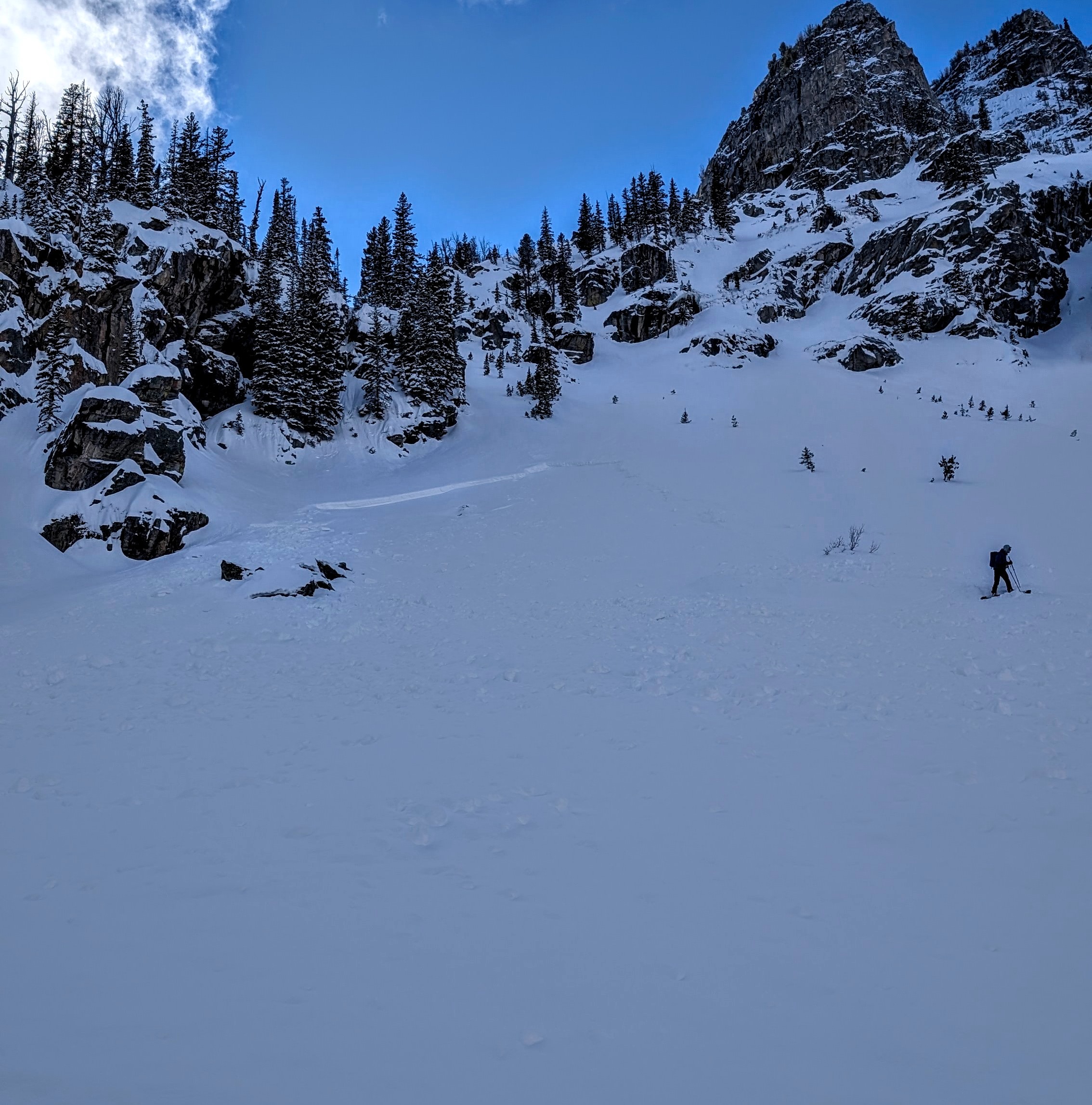
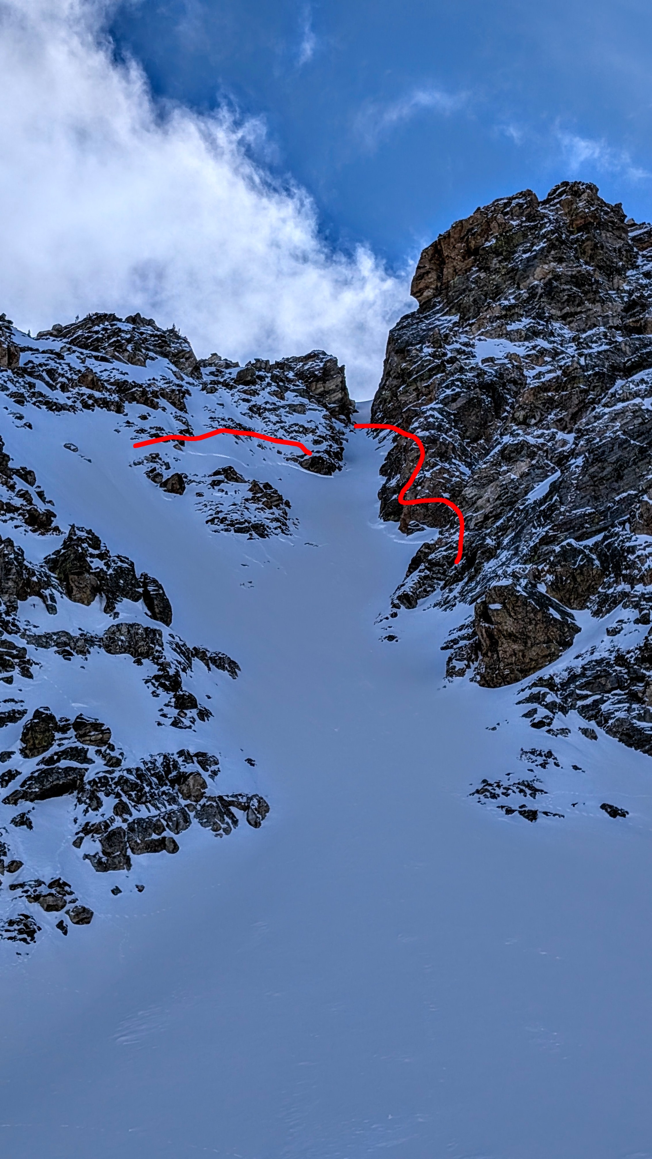
Multiple recent loose snow avalanches on multiple aspects, natural and skier triggered L AS D1 NE 10,000 (Peaches Ridge) x 2 (Today) L N D2 SE 9,800 (Upper Stewarts Draw, today) multiple small loose on south aspects alond Wister and South Aspects in Avalanche Canyon. Recent Storm Slab activity: These looked to run mid storm at some point based on some new snow covering debris and max crown depths looked around 20" SS N D2 9900 North (North side of 25 Short) SS N D1.5 9600 East (East end of Wister, 11's) SS N D2 10,200 East (East End of Wister, middle 11's) SS N D2 10,000 East (Steeper than Cham)Weather
Thick low level clouds this morning with noticeable clearing throughout the morning into the afternoon but never went fully clear. Cool temps in the alpine, but intermittent sun was strong. Mostly calm winds with light westerly breeze at upper elevations in exposed areas.
Snowpack
Upper Elevations: In exposed leeward terrain, we had moderate planar hand shears in the 8-12 inch range with some associated graupel. In these locations, total drift heights were 20-24 inches. On sunny slopes, there was good bonding to the underlying crusts. On shady slopes, where new snow totals were around 20 inches, the same mid-storm interface existed. The slab above the recently buried surface on shady northerly slopes was fist (surface) down to 4 finger (just above faceted snow). There was clearly some wind effect with this last storm, but even with settlement, we had no cracking and surfaces were mostly soft. Steeper, sunny slopes were just starting to feel a little upside down before we transitioned to northerly terrain around 1 pm and very steep sunny slopes had some active shedding. In general, lots of settled powder with minimal wind effect where we travelled.
MIddle Elevations: Settled powder and minimal wind effect. Good bonding of new snow to buried crusts but a mid storm interface did show some moderate, broken hand shears. Lots of buried facets on northerlies. Loose dry was more of a problem on steep shady slopes at middle elevations (as well as protected slopes at upper elevations) and was noted on steep rollovers. There was some facet entrainment but not a lot.
Avalanche
- Size
- D1.5 R2
- Type
- SS
- Count
- 4
- Aspect
- E
- Trigger
- N
- Elevation
- 9600 ft
Multiple small loose avalanches in south facing terrain at middle and upper elevation terrain from yesterday and today. Storm slab activity noted in the instability comments looked to probably happen mid storm cycle (maybe Wednesday) based on some snow covering the debris and crown