
Quick report
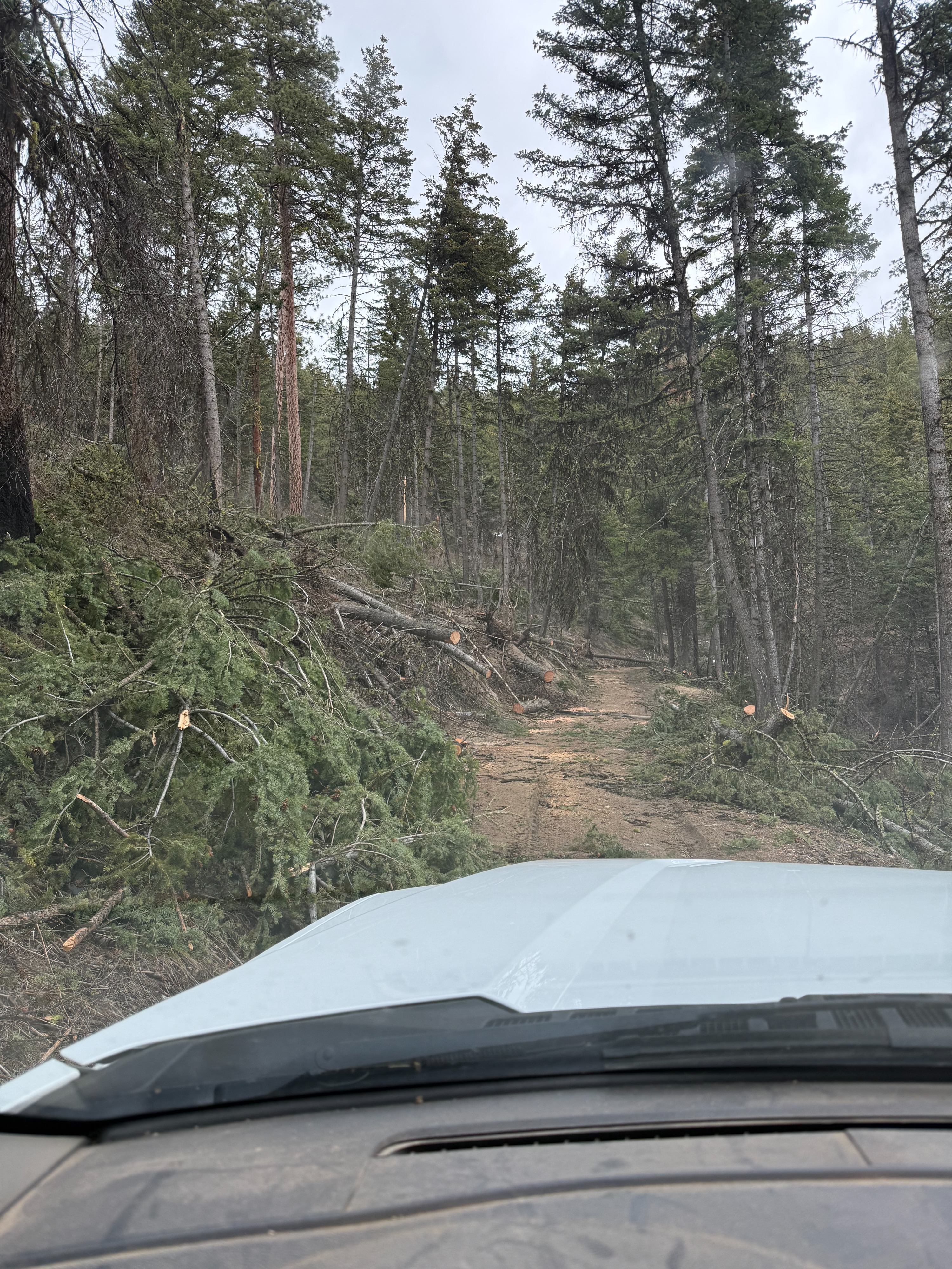
I experienced easy driving to the TH, with only 2 small snow patches that required 4wd. Big shoutout to whoever cleared the dozens of trees across the road.
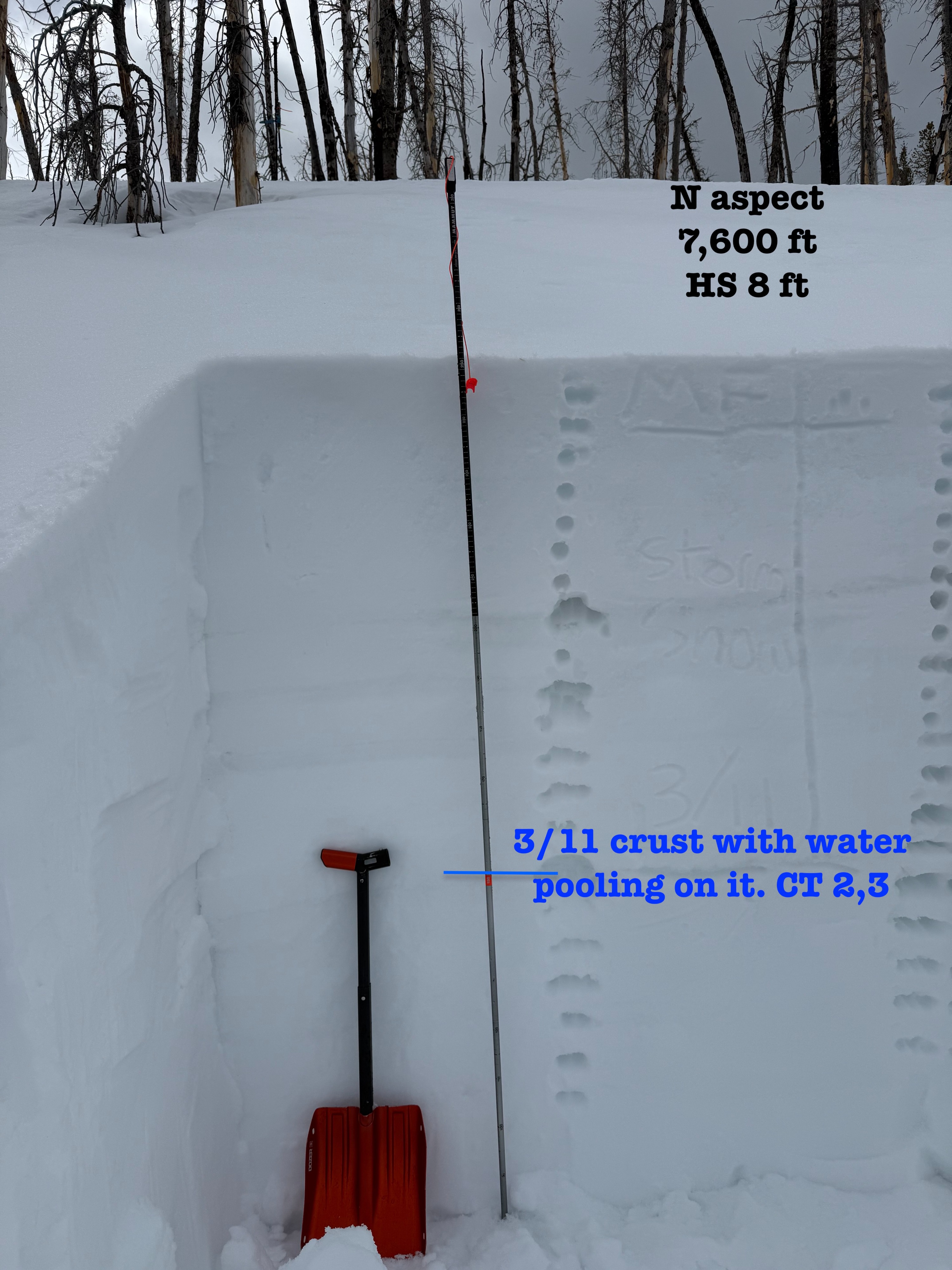
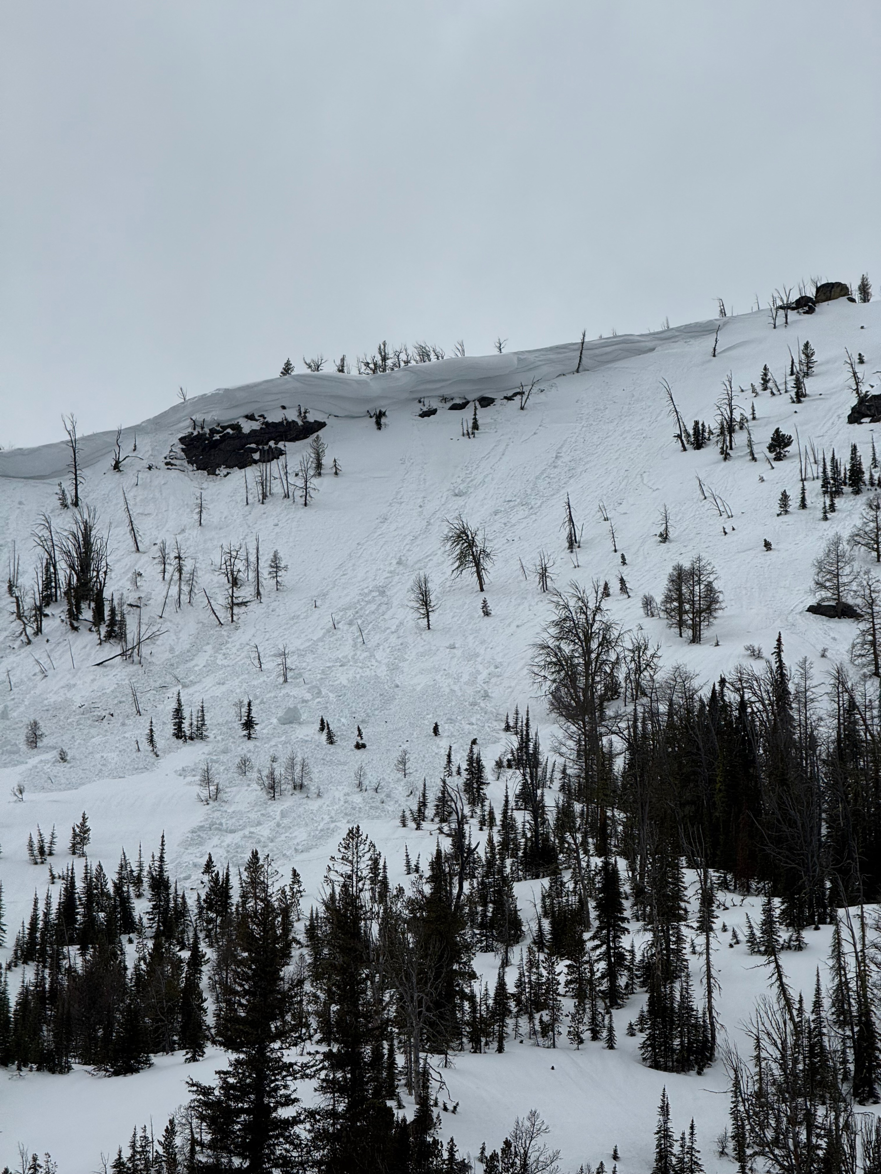
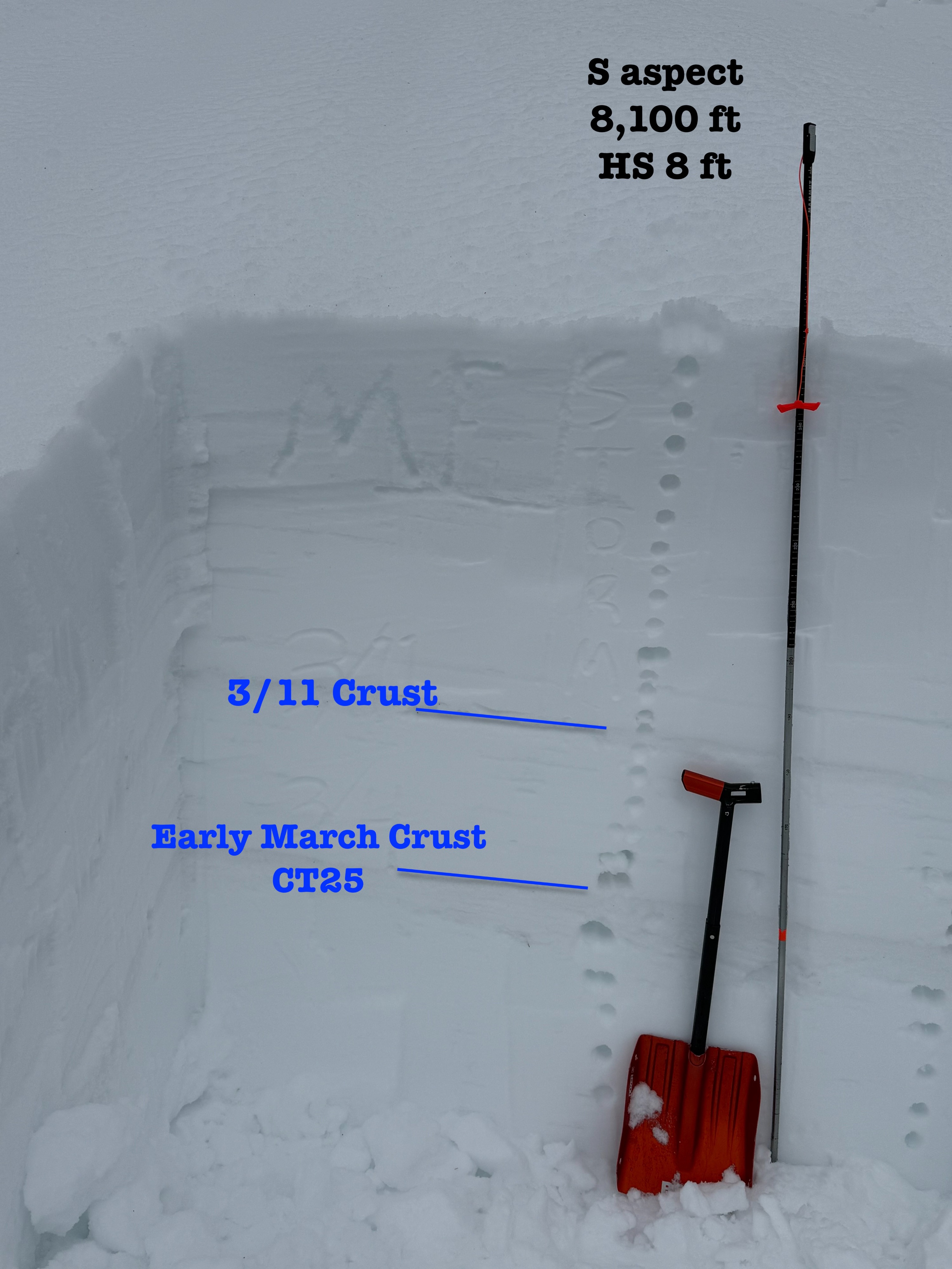
Snow coverage from TH to 6,500 ft was patchy, and downfall made it tough to link the patches smoothly. Once above 7,000 ft travel went smoothly. Snow surfaces were softening throughout the day, but ski pen was never deeper than 2-3 inches. I dug a snow pit on a true N aspect at 7,600 and had mutliple CT's that failed easy and suddenly on the first decompsoing crust layer where free water was pooling. I continued up the ridge where I observed natural WL and SS/PS avalanches on a NE aspect around 8,400ft. I dug a pit on a S aspect at 8,100 ft and found a similar setup of meltwater pooling on decompsing crusts, with CT's failing in the hard taps.
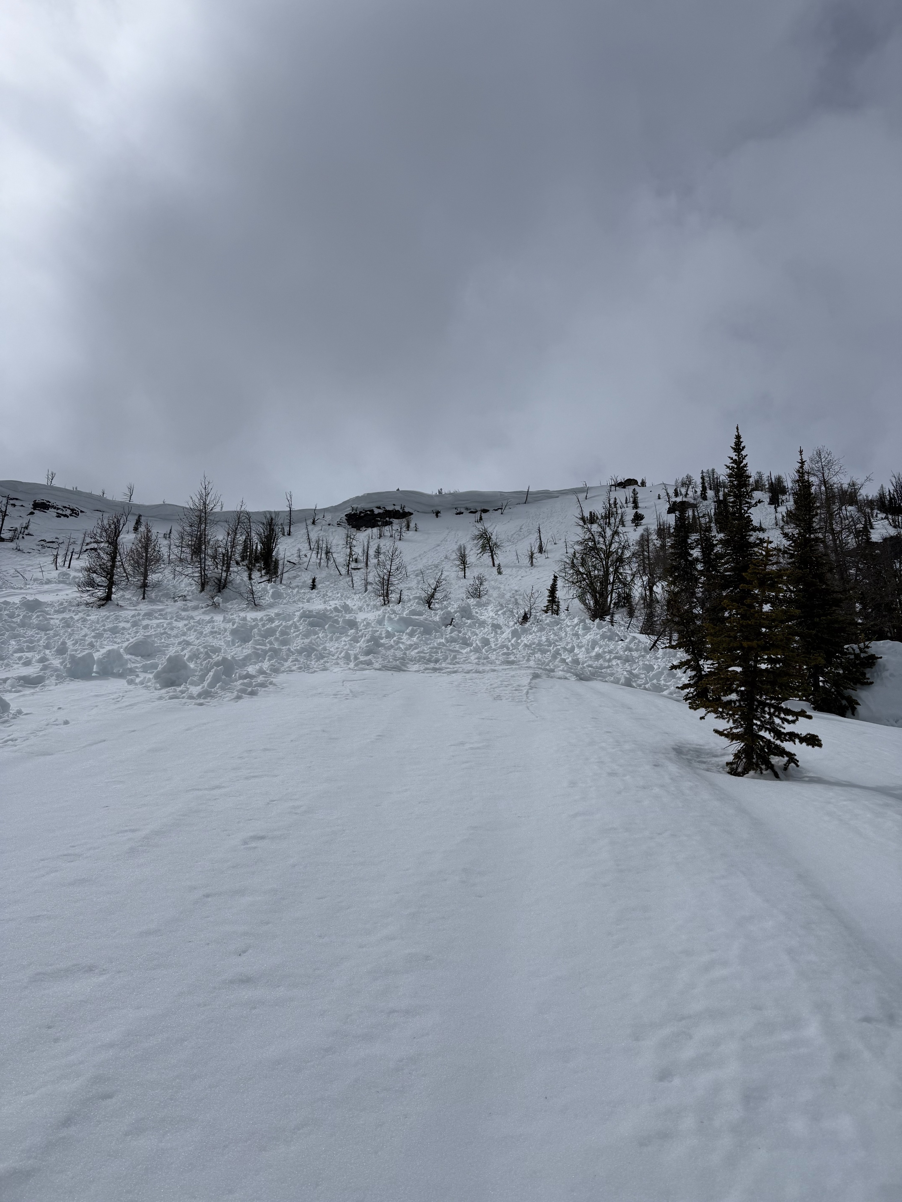
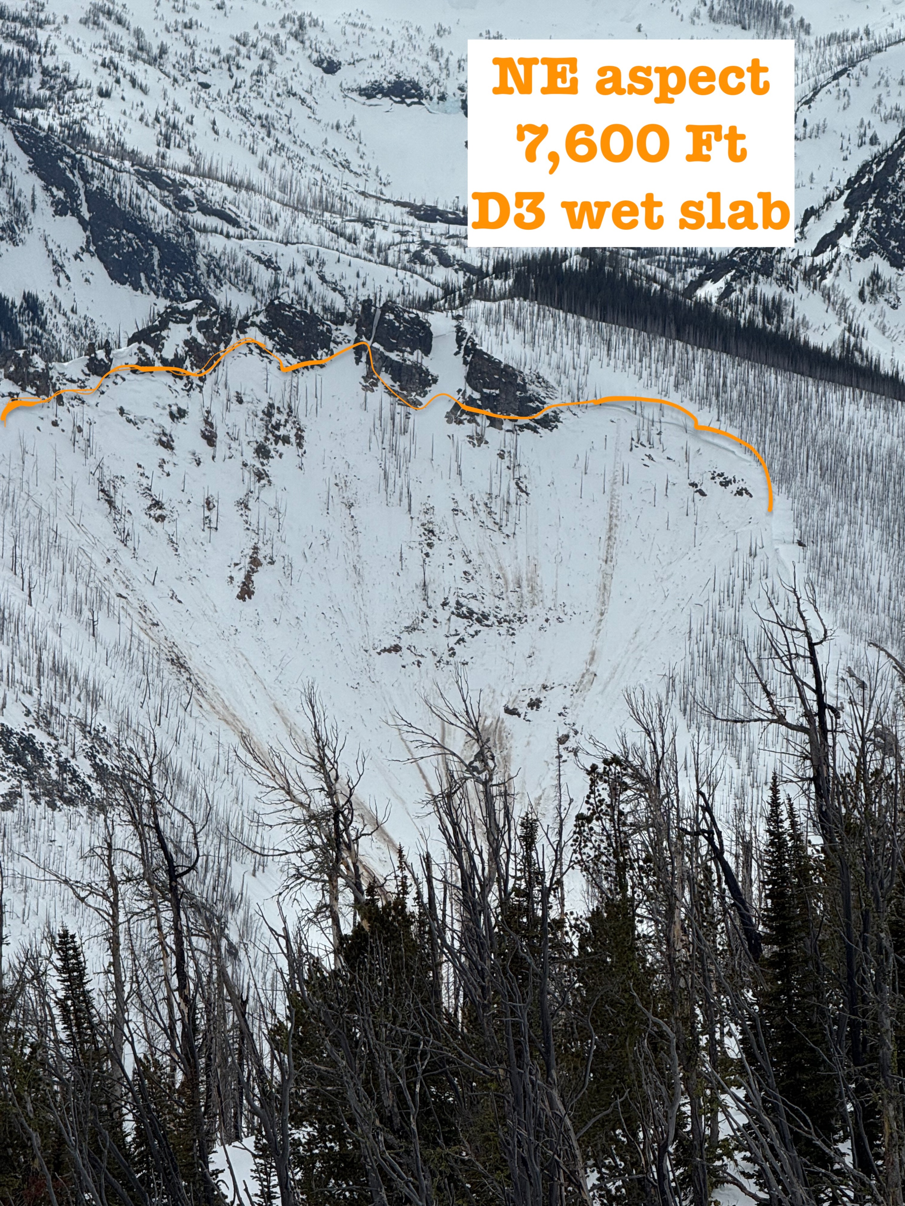
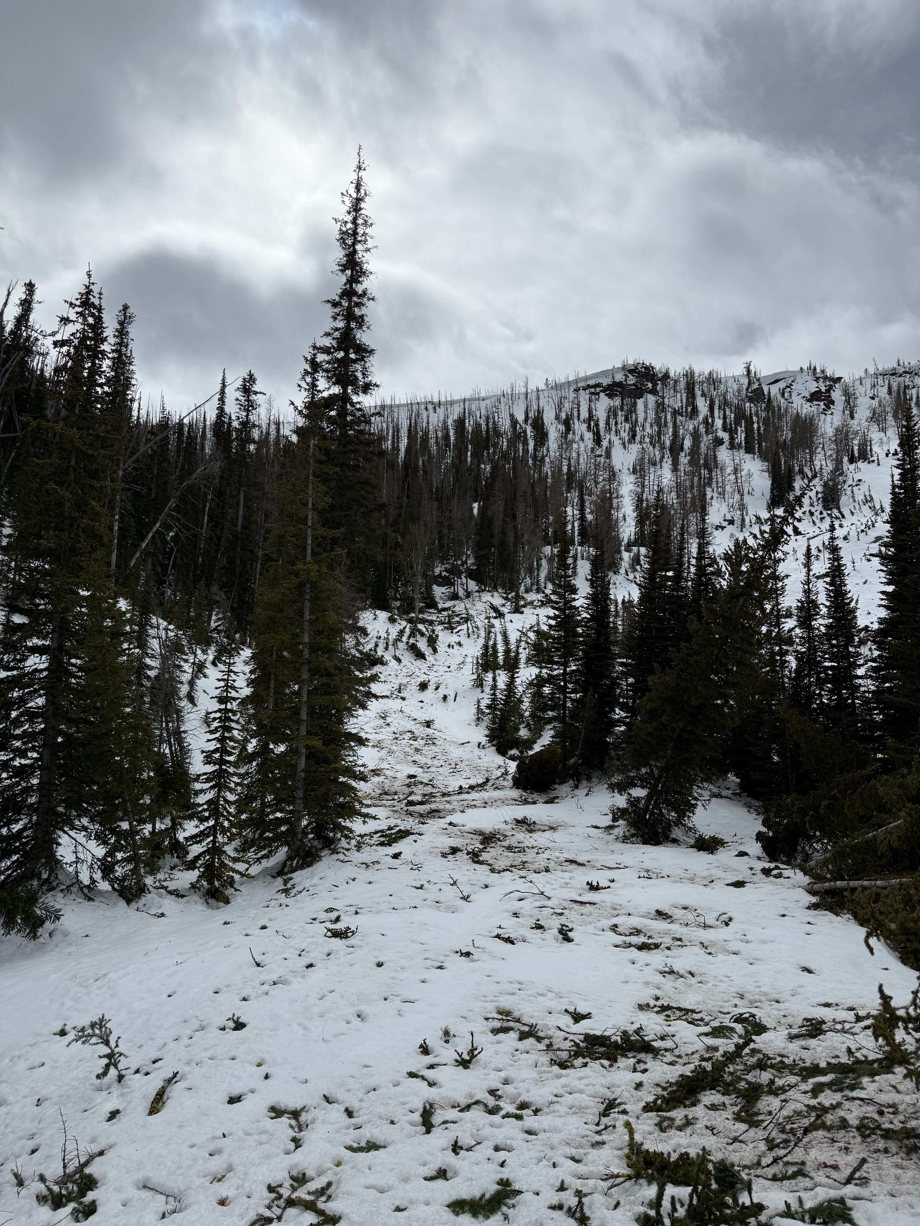
On the E ridge of Pyramid Butte I observed the previous reported D3 wetslab that likely failed last week, and ran out of sight to valley bottom. From here, I travaled down to to the bottom of the PS avalanche, which ran full path during the large storm, likely 3/14, and took out mature timber.
I return to the TH via the ridge, and with creative techniques employed over to cross over down trees and dirt patches.
The snow continued to soften throughout the day, and was actively melting below 6,500ft throughtout the day.
I observed no instabilty today, but evidence of many different types of instabilty from the last 10 days.Weather
- Cloud Cover
- overcast
- Wind Loading
- previous
- Recent Snowfall
- 2
- Snow Avail For Transport
- none
Temps were above freezing the entire time I was out, and high clouds trapped heat. Mixed precip throughout the day, some snowflakes, some mist, and the occasinal rain drop. No measurable precip. Winds moderate, with strong gusts out of the WSW shifting to SW in the afternoon. No snow transport was observed, even at uppermost peaks.
Snowpack
I traveled mainly on an E ridgeline today, and observed from 6,000ft to 8,500ft. Contious snow on N aspects @ 6,000 ft, E aspects @ 6,500 ft, and S aspects at 7,000 ft. While I was out there was no surface crust on any aspect/elevation. Very little to no snow on the drive up below 6,000 feet. Deeper in the drainages, it appeared the snow line was ~6,000 ft on shaded aspects.
The upper 8 inches was a 1F+ crust layer that softened throughout the day. The AR storm snow has consolidated down to ~100 cm on both shaded (N aspect, 7,600ft) and solar aspects (S aspect, 8,100ft) where I dug. Below this, water had pooled in the decomposed 3/11 crust and the crust below. The upper 4-5 ft on the solar and shaded aspects where I dug were moist.
In the N aspect pit, I had a CT2 and 3, sudden collapses down 103 cm on the 3/11 saturated layer. This pit was representative of the slope where the Wet slab failed laast week
In the S aspect pit, CT25, sudden planar down 97cm on the Early march saturated layer.
Avalanche
Wet Loose activity from last weekend on shaded aspects at mid and upper elevations. Saw a D3 wet slab that was previously reported, likely failed during the warm up last week. I also saw D2.5 storm slab that likely failed during the AR event, and stepped down to the Jan drought layer.