
Quick report
- Aspect
- North
- Elevation
- 3018 m
- Slope Angle
- 33°
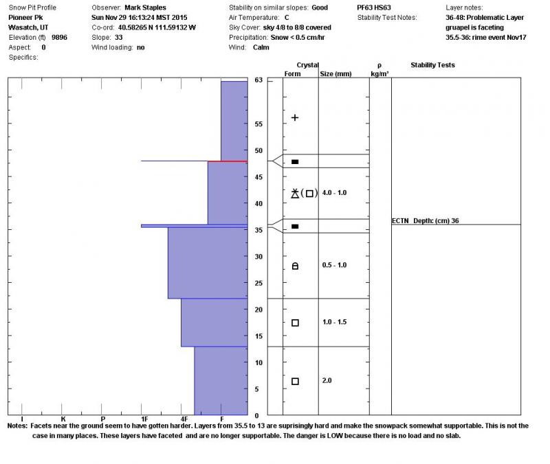
Throughout the Central Wasatch there seem to be 2 weak layers
- Facets at the ground. These seem to have gotten harder in some places but remain soft and weak in others.
- Facets in an obvious graupel layer under the new snow that fell over Thanksgiving and the following weekend. This layer rest on a crust from a rime event that occurred Nov 17.
3-4" of graupel fell on Thursday, Nov 20th. The following days had very clear, cold skies at night and warm sunny days. That faceted the snow surface. This faceting occurred regardless of whether there was graupel or not. Southerly aspects fared better, but still have faceted snow. We'll see how those aspects develop. The northern half of the compass as well as east and west aspects have both of these layers.
What seems to vary the most in the snowpack is the harder snow sandwiched between the "graupel facets" and facets at the ground. In some places like this, that snow is somewhat supportable. In other places, this layer is not supportable and very faceted.
Snowpack
- Instability Comment
- <p>There is plenty weak snow in the snowpack. <strong>What is lacking</strong> for unstable conditions is a <strong>load or a slab</strong>. Right now the only places to find enough of a slab are slopes with wind-blown snow and these don't have too much of a load, just a stiff slab.</p> <p><strong>The question</strong> then is how much and how fast will snow fall in future storms. If we get a lot of snow really quickly, it will be easy. The danger will spike and we'll get avalanches. If snow continues to trickle in a few inches at a time, we'll slowly build a slab on top of these facets. Snowpacks rarely get stronger in December, so I think we'll slowly inch toward the tipping point under this scenario without these facets healing. As long as the snowpack remains thin, it will continue to get weaker.</p>
6" of low density new snow over the last four days.