

Boletín de aludes

Salt Lake

Utah Avalanche Center
Ver en el mapa

Peligro de aludes

  • Alta montaña
  • Límite del bosque
  • Bajo el límite del bosque
Desactualizado: este boletín caducó 2 years ago. Estás viendo condiciones pasadas, no el boletín vigente.

Lo esencial

The avalanche danger is MODERATE on wind-drifted slopes at the upper elevations where triggering shallow soft slabs of wind-drifted snow are possible. The avalanche danger is LOW at the low and mid elevations. Watch for long-running sluffing in the dry new snow in steep northerly-facing terrain and sluffing in loose, wet snow on south and west aspects.

If you choose to step into bigger terrain, evaluate each slope carefully for wind-drifted snow or thinner, rockier slopes where it is possible to trigger an avalanche. Consider the consequences of your terrain choices if you get caught in even a small avalanche.

Problemas de aludes

  • Loose Wet

    • Alta montaña
    • Límite del bosque
    • Bajo el límite del bosque
    Probabilidad
    Possible
    Tamaño
    1

    Cool temperatures and a snow surface that has already seen some warming should keep wet avalanche activity to a minimum today. But the strong March sun will heat the snow surface and I expect some loose sluffing in wet snow on steep solar aspects, with possible greenhousing at low elevations. This is especially a concern in steep gullies and chutes where wet sluffs may run long distances and a rider may be unable to escape.

  • Wind Slabs

    • Alta montaña
    • Límite del bosque
    • Bajo el límite del bosque
    Probabilidad
    Possible
    Tamaño
    2

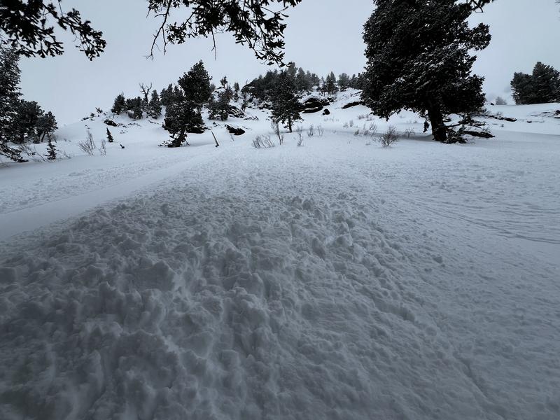
    Sensitive soft slabs of wind-drifted snow and fresh cornices can be found at the upper elevations. Any wind drifts you encounter are likely to be shallow (4-8") and not wide (20-40'), but they may be large enough to carry you in steeper terrain.

    With reports of sensitive and large cornices adorning many ridges, stay well back from corniced ridgelines.

    To learn more about wind in the mountains, check out Logan forecaster Toby Weed's Blog.

Recent Activity

Minor avalanche activity was reported from Thursday, including long-running sluffs in the storm snow, and sensitive cornices and shallow wind slabs along exposed ridgelines, as shown in photo below from Bo Torrey along the Park City ridgeline.

As we transition to a generally stable snowpack and many are starting to pursue bigger objectives, be sure to read Drew Hardesty's latest blog "Is it REALLY Low Danger?"

Special Announcement

We are seeking a passionate individual to join us as Executive Director of the nonprofit Utah Avalanche Center.

Snow and Weather

This morning: Skies are partly-cloudy and temperatures range from the single digits above 10,000' through the mid teens at low and mid elevations. Winds are from the north/northwest and light, less than 10 mph, with 11,000' wind speeds near 20 mph. 3-7" of new snow has fallen over the past 24 hours, with up to a foot in some locations over the past few days.

Today: Mostly sunny skies with cool temperatures reaching 25° F at mid elevations and 10-15° F at the upper elevations. Winds will be from the north/northwest and light, gusting into the low 20's mph along the highest ridges and peaks. With some low-level moisture in place, greenhousing (where heat is trapped and dampens the snow surface) is possible and may also lead to some light snow showers.

Although some slopes will be crusted from Thursday, soft snow can be found on many slopes at the mid and upper elevations where travel and riding conditions are generally superb.

Extended Forecast: Sunny with rising temperatures this weekend with light snow possible early this coming week. A potentially significant winter storm possible by about Wednesday.

Additional Info

Come join Snowbasin Ski Patrol and Wasatch Backcountry Rescue for an Avalanche Dog Fundraiser on Saturday, March 9 at 6 PM at the Union Grill (315 24th Street, Ogden UT).

General Announcements

CLICK HERE FOR MORE GENERAL INFO AND FAQ

This information does not apply to developed ski areas or highways where avalanche control is normally done. This forecast is from the U.S.D.A. Forest Service, which is solely responsible for its content. This forecast describes general avalanche conditions and local variations always occur.

Observations and Avalanches

Backcountry Emergency Procedures

Instagram

Facebook

Get Forecast Email

Previous Forecasts

Contact via email

Submit Observation

Regiones cubiertas