Boletín de aludes

Northwest Mountains

Crested Butte Avalanche Center
Ver en el mapa

Peligro de aludes

Sun
Alta montaña
2 · Moderado
Límite del bosque
2 · Moderado
Bajo el límite
1 · Débil
Desactualizado: este boletín caducó 4 years ago. Estás viendo condiciones pasadas, no el boletín vigente.

Lo esencial

Instabilities from the most recent storm are generally improving, but there are some lingering concerns for slabs to break up to several feet deep on the small-grained facet layer at the storm interface. The most concerning slopes are drifted terrain from strong winds during the storm and sunny aspects where warming slabs have produced a few natural avalanches in the past few days. Assess the snowpack structure and terrain consequences before riding in steep terrain. 

Problemas de aludes

  • Persistent Slabs

    • Alta montaña
    • Límite del bosque
    • Bajo el límite del bosque
    Probabilidad
    Possible
    Tamaño
    1–2.5

    The Northwest Mountains picked up over 2 feet of snow accompanied by strong winds during the most recent storm that ended Monday.   The storm formed slabs up to several feet thick above small-grained facets that are prolonging instabilities on some slopes.  Be cautious of leeward terrain and southerly aspects, which have been most active this week.   Slabs are larger and more cohesive on wind-loaded slopes.  Slabs are smaller and less common in wind-sheltered terrain.  Use stability tests to assess instabilities in the upper snowpack.  You can generally avoid the problem on slopes less than about 35 degrees.

    1/31: A trio of natural avalanches on Schuylkill Ridge.  This image highlights the dangerous size potential of avalanches in leeward terrain.
Avalanche Discussion

We're seeing more evidence of natural slab avalanche activity related to this gradual warmup than expected, so we've held off on any danger changes to allow the snowpack to adjust another day.  Several slab avalanches D1.5 to D2 appear to have run on Thursday (Schuylkill Ridge, Evan's Basin), and we continue to get unstable pit results on similar slopes.  The combination of a warming/settling slab over the small-grained facets buried in the upper snowpack seems to be a recipe for trouble right now.  The lingering issues have been most active on the southern half of the compass over the past few days.   I'll leave yesterday's discussion up for another day, with a few additions incorporating yesterday's observations.  

A few patterns are emerging after the storm helping to inform your backcountry decisions over the next few days.  Thank you for your observations which help us paint a more accurate picture of conditions.    

  • This was the first major storm this winter that didn't produce natural avalanches breaking on our early-season weak layers, suggesting an improving trend that matches our snowpack observations.  However, a skier triggered a large avalanche that broke near the ground on Wednesday near Taylor Reservoir.  This forecaster follow-up has a lot of informative details about the close call.  Although this was outside of our forecast area, the snowpack depth and structure are similar to what you will find in the snow-deprived parts of the Southeast Mountains, from Mt. CB to Whetstone to lower Brush and lower Cement Creek.  That is why we are continuing to message the threat of avalanches breaking on deeply buried weak layers in our shallower zone.
  • During the storm, natural activity breaking in the upper snowpack was more frequent on wind-loaded slopes near and above treeline, where slabs are thicker and stiffer (up to D2.5 in the Northwest Mountains and up to D2 in the Southeast Mountains).  The consequences are more serious and instabilities may linger longer on those slopes.  Almost all of the reported avalanches below treeline during the most recent storm were D1 to D1.5 in size.   That doesn't mean you can't get into trouble below treeline, but there are fewer instabilities and the size of avalanches breaking in the upper snowpack will generally be smaller.  If the snowpack is deeper than 5 feet, focus on terrain consequences below treeline in case you find a rare lingering instability in the upper snowpack.  
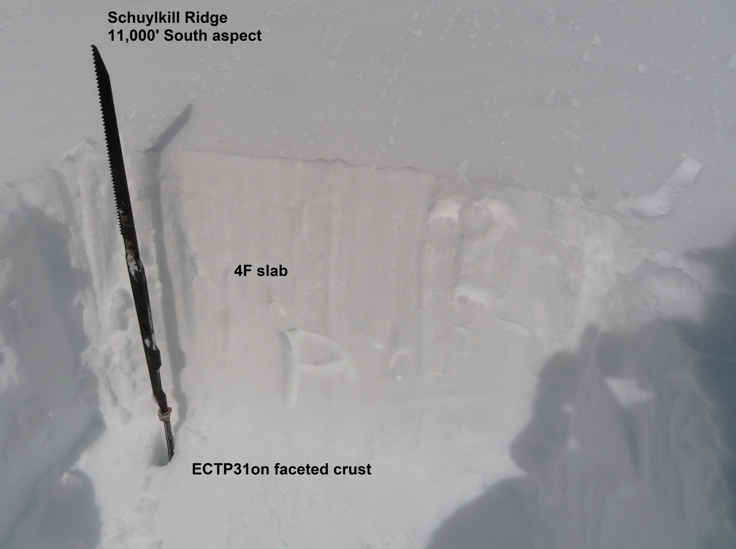
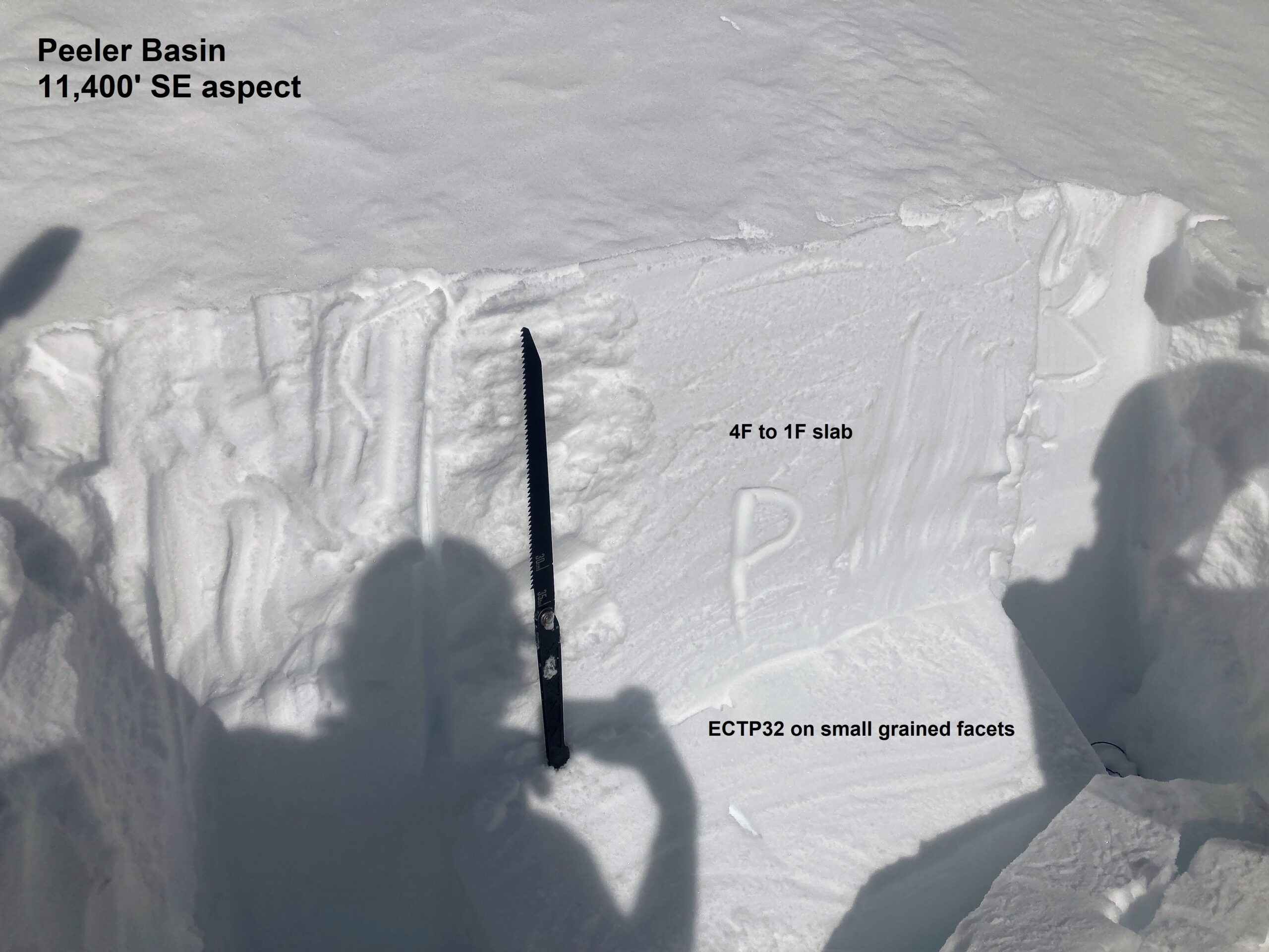
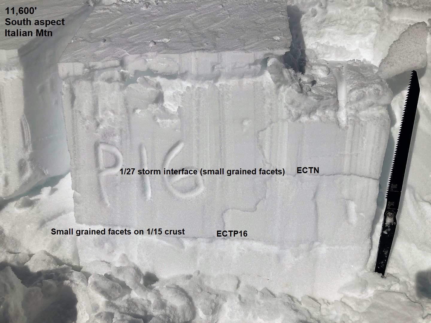
  • During the last few days, we've seen an uptick in natural and skier-triggered slides on sunnier aspects (Red Lady, Snodgrass, Schuylkill Ridge, Evan's Basin). This unstable pattern matches our recent unstable pit results (Italian Mountain, Schuykill Ridge, Peeler Basin) on faceted crusts or more advanced near-surface facets that were buried earlier in January.  Crusts can sometimes help preserve facets or create a more pronounced hardness change in the snowpack which prolongs instabilities.   Instabilities on southerly aspects will be more concerning mid to late day after surface crusts thaw and the snow surface gets wet or damp.  Regardless of what aspect you are on, it's worthwhile probing to make sure you're on a snowpack deeper than 5 feet (150 cm), and dig down a few feet to test the upper snowpack structure before riding in bigger or more consequential terrain.  

Keep those beacon skills dialed by joining CBAC and Irwin Guides Saturday, February 4th at the Slate River TH for free training. The 1-hour sessions will begin at 10, 11, and noon. No sign up necessary.

Regiones cubiertas