
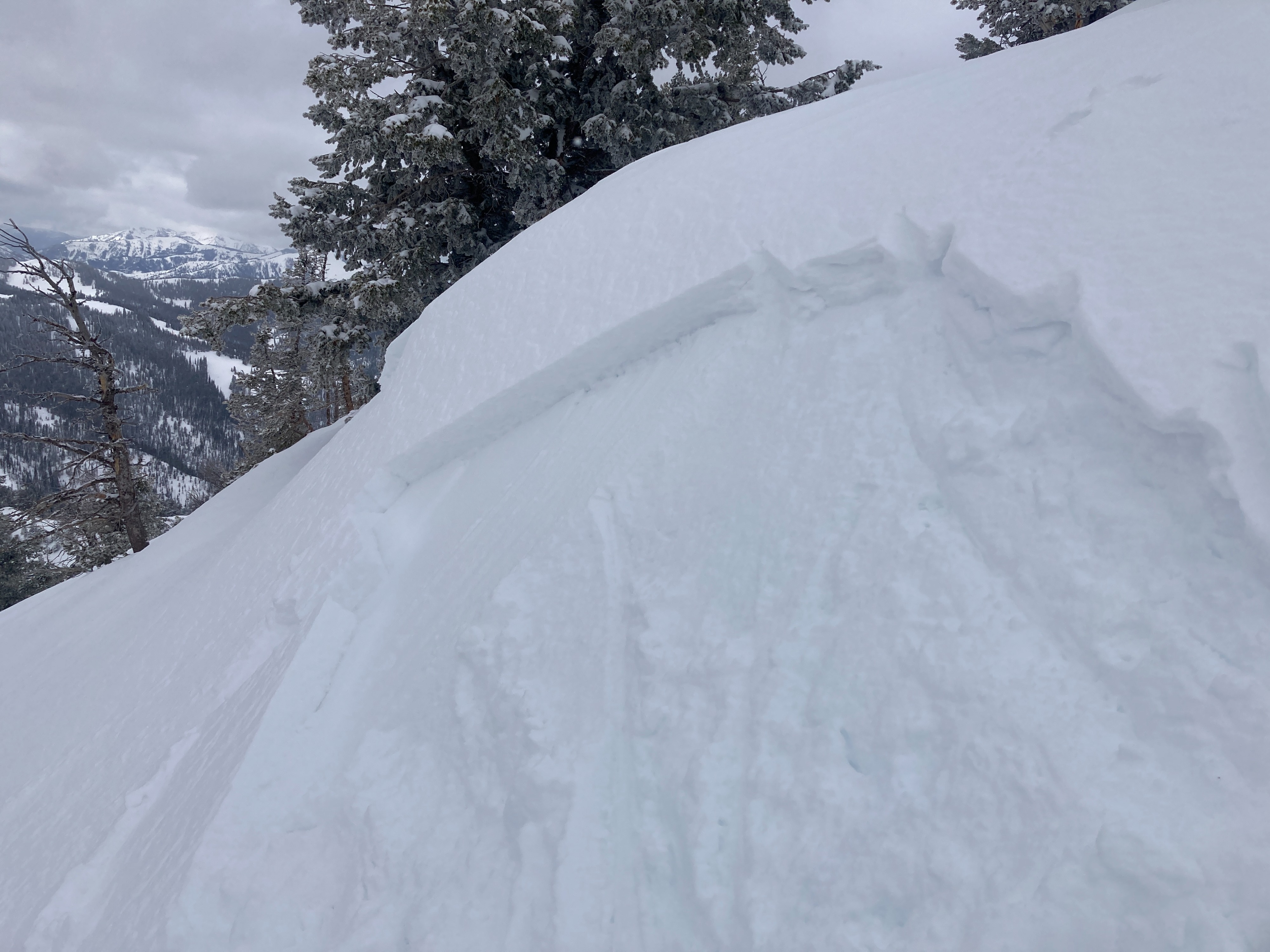
Quick report
- Cracking
- isolated
Toured to 10,300’ and traveled on all aspects of the compass. 4-6 inches of snow from Monday’s storm (3/3) is sitting on a firm crust on all aspects except for north above 8,500’. The recent snow appears to be bonding well to old surfaces in most terrain. The exception would be isolated pockets of wind slab that have formed in leeward upper elevation terrain close to ridgelines. I found several very small pockets of reactive wind slab about 8” thick on steep (>35 deg) south facing roll overs near the uptrack. These wind slabs were stubborn to initiate and ran sluggishly on the crust. Not really an issue unless in very exposed terrain. No loose snow sluffing was observed today.
Looking ahead, tonight and tomorrow's new snow should fall on a surface composed of mostly loose snow. The crust from last weekend’s warm weather is not far below the surface and some wind slabs may end up running on it. We’ll see how the weather shakes out tonight. Stay tuned.
Cracking was isolated to very small wind loaded pockets along the SE ridge uptrack.Weather
- Air Temp
- 25
- Cloud Cover
- broken
- Wind Loading
- none
- Recent Snowfall
- 4-6"
- Snow Avail For Transport
- small smounts
Mostly cloudy. Several brief periods of sun. Snow surfaces were staying cool while I was in the field (10am-1pm). Very calm conditions above 10k.