
Quick report
We traveled into a popular drainage of the West Cabinets today to get a better picture of current access conditions, collect baseline snowpack data, and to search for evidence of recently buried surface hoar.
- The snowpack we observed today is very similar to what has been seen in other parts of the Panhandle recently. Old snow from prior to 11/23 is generally only found above 5500 feet, and the snow that has fallen since then has begun to facet throughout.
- 50-60cm total depth above 5500 feet.
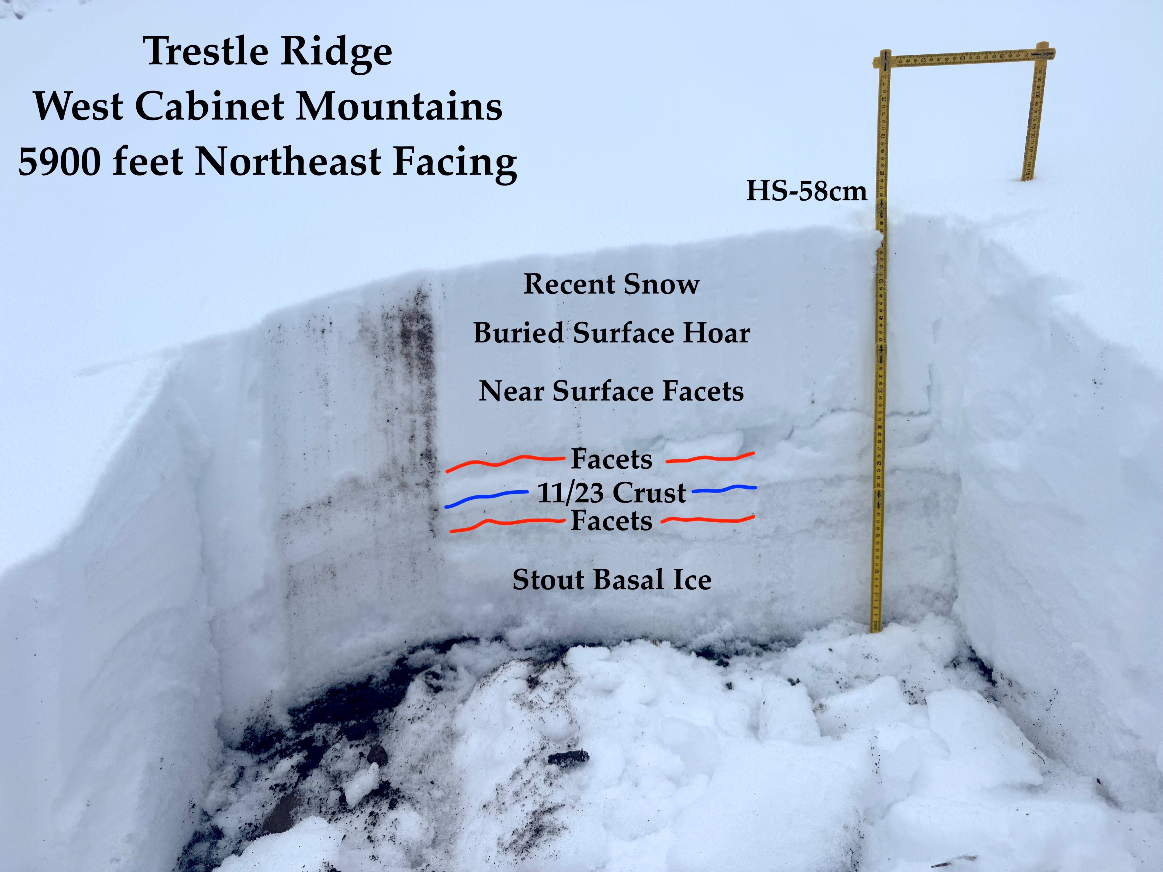
- Faceted grains developing both above and below the 11/23 crust.
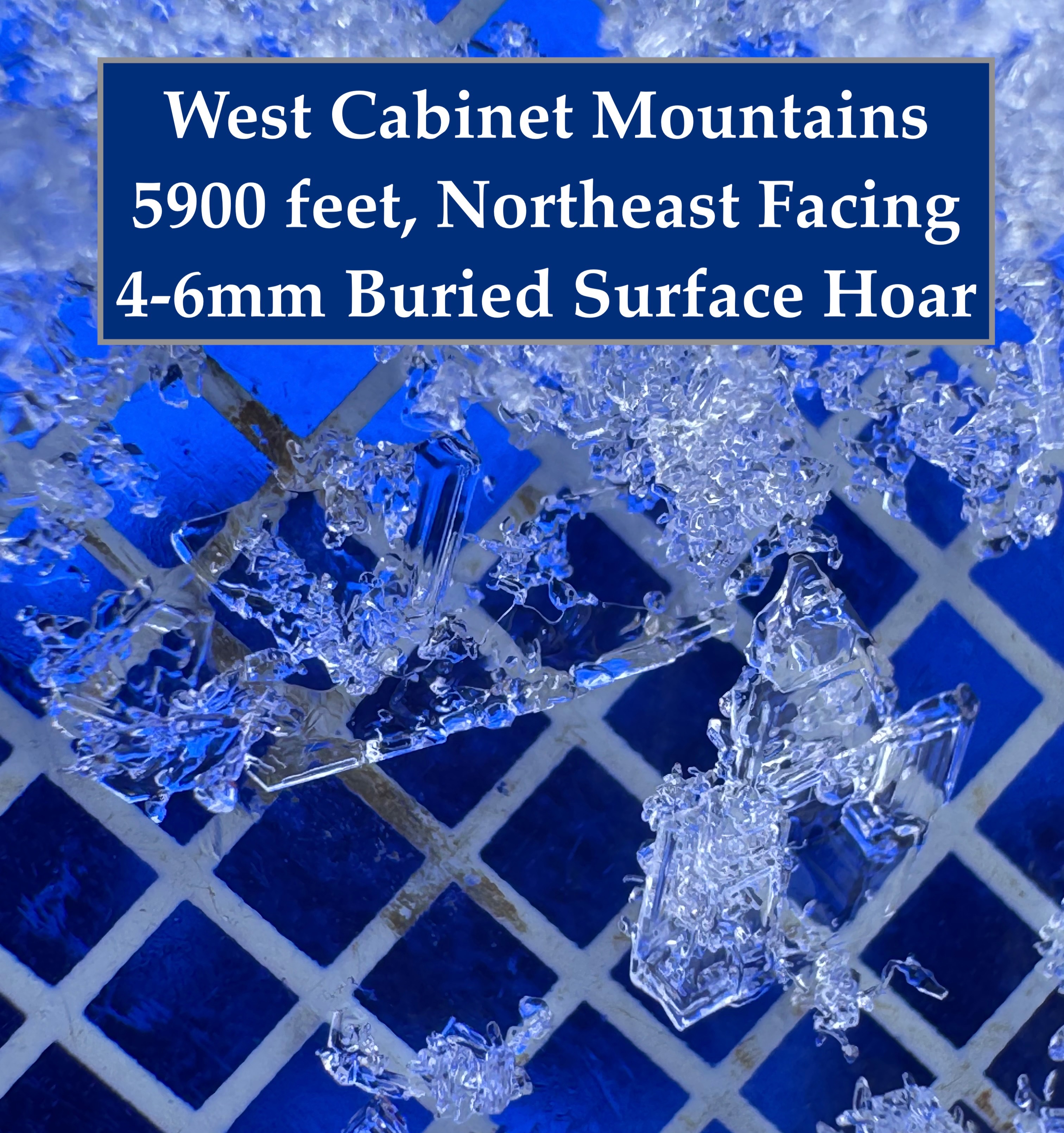
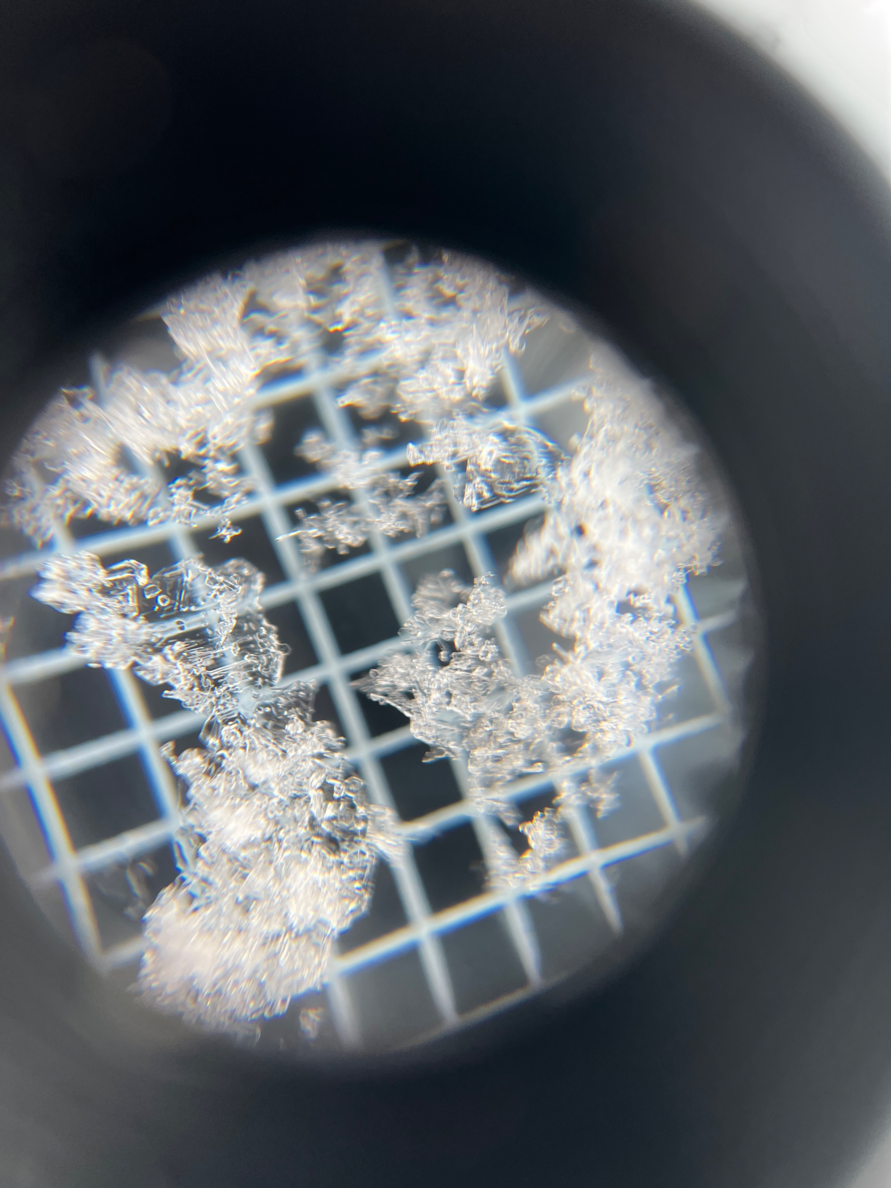
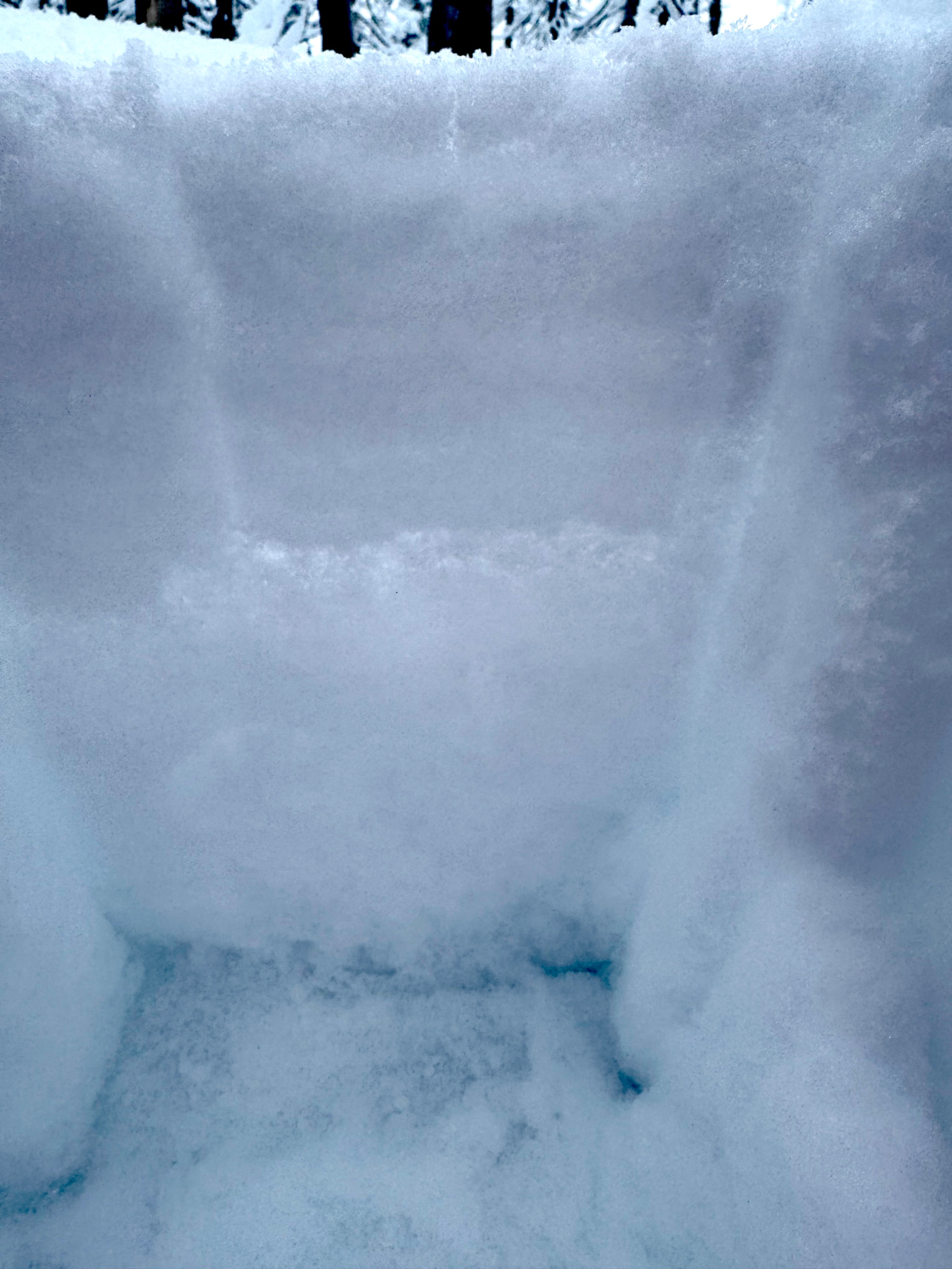
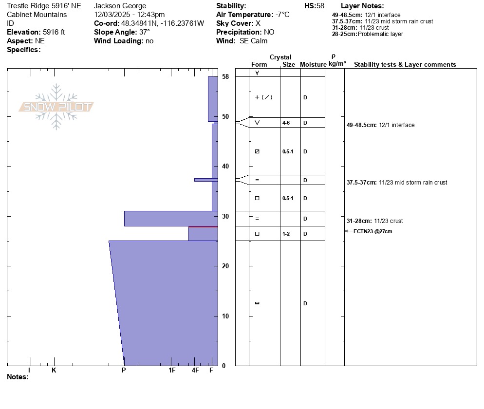
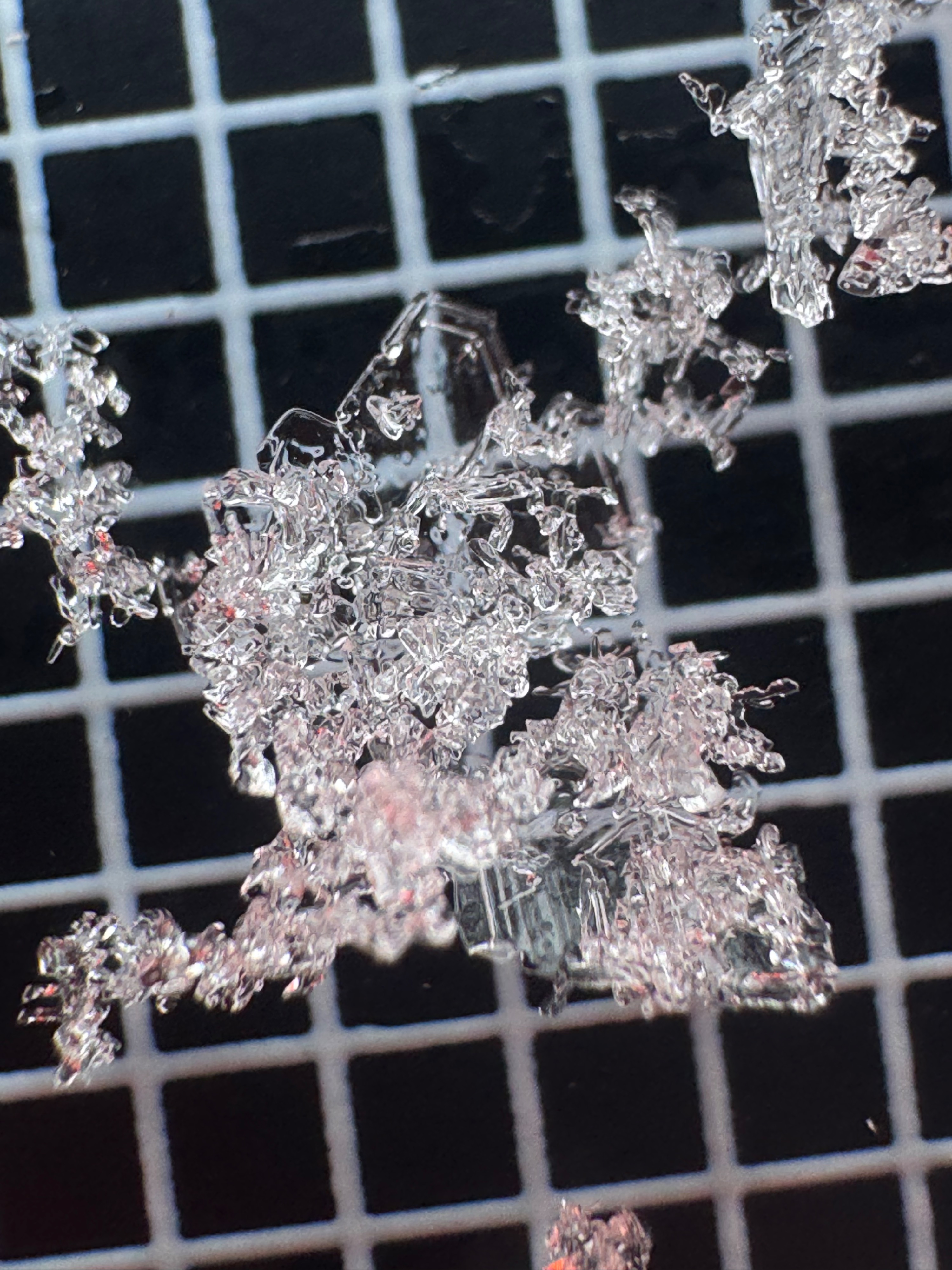
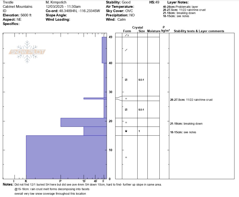
- Near surface facets and buried surface hoar found about 10cm beneath the surface on the 12/1 interface. The surface hoar was difficult to find below 5900 feet. We suspect that the elevation of the stratus deck on Sunday 11/30 may have been somewhere between 5600 and 5800 feet. If so, this would have limited surface hoar growth below that elevation.
- Access on the Trestle Creek Road was fair. We were able to safely drive to 4700 feet with 4x4 and good tires. Some braver people recently drove all the way to the pass at 5300 feet.
- Access for skiing is still not particularly appealing, but we are getting there. Many shallowly buried obstacles exist below 6000 feet, even on north facing slopes. We descended very cautiously and defensively.
Weather
- Air Temp
- 33
- Cloud Cover
- obscured
- Wind Loading
- none
- Rain Elevation
- not observed
- Recent Snowfall
- none
- Snow Avail For Transport
- moderate amounts
Overcast and foggy day. Calm to Very Light winds out of the SE. No new precipitation, but there is some rime growth occuring on the snow surface above 5000 feet.
Snowpack
Snowpack observations by elevation and aspect:
- 4700 feet hasty pit, East- 20cm of cumulative snowfall since 11/23. Estimated 2 inches during Monday's storm.
- 5000 feet hasty pit, Southeast- 25-30cm total snow depth. This was the lowest elevation with evidence of old hard snow at the base of the snowpack. Old snow is very thin and discontinuous at this elevation.
- 5500 feet full profile, Northeast- 49 cm total snow depth. Old snow layerbecomes thicker and more continuous at this elevation. Near surface facets visable at the 12/1 interface. Notable facet development both above and below the 11/23 crust.
- 5900 feet full profile, Northeast- 58cm total snow depth. Very similar snowpack structure to our pit site at 5500 feet overall. The primary difference being that we were able to confirm the presence of buried surface hoar at the 12/1 interface. Stability test results lacked propagation. Possibly due to the degradation and faceting occuring in the slab overlying the 11/23 crust. Multiple test pointed to the facets beneath the 11/23 crust as our layer of most concern today.
*Snowpilot profiles attached with more details from our two pit sites.
Avalanche
none observed, however visability of nearby terrain was very poor all day.