
Quick report
- Aspect
- North
- Red Flags
- Recent Avalanches, Poor Snowpack Structure
- Elevation
- 2987 m
- Slope Angle
- 36°
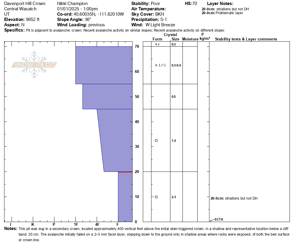
Headed out to start the accident investigation for the Davenport Hill avalanche. The weather was clearly prefrontal, and the area showed significant impact from additional avalanche control work done before rescue and recovery efforts. The crown was below a cliff band in a shallower part of the slope.
At the crown, we observed a 1F to 1F- slab composed of precipitation particles and wind-broken precipitation particles sitting on a layer of weak faceted snow. The primary failure layer was roughly 20 cm above the ground, resting on well-developed 2–3 mm facets. In shallower areas or spots with visible rocks, the avalanche stepped down to the ground.
Across the bed surface, we found large, well-developed facets, some as big as 4–5 mm. These facets showed striations, but we didn’t see obvious cupped depth hoar. This emphasizes how extensive and connected this weak layer is throughout the area, a key factor in the avalanche accident.
The terrain was unforgiving, with a notable terrain-trap gully that concentrated most of the debris.
Representative crown photos below: North Aspect - 9850' - riders right of Davenport Hill - below a cliff band.
A closer view of the crown - same location.
The 2-3mm facets that the avalanche in the crown we looked at failed on.
An image looking out at the bedsurf we descended, complex, rocky and shallow. Image taken from 9800' on a north aspect.