
Quick report
Lots of valley rain, especially on the Stanley side of Galena Summit. Much heavier precipitation from Smiley Creek to Stanley to Banner Summit. Some small, natural rain-driven wet loose avalanches observed south of Ketchum and near Stanley.
Cracking and collapsing were N/A, roadside observations. Widespread rollerballs below 7800-8000'. Isolated natural wet loose activity, all below the rain line.Weather
- Air Temp
- 30-37
- Cloud Cover
- obscured
- Rain Elevation
- Variable 5800-7700
- Recent Snowfall
- 0-12
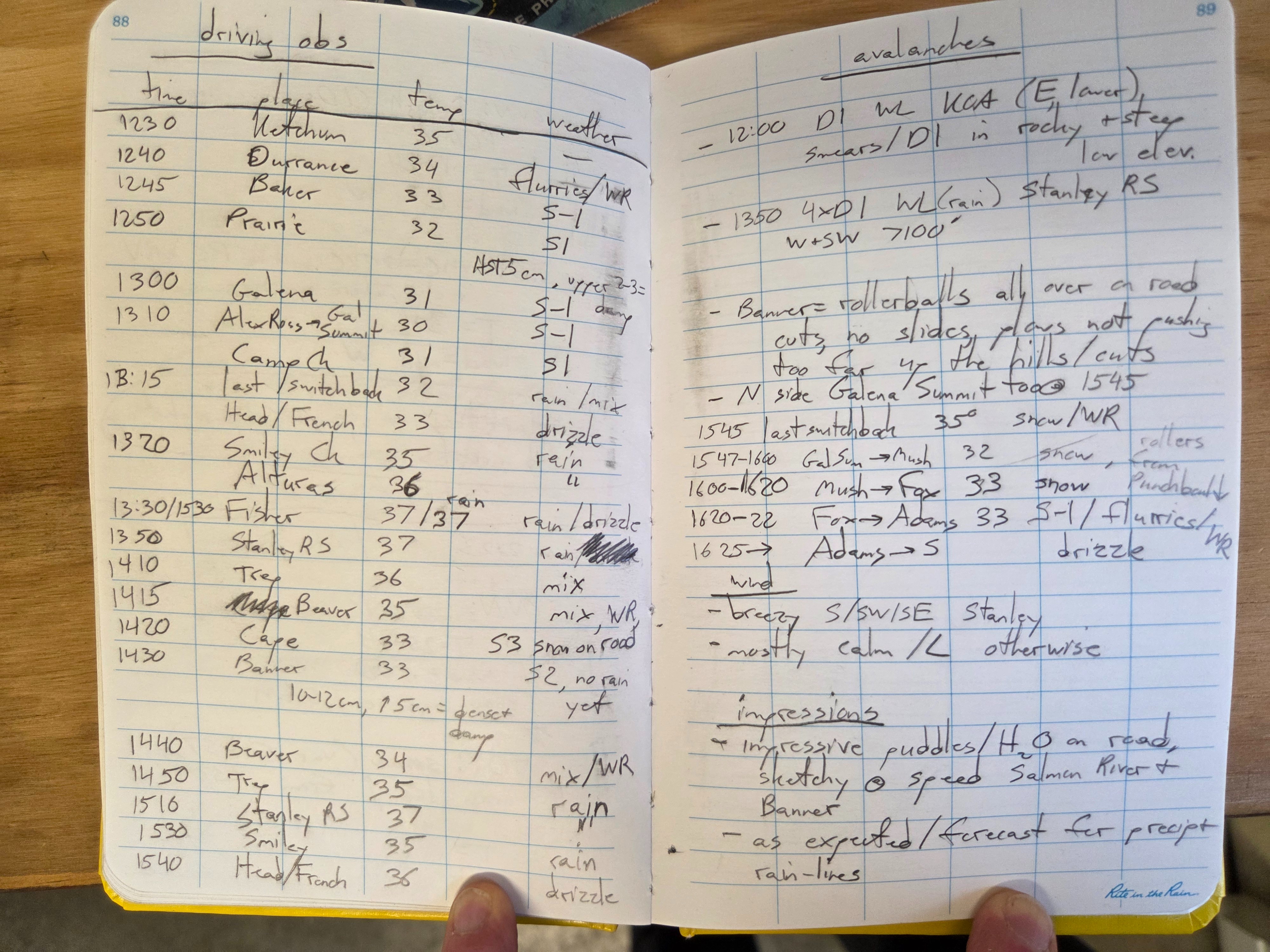
Skies were mostly obscured, some overcast near Hailey early afternoon. Winds were calm to light, but breezy in the Salmon River drainage (southerly). 1300hrs rain lines = 5800' in Wood River Valley, 7700' near Smiley Creek. 1500hrs rain lines = 6200' in WRV, 7700' near Smiley Ck. Banner Summit rain line = 6900' from 1400-1500hrs. Temperature and rain-snow line notes are attached as a photo.
Snowpack
1300 hrs Prairie Ck 6900': HN=5cm, upper 2-3cm very dense and moist.
1430 hrs Banner Summit 7100': HN=10-12cm, upper 5cm very dense and moist.
Avalanche
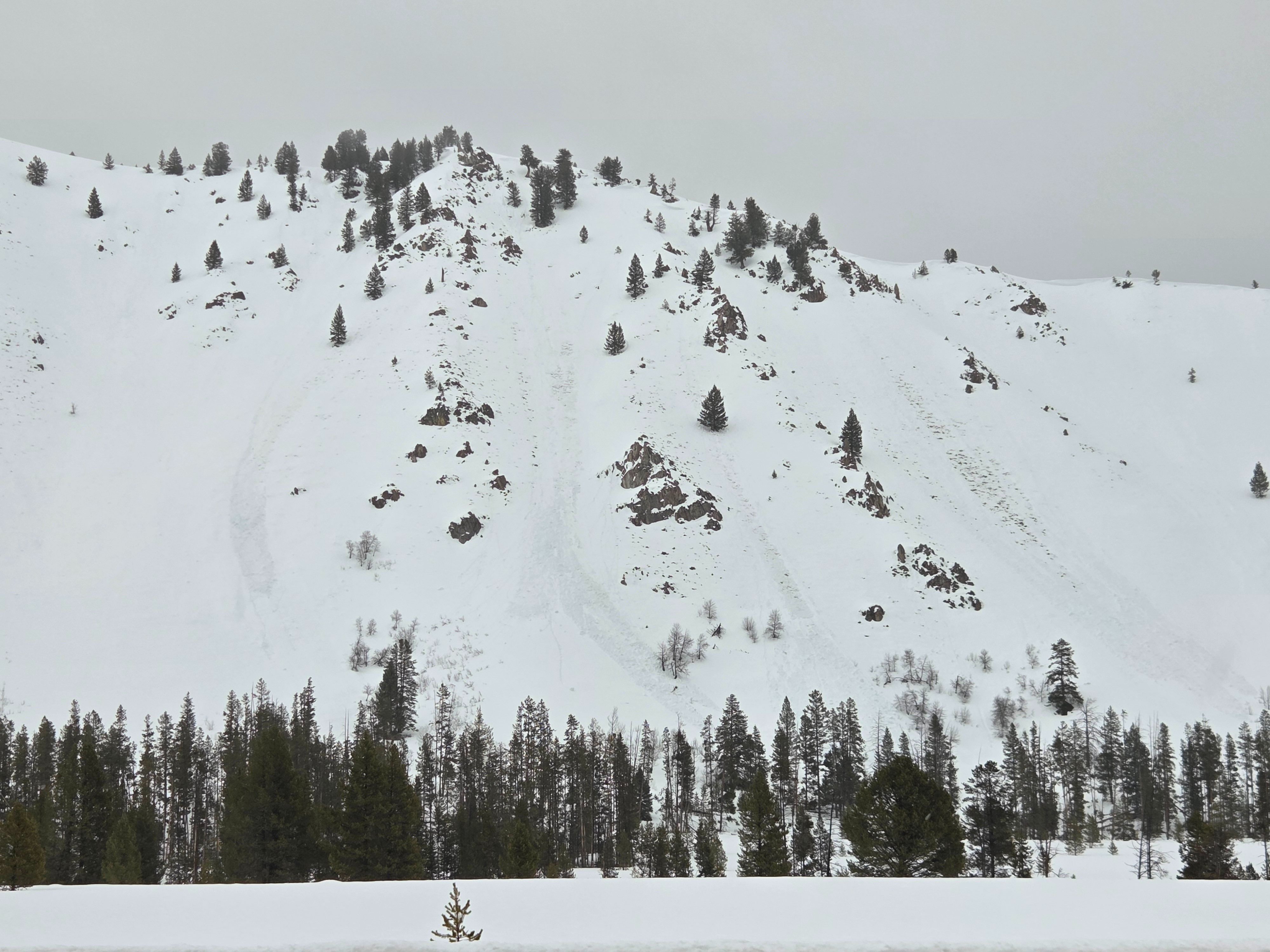
1 D1 wet loose in the KOA Chutes south of Ketchum (E aspect). 4 x D1 above the Salmon River near the Stanley Ranger Station (W, SW, 7100') - see attached photo.