
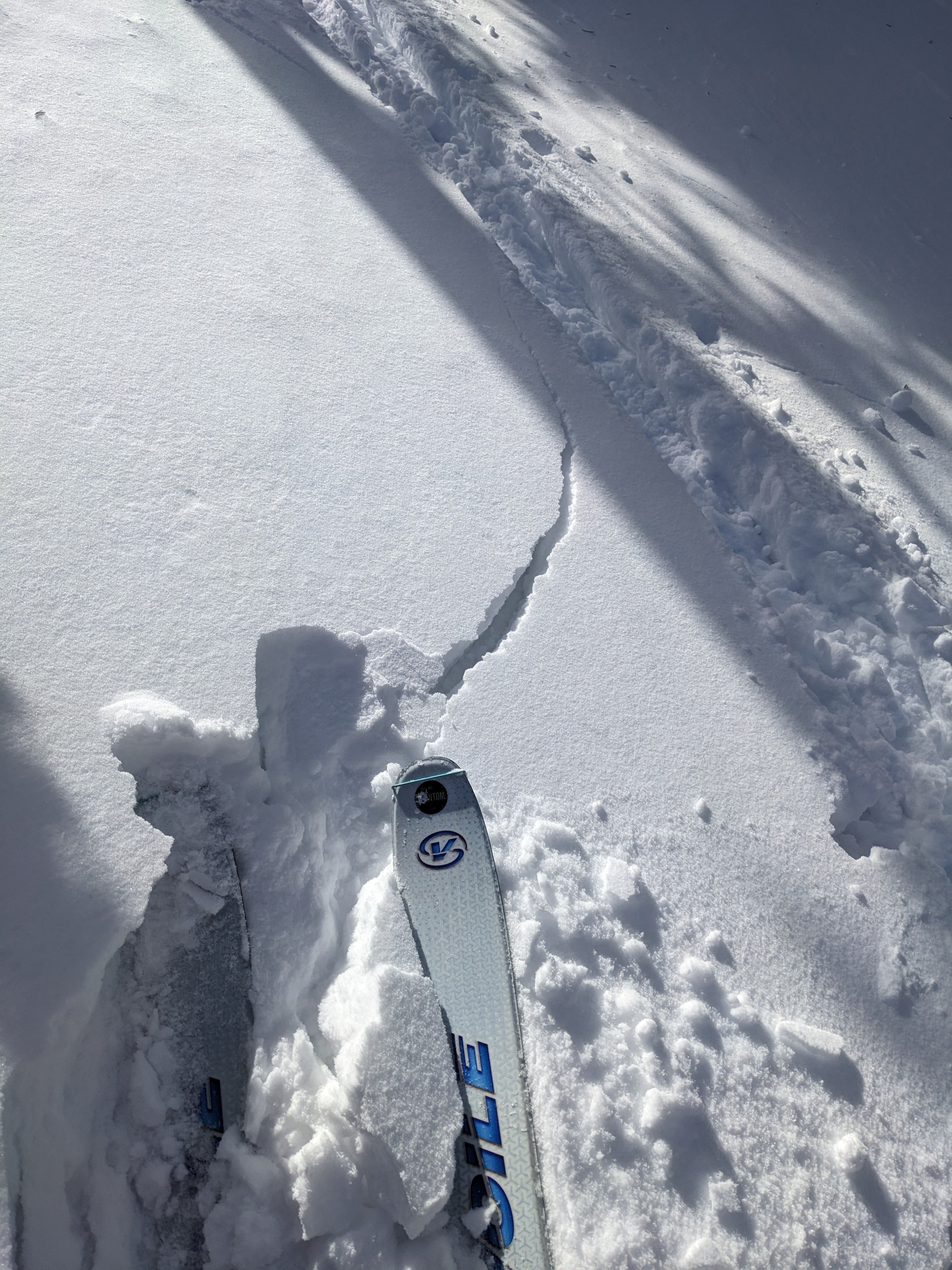
Quick report
- Cracking
- widespread
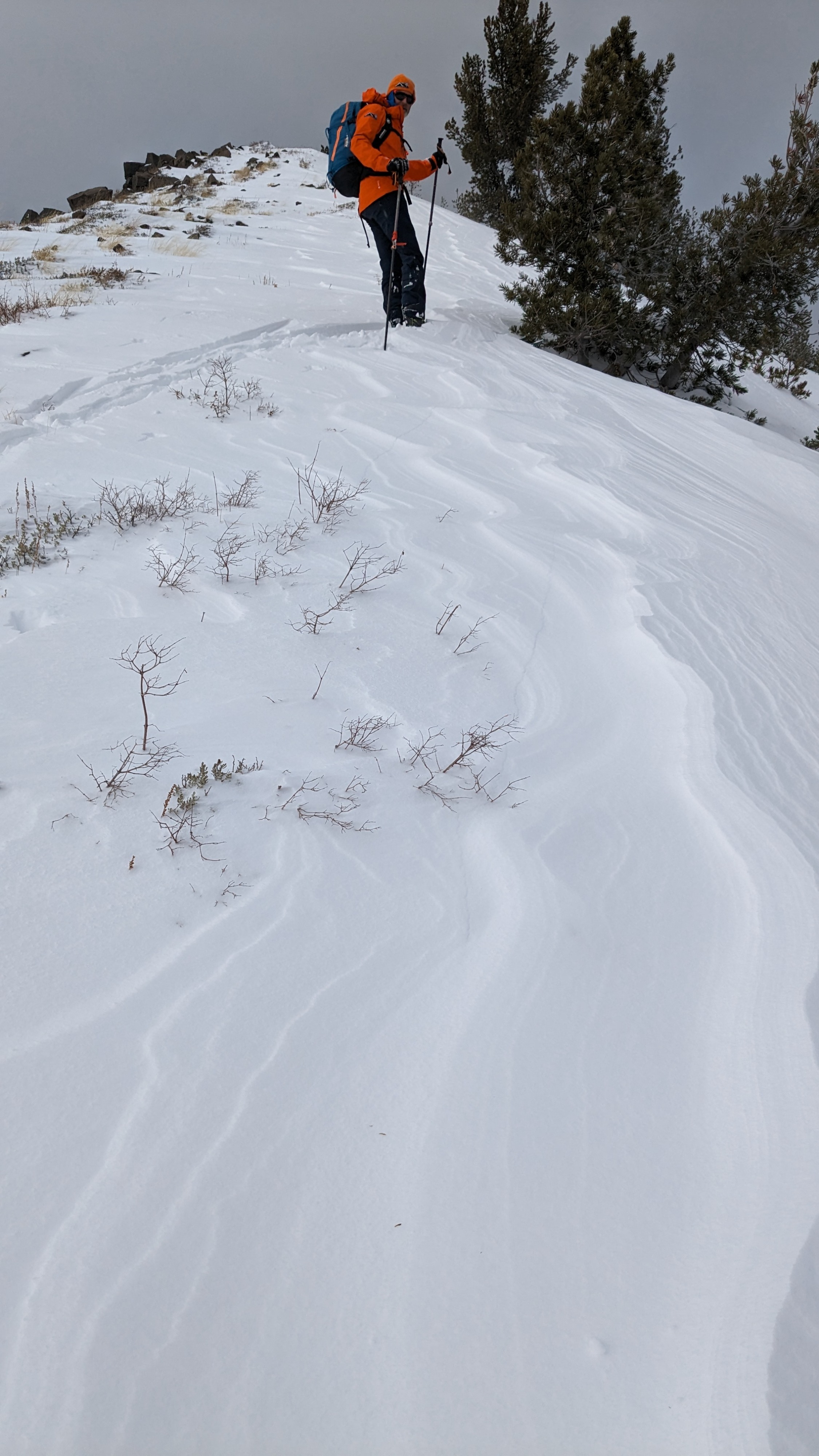
About 10 inches of new snow had accumulated on top of the old, weak, sugary snow (facets) in the Mt. Rose area. In more wind exposed areas, fresh wind slabs existed on wind-loaded slopes. The wind continued to add snow to these wind slabs today.
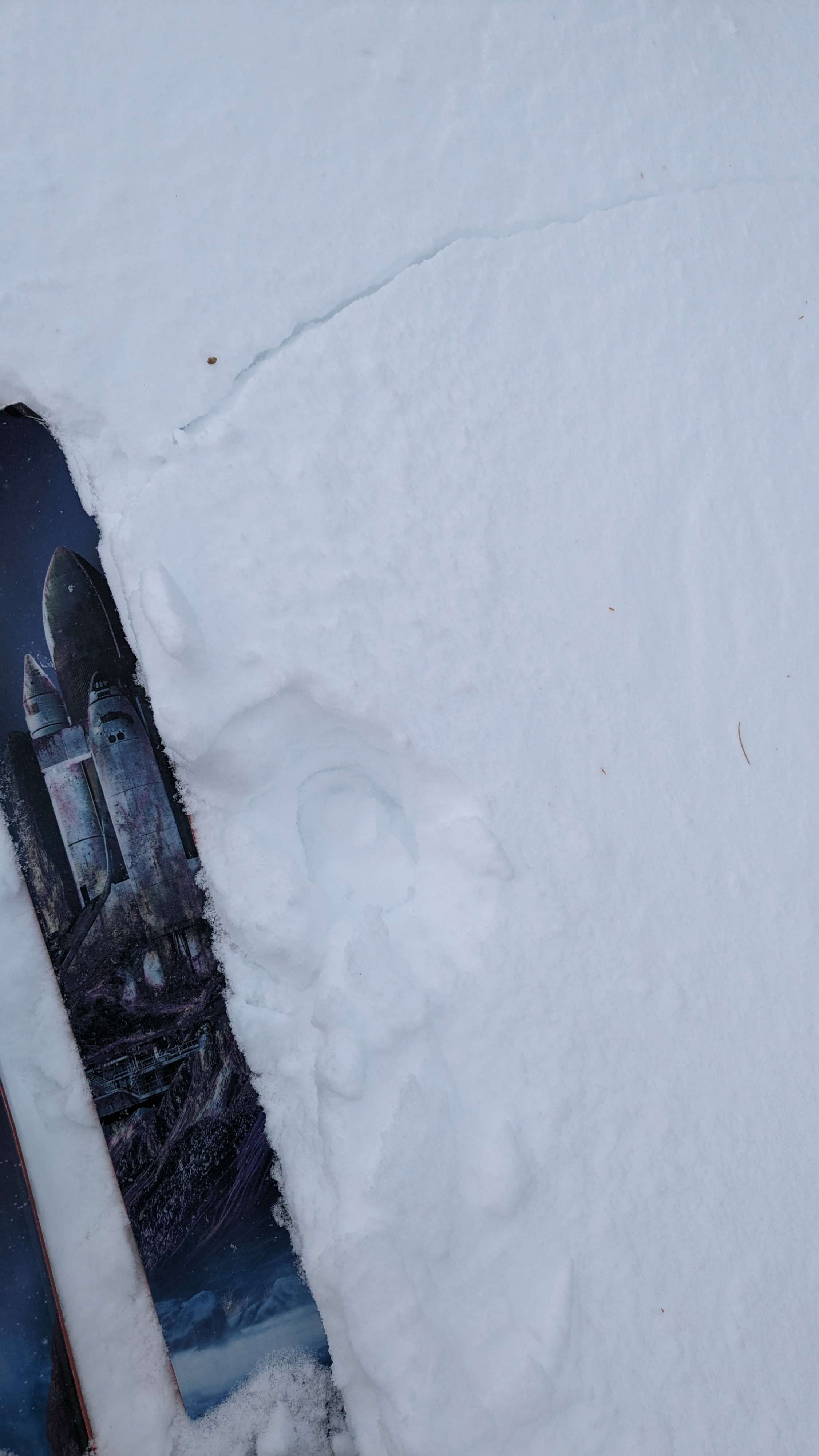
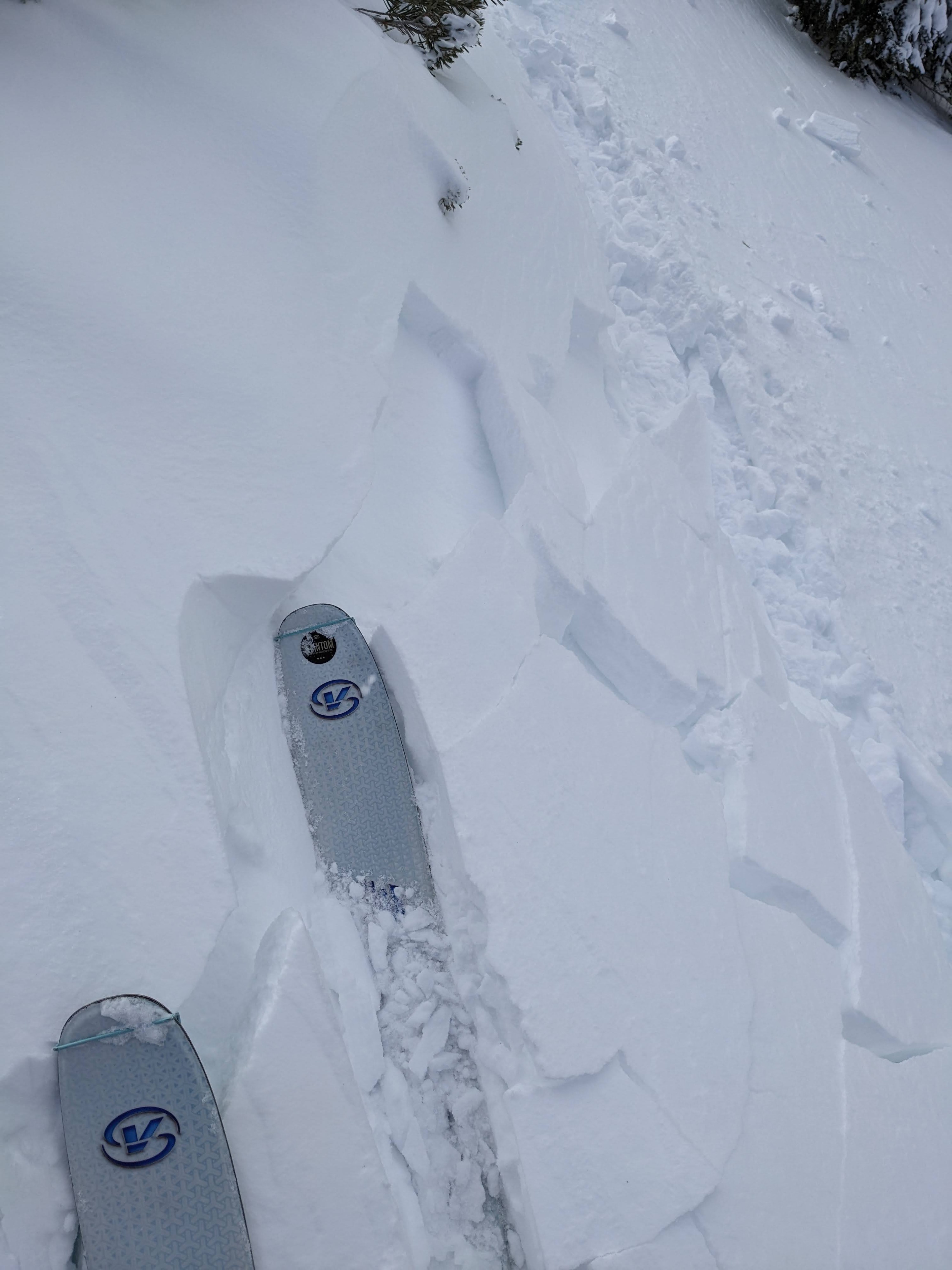
We encountered our first sign of instability about 20 ft from the truck when the old facets broke under our weight, and a crack shot out a few feet from our ski tips. We kept seeing shooting cracks as we traveled through sheltered and wind-loaded areas. Some broke at the base of newly formed wind slabs and some in the old, weak snow below (see instability comments).
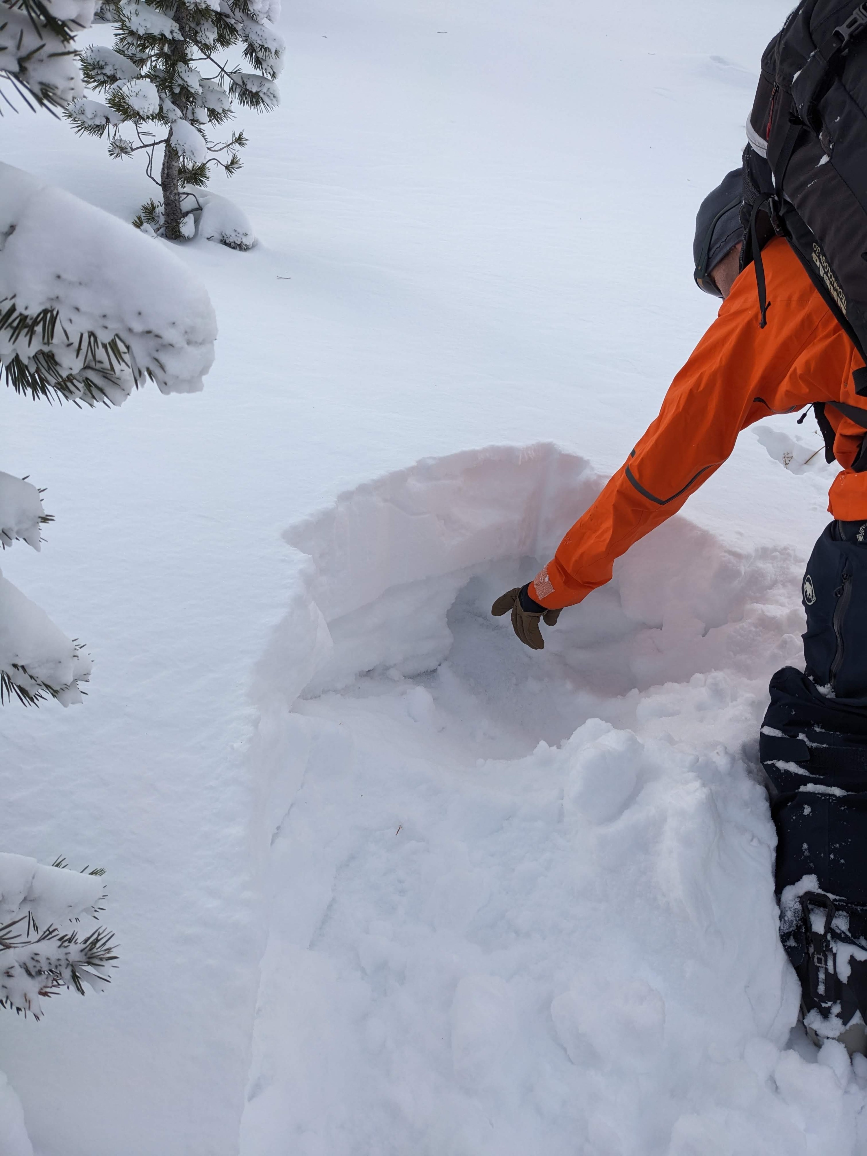
The snowpack structure remains weak in this area. Each time we stopped to dig into the snow on N and NE aspects between 8700 ft and 9800 ft, we found loose, sugary snow below the new snow. In some places, previous east winds scoured the weak snow away in the top part of the slope, but it still exists below the new snow in the middle and lower parts. We expected to experience more collapsing or whumpfing. However, the new snow has yet to consolidate into a slab in the more sheltered areas, so we often plunged right through it into the old, weak snow below. As the new snow becomes more supportable, it will also become more slab-like, while the weak snow below will remain weak.
We experienced skier-triggered cracking that failed below newly formed wind slabs but still in the new snow in many wind-loaded areas. Some places also cracked below the wind slabs on old, weak snow (facets), with the longest of these cracks shooting 20 ft from where they were triggered. We also caused smaller cracks that failed on those buried facets in more sheltered areas. This cracking occurred on the northerly aspects.Weather
- Air Temp
- 28
- Cloud Cover
- broken
- Wind Loading
- moderate
- Recent Snowfall
- 25
- Snow Avail For Transport
- moderate amounts
During our tour, cloud cover increased over the Sierra Crest and the Mt. Rose area. Snowfall remained light, but winds stayed strong enough for wind-loading to continue along the ridges.