
Quick report
- Cracking
- specific
- Collapsing
- widespread
Conditions were very real out at Titus today. The ~2' of fresh snow that has fallen since Wednesday (11/20) has added a whole lot of stress to the thin snowpack that existed before the storm. Triggering avalanches in locations where old weak snow exists near the ground is very likely. While less likely, there's an additional mid-storm density change that could contribute to shorter-term heightened instability.
The big take-home is to avoid traveling in or below upper elevation slopes suspected to harbor old, weak snow near the ground.
Weather
- Air Temp
- 30
- Cloud Cover
- overcast
- Wind Loading
- moderate
- Recent Snowfall
- 55 cm since (11/20)
- Snow Avail For Transport
- moderate amounts
Temperatures hovering around freezing, with consistent cloud cover and limited visibility. Light winds with sporadic moderate gusting and light intermittent snowfall throughout our brief tour.
Snowpack
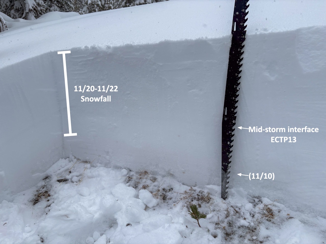
We found approximately 21" of new snow that had fallen since this storm started on Wednesday above 8500'. On the northern half of the compass, we found that this buried ~6" of old weak snow from earlier in November and October. On the southern half of the compass, this primarily fell on bare ground or thinner layers of old weak snow. We also found ridge top pockets of wind affected snow where depths were greater.
We dug a quick pit at 9500' on a North aspect and found 75 cm of snow with 45 cm of storm snow (since Wednesday 11/20) sitting on top of recent snowfall and some sugary weak facets near the ground. Our stability tests resulted in ECTP11@13 cm (failing the old weak snow) and ECTP13@42 cm (failing on a mid-storm interface).
Avalanche
- Size
- D2 R3
- Type
- SS
- Aspect
- NE
- Trigger
- AS
- Elevation
- 9500 ft
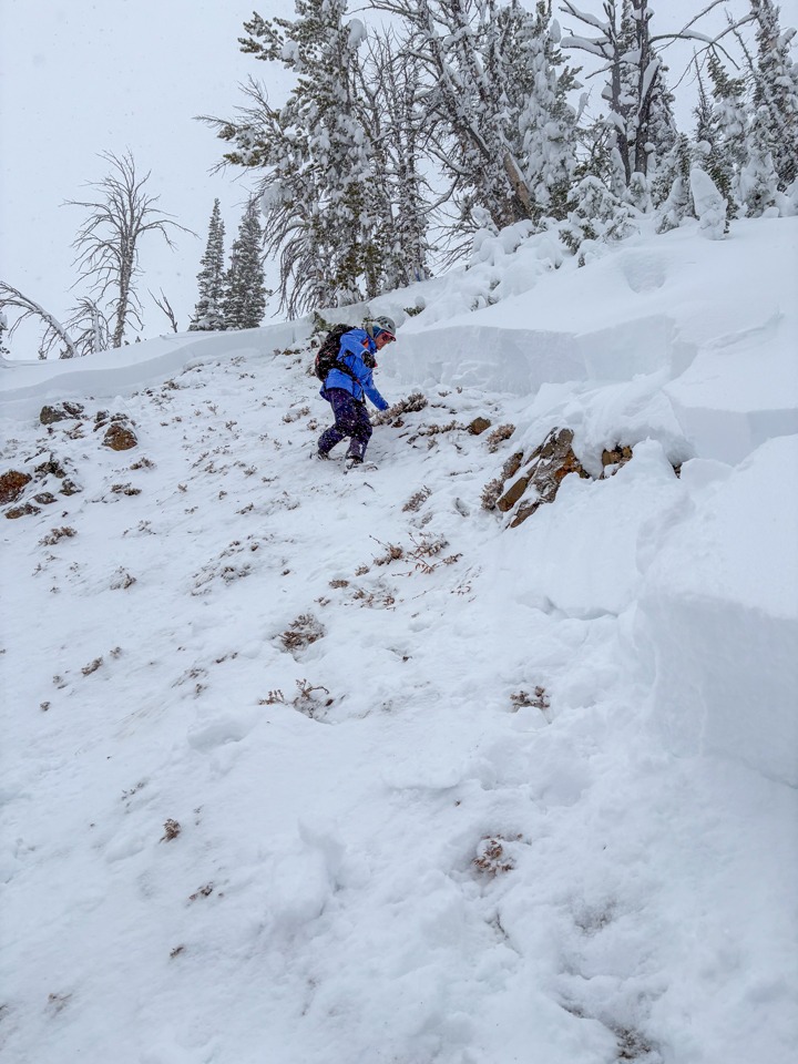
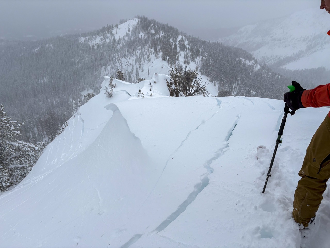
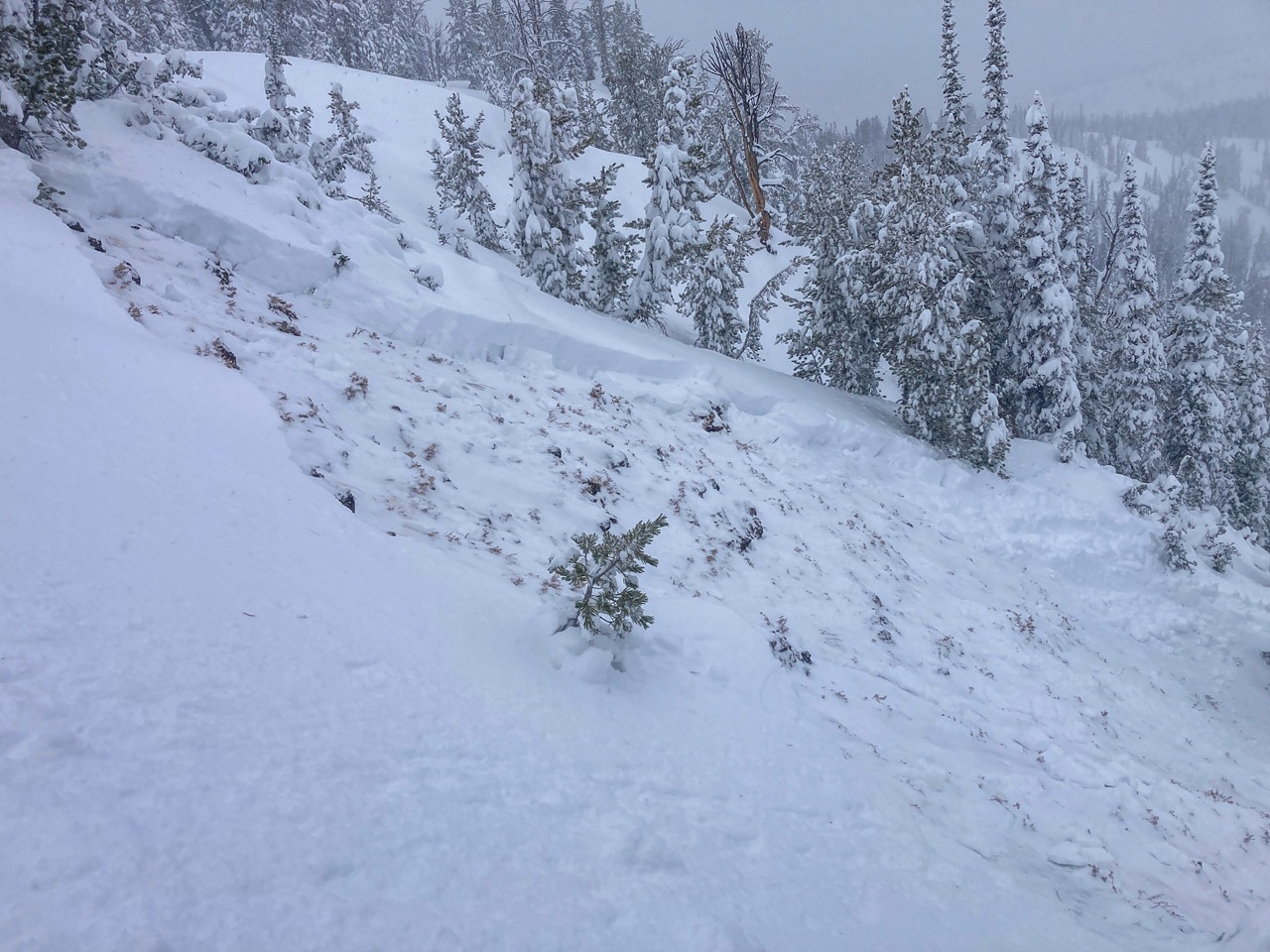
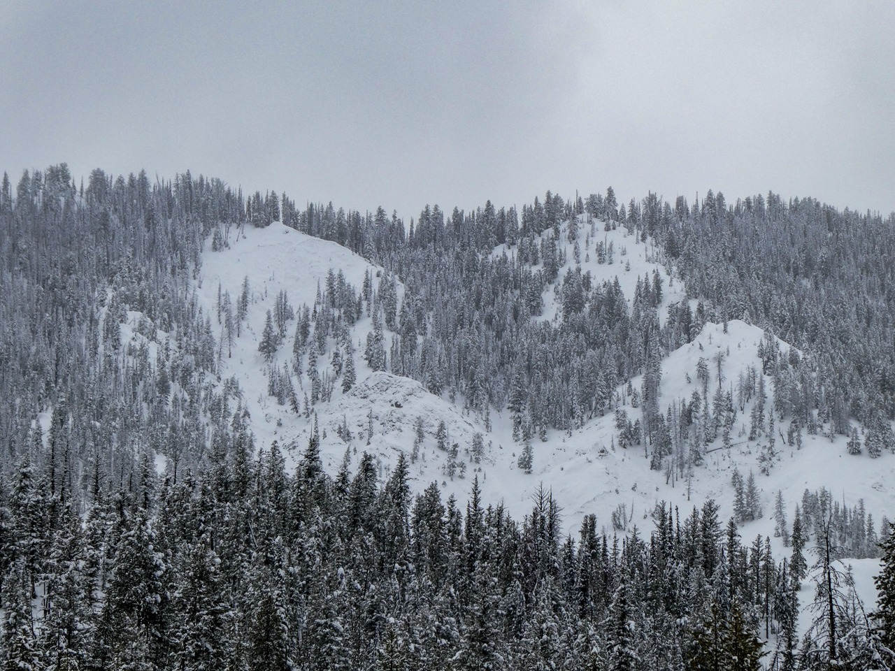
We remotely triggered two avalanches while on our brief tour today in close vicinity to each other: 1) The first was remotely triggered as we approached a wind loaded NNE slope from the safety of the ridge top. It failed and arrested on the slope but left full-depth cracks along the ridgeline and throughout the start zone. It failed on weak snow near the ground. 2) The second avalanche (detailed above) was remotely triggered on a NE slope from the ridge top as well. We felt a collapse, then walked around the corner to see a large avalanche had released. The avalanche failed on weak snow near the ground.